Matanzas Bay facts for kids

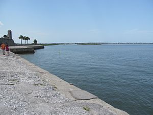
Matanzas Bay is a saltwater bay located in St. Johns County, Florida. It's like a big, calm pool of ocean water that connects to the Atlantic Ocean through a narrow opening called the St. Augustine Inlet. This bay is an important part of the city of St. Augustine and the surrounding area.
Contents
What Waters Connect to Matanzas Bay?
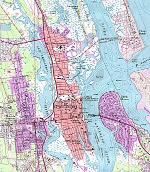
Several other waterways connect to Matanzas Bay, making it a busy hub for water flow. Imagine them like different arms reaching out from the bay:
- Salt Run: This is an inlet that helps form a peninsula (a piece of land almost surrounded by water) on Anastasia Island. Part of Anastasia State Park is found here.
- Matanzas River: This is a tidal channel, meaning its water level changes with the ocean tides. It's part of the Intracoastal Waterway, a long path for boats along the coast. The Matanzas River flows for about 15 miles, separating Anastasia Island from the mainland.
- San Sebastian River: This river flows west from the Matanzas River. It helps create the land where the oldest part of St. Augustine, from the Spanish era, is located.
- Hospital Creek: This tidal channel flows north. It's famous because Pedro Menéndez de Avilés, who founded St. Augustine, sailed into this creek when he first arrived.
- Tolomato River: Also known as the North River, this is another tidal channel that flows north.
Interesting Facts About Matanzas Bay
Matanzas Bay is surrounded by interesting places and features.
Cities and Towns
The main city on Matanzas Bay is St. Augustine. Another town nearby is Vilano Beach.
Tides in the Bay
The water level in Matanzas Bay changes quite a bit with the tides. On average, the water rises and falls about 4.5 feet between high tide and low tide.
Bridges Over the Bay
A major road, State Road A1A, crosses Matanzas Bay. It uses the famous Bridge of Lions to connect the mainland part of St. Augustine with the part of the city that is on Anastasia Island.
Wetlands and Nature
Many natural areas around the bay are called tidal wetlands or salt marshes. These are important habitats for many plants and animals. However, some of these wetlands in St. Augustine have been changed or removed over time due to building projects like seawalls and new neighborhoods. Still, other parts of the Intracoastal Waterway connected to the bay have healthy wetlands.
Parks and Historic Sites
Two important places near Matanzas Bay are:
- Castillo de San Marcos National Monument: This is a very old Spanish fort that was finished in 1675. It stands right by the bay.
- Anastasia State Park: This park offers beautiful beaches and natural areas on Anastasia Island, close to the bay.
See also
 In Spanish: Bahía de Matanzas (Florida) para niños
 | Shirley Ann Jackson |
 | Garett Morgan |
 | J. Ernest Wilkins Jr. |
 | Elijah McCoy |


