Maunawili, Hawaii facts for kids
Quick facts for kids
Maunawili
|
|
|---|---|

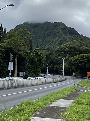
Intersection of Route 61 and Route 83 in Maunawili
|
|

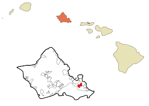
Location in Honolulu County and the state of Hawaii
|
|
| Country | United States |
| State | Hawaii |
| Area | |
| • Total | 1.83 sq mi (4.74 km2) |
| • Land | 1.83 sq mi (4.74 km2) |
| • Water | 0.00 sq mi (0.00 km2) |
| Elevation | 69 ft (21 m) |
| Population
(2020)
|
|
| • Total | 2,026 |
| • Density | 1,108.32/sq mi (427.86/km2) |
| Time zone | UTC-10 (Hawaii-Aleutian) |
| ZIP code |
96734
|
| Area code(s) | 808 |
| FIPS code | 15-50750 |
| GNIS feature ID | 0362301 |
Maunawili (Hawaiian pronunciation: [mɐwnəˈvili]) is a quiet residential area in Hawaii. It's known as a census-designated place (CDP), which means it's a special area set up by the government just for counting people. Maunawili is located on the island of Oʻahu in Honolulu County.
As of 2020, about 2,026 people live there. Maunawili is found mauka, which means inland or on the mountain side. It's near Kalanianaʻole Highway. The area is mostly made up of homes, schools, and churches. You can also find horse stables, which gives it a peaceful, rural feel. There are no big stores or businesses in Maunawili itself. However, nearby Kailua is just a short drive or bus ride away.
Maunawili Valley stretches out behind a famous mountain peak called Olomana. The homes in Maunawili only go partway into this large valley. The valley gets a lot of rain, which helps some farms grow crops like bananas. Water from the many streams in Maunawili is sent through a ditch to Waimānalo. This helps farms in that drier area.
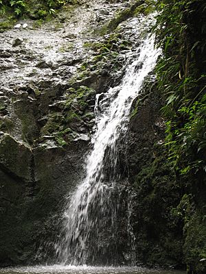
You can find a golf course and the Hawaiian Agriculture Research Center in the valley. This research center works on growing different types of sugar cane, coffee, and cacao. A popular outdoor spot is the Maunawili Demonstration Trail. This state-maintained trail goes across the upper part of Maunawili Valley. You can get on the trail from the Pali Highway or from a connecting path in upper Maunawili that leads to Maunawili Falls.
The postal code for Maunawili is 96734, which is the same as for Kailua.
Contents
Exploring Maunawili's Location
Maunawili is located at coordinates 21°22′36″N 157°45′37″W. It sits right next to the community of Kailua.
The United States Census Bureau says that Maunawili covers an area of about 4.8 square kilometers (or 1.8 square miles). All of this area is land, with no large bodies of water inside its borders.
Understanding Maunawili's Population
| Historical population | |||
|---|---|---|---|
| Census | Pop. | %± | |
| 2020 | 2,026 | — | |
| U.S. Decennial Census | |||
In the year 2000, there were 4,869 people living in Maunawili. These people lived in 1,458 households, with most of them being families. The population density was about 1,399 people per square mile.
Maunawili is a diverse place. In 2000, people from many different backgrounds lived there. This included people who identified as White, Black or African American, Native American, Asian, and Pacific Islander. Many residents also identified with two or more races. A small percentage of the population was Hispanic or Latino.
The average household in Maunawili had about 3.10 people. The average family had about 3.31 people. About 31.7% of households had children under 18 living with them. Most households (68.7%) were married couples living together.
The median age in Maunawili in 2000 was 41 years old. This means half the people were younger than 41, and half were older.
Schools in Maunawili
The Hawaii Department of Education manages the public schools in Hawaii. In 2000, Maunawili Elementary School and Kailua High School were considered to be within the Maunawili CDP. However, by 2010, these schools were officially defined as being part of the Kailua CDP.
See also
 In Spanish: Maunawili para niños
 | DeHart Hubbard |
 | Wilma Rudolph |
 | Jesse Owens |
 | Jackie Joyner-Kersee |
 | Major Taylor |


