Mayfield, Midlothian facts for kids
Quick facts for kids Mayfield |
|
|---|---|
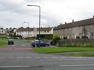
 Lawfield Road, typical scene of modest housing and communal green space in Mayfield |
|
| Population | 13,690 (2020) |
| Council area | |
| Country | Scotland |
| Sovereign state | United Kingdom |
| Police | Lothian and Borders |
| Fire | Lothian and Borders |
| Ambulance | Scottish |
| EU Parliament | Scotland |
Mayfield is a community found in Midlothian, Scotland. It is located just south of Dalkeith, close to Edinburgh. You can find it between the A68 and the A7 roads. In 2020, Mayfield had an estimated population of 13690 people.
Discovering Mayfield
Mayfield was built in the 1950s. It was created to provide homes for many people. These included workers from nearby coal mines, called collieries, in Newtongrange and Easthouses. It also housed other important workers and people who worked in a local industrial area.
However, the coal mining industry started to decline in the 1980s. This led to the closure of the coal mines.
A Growing Community
In the 1950s, the population in this part of Newbattle parish grew very quickly. The new Mayfield housing area became so large that it almost completely surrounded the older mining village of Easthouses. Today, Mayfield has a population similar to that of a small town.
As Mayfield and Easthouses continued to grow, a new Church of Scotland building was needed. In 1955, the Mayfield and Easthouses church was built. It was designed to be useful and practical. It served as a place for worship and also as a meeting place for many groups. These groups included the Boys Brigade, Girls Brigade, Cubs, Scouts, and Brownies.
Schools in Mayfield
Mayfield is home to three primary schools. Mayfield Primary School is connected to St. Luke's RC Primary School. There is also Lawfield Primary School. Lawfield Primary is a newer school that was formed by combining the former Langlaw Primary and Bryans Primary schools.
 | Calvin Brent |
 | Walter T. Bailey |
 | Martha Cassell Thompson |
 | Alberta Jeannette Cassell |

