Mayrung, New South Wales facts for kids
Quick facts for kids MayrungNew South Wales |
|
|---|---|

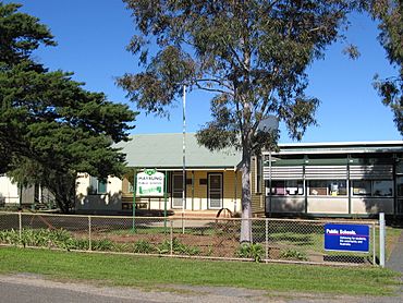
Mayrung Public School
|
|
| Postcode(s) | 2710 |
| Location |
|
| LGA(s) | Edward River Council |
| County | Townsend |
| State electorate(s) | Murray |
| Federal Division(s) | Farrer |
Mayrung is a small community located in the central part of the Riverina region in New South Wales, Australia. It is about 45 kilometers east of a place called Pretty Pine. Mayrung is also about 35 kilometers northeast of the larger town of Deniliquin.
The History of Mayrung's Name
Before European settlers arrived, the land around Mayrung was home to Aboriginal people. The Wiradjuri people lived in this area. They called the district 'Carawatha'. This name is thought to mean 'place of pines'.
Another Aboriginal group, the Wamba Wamba speakers, also live in the region. They have a word, marrung, for the special sand hill Murray Pines found here. The name 'Mayrung' comes from this Wamba Wamba word. It's an Anglicisation, which means the English settlers changed the original Aboriginal word to sound more like an English name.
Farming and Irrigation in Mayrung
Mayrung is located in an important farming area called the Berriquin Irrigation Area. This area uses a special system to bring water to farms. This water helps grow many different crops and raise animals.
Farmers in Mayrung produce a variety of goods. They grow crops like wheat, rice, and other cereals. They also raise animals such as sheep for wool and lambs for meat. Dairy products, vegetables, cattle, and pigs are also important parts of the local farming. This makes Mayrung a key part of Australia's food production.
 | Charles R. Drew |
 | Benjamin Banneker |
 | Jane C. Wright |
 | Roger Arliner Young |

