McNary, Texas facts for kids
Quick facts for kids
McNary, Texas
|
|
|---|---|
|
Unincorporated Community
|
|
| Country | United States |
| State | Texas |
| County | Hudspeth |
| Elevation | 3,576 ft (1,090 m) |
| Time zone | UTC-6 (Central (CST)) |
| • Summer (DST) | UTC-5 (CDT) |
| ZIP codes |
79839
|
| Area code | 915 |
| GNIS feature ID | 1362526 |
McNary is a small place in Texas, United States. It's called an unincorporated community. This means it's a group of homes and businesses that isn't officially a city or town with its own local government. About 250 people live there.
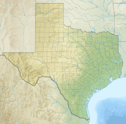
McNary is located where two major roads meet: Interstate 10 and State Highway 20. It's also very close to the Rio Grande river, only two miles away. You can find it in the southwestern part of Hudspeth County, about 23 miles west of a town called Sierra Blanca.
History of McNary
McNary has an interesting past. It started as a small settlement in 1921. Back then, it had a different name: Nulo.
How McNary Got Its Name
The name changed in September 1923. The community was renamed McNary after a local businessman named James G. McNary. This happened when the Galveston, Harrisburg and San Antonio Railway built a train station there.
Cotton and the Railway
The railway station was very important for McNary. It became a place where people could ship goods. One of the main products shipped from McNary was cotton. This cotton came from a large farm nearby called the Algodon Plantation.
 | Frances Mary Albrier |
 | Whitney Young |
 | Muhammad Ali |


