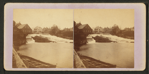
Megunticook River facts for kids
Quick facts for kids Megunticook River |
|
|---|---|
| Country | United States |
| Physical characteristics | |
| Main source | Maine 142 feet (43 m) |
| River mouth | West Penobscot Bay sea level 44°12′36″N 69°03′47″W / 44.210°N 69.063°W |
| Length | 3.5 miles (5.6 km) |
The Megunticook River is a short river located in Camden, Maine. It flows from a lake to the ocean.
About the Megunticook River
The Megunticook River is only about 3.5 miles (5.6 kilometers) long. It starts at Megunticook Lake and flows southeast. The river ends when it reaches West Penobscot Bay. This bay is part of the Atlantic Ocean.
Where Does It Flow?
The river begins at the spillway of Megunticook Lake. A spillway is like an overflow area for a dam. From there, the river travels through the town of Camden. It then empties into West Penobscot Bay.
The Seabright Dam
A dam called Seabright Dam affects the river. It raises the water level in the upper part of the river. Below the dam, the river flows like a "mill stream." This means it used to power old mills in the village.
In 2016, people noticed that the water levels above the Seabright Dam were low. The local government, called the Camden select board, looked into the problem. They thought about fixing cracks in the rocks near the dam. This would help keep the water levels normal.
 | Ernest Everett Just |
 | Mary Jackson |
 | Emmett Chappelle |
 | Marie Maynard Daly |


