Melado River facts for kids
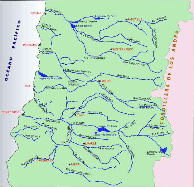
The Melado River is an important waterway in the Maule Region of Chile. It flows through the Province of Linares, a beautiful area known for its natural landscapes. The Melado River starts high up in the Andes Mountains.
It begins as the Guaiquivilo River. This river is formed when two smaller rivers, the Cajón Troncoso and the Palaleo, join together. The Cajón Troncoso starts near the border with Argentina. The Palaleo flows out of a lake called Dial. The Guaiquivilo River then flows north through a long valley between mountains.
How the Melado River is Formed
On its left side, the Guaiquivilo River is next to the Melado mountain range. These mountains are very tall, often over 2,500 meters high. They act like a natural wall, separating the Guaiquivilo valley from other river valleys nearby. These other rivers include the Longaví, Achibueno, and Ancoa. All these rivers eventually flow into the Loncomilla River, which is a main branch of the Maule River.
On its right side, the Guaiquivilo River meets another river called San Pedro or La Puente. This river gets its water from a glacier near the San Pedro volcano. After these two rivers meet, the Guaiquivilo officially becomes known as the Melado River.
Using the Melado River's Water
The Melado River is very useful for generating electricity. A large dam has been built on the river to create a reservoir. This water is then used to power the Pehuenche Hydroelectric Plant. This plant uses the force of the water to make clean energy for homes and businesses.
The Melado River eventually joins the larger Maule River. It flows into the Maule River after the Maule has already traveled about 75 kilometers.
There is also a special channel called the Canal Melado. This channel helps move water from the Melado River. It goes through the Guaiquivilo valley and then through a long tunnel, about 4.2 kilometers long. This water is then sent to the Ancoa River, helping to provide water to that area as well.
See also

- In Spanish: Melado River for kids
 | James Van Der Zee |
 | Alma Thomas |
 | Ellis Wilson |
 | Margaret Taylor-Burroughs |


