Mentasta Lake, Alaska facts for kids
Quick facts for kids
Mentasta Lake
Mendaesde
|
|
|---|---|

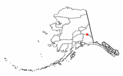
Location of Mentasta Lake, Alaska
|
|
| Country | United States |
| State | Alaska |
| Census Area | Copper River |
| Area | |
| • Total | 302.52 sq mi (783.54 km2) |
| • Land | 300.63 sq mi (778.62 km2) |
| • Water | 1.90 sq mi (4.92 km2) |
| Population
(2020)
|
|
| • Total | 127 |
| • Density | 0.42/sq mi (0.16/km2) |
| Time zone | UTC-9 (Alaska (AKST)) |
| • Summer (DST) | UTC-8 (AKDT) |
| Area code(s) | 907 |
| FIPS code | 02-48540 |
Mentasta Lake is a small community in Alaska, United States. Its name in the Ahtna Athabascan is Mendaesde. It is known as a census-designated place (CDP). This means it is a special area created by the United States Census Bureau for gathering population data.
Mentasta Lake is located in the Copper River Census Area, Alaska. In 2010, about 112 people lived there. By 2020, the population grew slightly to 127 people.
Contents
Where is Mentasta Lake?
Mentasta Lake is found in a beautiful part of Alaska. Its exact location is at 62.923924 degrees north latitude and -143.533240 degrees west longitude.
The community covers a total area of about 305.1 square miles (783.54 square kilometers). Most of this area, about 303.1 square miles (778.62 square kilometers), is land. The rest, about 2.0 square miles (4.92 square kilometers), is water.
How Many People Live Here?
The number of people living in Mentasta Lake has changed over the years.
| Historical population | |||
|---|---|---|---|
| Census | Pop. | %± | |
| 1940 | 15 | — | |
| 1960 | 40 | — | |
| 1970 | 68 | 70.0% | |
| 1980 | 59 | −13.2% | |
| 1990 | 96 | 62.7% | |
| 2000 | 142 | 47.9% | |
| 2010 | 112 | −21.1% | |
| 2020 | 127 | 13.4% | |
| U.S. Decennial Census | |||
Mentasta Lake was first counted in the U.S. Census in 1940. Back then, it was called "Montasta Lake." It was an unincorporated native village. It wasn't counted in 1950. In 1960, it appeared as "Mentasta." By 1970, it was called Mentasta Lake again. In 1980, it officially became a census-designated place (CDP).
In 2000, there were 142 people living in Mentasta Lake. These people lived in 54 households, and 32 of these were families. The community was not very crowded, with less than one person per square mile.
Community Makeup in 2000
- About 29% of the people were White.
- About 63% were Native American.
- About 8% were from two or more racial backgrounds.
Many households had children under 18 living with them (about 31.5%). The average household had about 2.6 people. Families were a bit larger, with an average of 3.3 people.
Age Groups in 2000
The community had people of all ages:
- About 35% were under 18 years old.
- About 24% were between 25 and 44 years old.
- About 27% were between 45 and 64 years old.
- About 6% were 65 years or older.
The average age of people in Mentasta Lake was 32 years old.
Learning and Education
Students in Mentasta Lake attend schools that are part of the Alaska Gateway School District. The local school is called Mentasta Lake Katie John School. It serves students from kindergarten all the way through 12th grade.
A very important person from Mentasta was Katie John. She was a well-known activist who worked to protect the rights of people to hunt and fish for food. She lived to be 97 years old. In the 1970s, Katie John helped create an alphabet for the Ahtna language. She also recorded how to pronounce words in the Mentasta Dialect of the language. This helped preserve the language for future generations.
See also
 In Spanish: Mentasta Lake (Alaska) para niños
 | Valerie Thomas |
 | Frederick McKinley Jones |
 | George Edward Alcorn Jr. |
 | Thomas Mensah |

