Merrion, Dublin facts for kids
Quick facts for kids
Merrion
Muirfin
|
|
|---|---|
|
Suburb
|
|

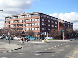
The Merrion Centre (shopping centre)
|
|
| Country | Ireland |
| Province | Leinster |
| County | City of Dublin |
| Time zone | UTC+0 (WET) |
| • Summer (DST) | UTC-1 (IST (WEST)) |
| Area code(s) | 01, +353 1 |
| Irish Grid Reference | O190325 |
Merrion (called Muirfin in Irish) is a cool suburban area in Ireland. It's like a neighborhood located about 4 kilometers (about 2.5 miles) southeast of Dublin City. Merrion is also known as a "townland," which is a small piece of land with a traditional name. This townland covers an area of about 0.8 square kilometers.
Contents
Exploring Merrion
Where is Merrion?
Merrion is located along a road called Merrion Road. To its north, you'll find the area of Ballsbridge, and to its south is Booterstown. This part of the road is about 1 kilometer long.
What Can You Find in Merrion?
Even though it's a suburban area, Merrion has many useful places! Along Merrion Road, you can find a shopping mall called the Merrion Centre. There's also St. Vincent's University Hospital, which is a big hospital. You can also see a Catholic church named Our Lady Queen Of Peace.
Other places in Merrion include the Merrion Inn, which is a public house (like a local gathering spot), a petrol station, and a branch of the Bank of Ireland. There's also a restaurant and several other shops where you can buy different things.
Merrion's Location in Dublin
Merrion is part of the administrative area of Dublin City. This means it's managed by the Dublin City Council. The area of Merrion ends near the Merrion Gates, which is close to the border of another administrative area called Dún Laoghaire–Rathdown.
 | Ernest Everett Just |
 | Mary Jackson |
 | Emmett Chappelle |
 | Marie Maynard Daly |


