Miguel Peña Parish facts for kids
Quick facts for kids
Miguel Peña Parish
|
|
|---|---|
| Time zone | UTC−4 (VET) |
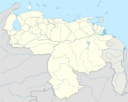
Miguel Peña is a very large area in the city of Valencia, in Carabobo, Venezuela. It's one of the most populated places in the entire country!
This area is located in the southern part of Valencia. It covers about 200 square kilometers. Many people live here, making it a very busy place.

Contents
About Miguel Peña
This area is named after Miguel Peña (1781–1833). He was an important politician from Valencia. He helped create Venezuela in the early 1800s.
Over the last 40 years, many people have moved to Miguel Peña. They came from other parts of Venezuela, especially poor farmers from the south and from Caracas. People also moved here from other Latin American countries. They were looking for jobs because Valencia was growing with new industries.
This growth has brought some challenges.
How the Population Grew
The table below shows how much the population of Miguel Peña has grown. You can see how many people lived here in different years.
| Year | Population |
|---|---|
| 1990 | 233.829 |
| 1991 | 246.057 |
| 1992 | 258.300 |
| 1993 | 270.525 |
| 1994 | 282.818 |
| 1995 | 295.189 |
| 1996 | 307.665 |
| 1997 | 320.297 |
| 1998 | 333.152 |
| 1999 | 346.265 |
| 2000 | 359.582 |
| 2005 | 428.831 |
A Look at History
Around 1936, there was a small village called Cruz de Legua. This is where the Lomas de Funval neighborhood is today. In the 1940s, the area was mostly farmland. There were large farms and a few scattered houses where farmers lived.
In the 1940s and 1950s, new neighborhoods started to appear. This happened as Valencia became an industrial city. Some of the first areas built were Urbanización Mendoza and Urbanización El Palotal. There was not much planning for this growth.
The Miguel Peña area was officially created by law on August 4, 1971. In the 1970s, new main roads were built. These included Aranzazu Avenue and Lisandro Alvarado Avenue. A new road to the south, called El Paíto, was also made.
The fast growth continued in the 1980s and 1990s. This led to problems with public services, like water and electricity.
Main Areas and Roads
Miguel Peña has grown a lot, and it has many different parts. Some of the main neighborhoods include:
- The Fundación Mendoza: This neighborhood was built for workers of the Mendoza company.
- El Palotal: This area was built by a special bank for working-class families.
- La Antena
- Las Flores
- La Unidad
- Ruiz Pineda
- Santa Inés
- Barrio La Victoria
Many other areas here are still developing. Some of these places might not have full services yet, like proper electricity or water pipes.
Some of the important main roads in Miguel Peña are:
- Avenida Las Ferias
- Avenida Lisandro Alvarado
- Avenida Aranzazu
- Avenida la Romana
- Avenida Sesquicentenario
- Vía el Paito: This road follows an old Spanish path that went to the town of Tocuyito.
Fun Places to Visit
- Parque Recreacional del Sur: This is a large park where people can relax and have fun.
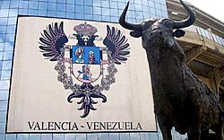
- Plaza de toros Monumental de Valencia: This is part of the Parque Recreacional del Sur. It has one of the biggest bullrings in Latin America. But today, it's mostly used for concerts and other cultural events, not just bullfighting.
Learning and Culture
Miguel Peña has a public library called Miguel Colombet. You can find it on Calle Sucre.
There are also two main high schools: Liceo Zuloaga and Liceo Ponce Bello. Many other elementary schools are in the area too.
Getting Around
Most people in Miguel Peña travel by bus. Different bus companies serve the area.
Metro Stations
Valencia has an underground train system called the Valencia Metro. The metro line starts in Miguel Peña. There are two metro stations in this area:
- Estación La Monumental
- Estación Las Ferias
Postal Code
The postal code for Miguel Peña is 2001.
See also
 In Spanish: Parroquia Miguel Peña para niños
 | Janet Taylor Pickett |
 | Synthia Saint James |
 | Howardena Pindell |
 | Faith Ringgold |


