Milecastle 18 facts for kids
Quick facts for kids Milecastle 18 |
|
|---|---|
| Northumberland, England, UK | |

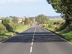
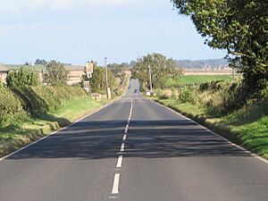
The line of Hadrian's Wall (beneath the modern road) at Milecastle 18
|
|
|
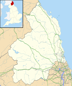
Location in Northumberland
|
|
| Coordinates | 55°00′35″N 1°55′35″W / 55.009777°N 1.926324°W |
Milecastle 18, also called East Wallhouses, was a small fort built by the Romans. It was part of Hadrian's Wall, a huge stone wall across northern England. This milecastle is found near East Wallhouses in Northumberland. Today, you can still see a raised area in the ground where it once stood.
Milecastle 18 is special because it seems different Roman legions worked on it. A "legion" was a large unit of Roman soldiers. Historians think one group of soldiers might have started building it. Then, another group might have finished the job. One of its nearby watchtowers, called a turret, was even used as a workshop. Soldiers might have repaired shoes there!
Contents
Building Milecastle 18
Milecastle 18 was built in a unique way. It was a "long-axis milecastle," meaning it was longer from north to south. It also had "Type I gateways." Usually, long-axis milecastles were built by the Legio VI Victrix or Legio XX Valeria Victrix. But Type I gateways were typically built by the Legio II Augusta. Milecastle 18 is the only one of the 80 milecastles with this mix!
The gateway of this milecastle was built a bit more roughly than others. Its north wall was wide, but its side walls were narrow. This also suggests that different legions worked on it. One legion might have started it, and another finished it.
The milecastle is located on the Military Road. This is just west of East Wallhouses. It measured about 16.4 meters (53 feet 8 inches) from east to west. It was about 18.1 meters (59 feet 6 inches) from north to south. Its side walls were about 2.36 meters (7 feet 9 inches) thick. This site was officially protected as an ancient monument in 1997. You can't see many stone remains today. But part of the milecastle is visible as a platform. It is about 0.5 meters (1.6 feet) high next to the road. The modern road covers much of the old milecastle.
Digging Up the Past: Discoveries
Archaeologists have dug up Milecastle 18 several times. These digs help us learn more about its history.
What Was Found in 1931?
In 1931, archaeologists dug at Milecastle 18. They found that most of its stones had been taken away. This is called "robbing" of stone. Only the part of the milecastle under the modern road was still preserved.
Discoveries in 1978
In 1978, more digging happened just west of the milecastle. Near a farm, they found old cobblestones and sandstone. These might have been part of a Roman road. This road could have led to the south gate of the fort. It might have been part of the Roman Military Way.
The Ditch in 1999
In 1999, the ditch outside this milecastle was dug up. It was found to be 13 meters (about 42 feet) wide. It was also between 2.74 and 2.96 meters (about 9 to 9.7 feet) deep. The ditch had a U-shape. There was no sign of a path crossing it. However, a path used to cross the Vallum south of the wall. The Vallum was a large ditch and earthwork built by the Romans.
Nearby Watchtowers: Turrets
Each milecastle on Hadrian's Wall had two watchtowers. These were called turrets. They were placed about one-third and two-thirds of a Roman mile west of the milecastle. Soldiers from the milecastle would have guarded these turrets. The turrets connected to Milecastle 18 are Turret 18A and Turret 18B.
Turret 18A (Wallhouses East)
Turret 18A is located where Moorhouse Road meets the Military Road. You can spot its location by a slight rise in the hedgeline. When it was dug up in 1931, it was very well preserved. Its ladder platform was still standing tall. It even had six stone steps. A large stone ball, called a ballista ball, was also found there. This was a type of ammunition used by Roman war machines.
West of Turret 18A, the Vallum was excavated in 1980–81. This was done before a pipeline was built. The Vallum was 8 meters (about 26 feet) wide and 2.29 meters (about 7.5 feet) deep here. The earth mounds next to the Vallum had been broken through. This allowed a metal path to be laid across during the Antonine period. Old plow marks were found under the mounds. This shows that farming happened in this area before the Vallum was built. Turret 18A became a protected monument at the same time as Milecastle 18.
Turret 18B (Wallhouses West)
Turret 18B lies under the grass verge of the Military Road. An old toll house, which is now gone, used to stand over much of the turret's remains. This turret was partly dug up in 1931. A full excavation was done by Durham University in 1959.
The excavations showed a clay platform on the turret's floor. There was also a hearth in the doorway. This turret might have been a workshop. The hearth showed signs of being used at very high temperatures. A 1-meter (about 3.3 feet) deep layer of ash, stained with iron, was found. Many iron objects were also discovered. A small area nearby seemed to be used as a coal storage.
Finds included an iron shield boss (the center part of a shield). Sixty hobnails were also found. These are small nails used in shoe soles. This suggests that shoes were repaired here. Other finds included a brooch, three copper items, and a bone plaque. A "struck flake" (a piece of stone used as a tool), cooking pots, and animal bones were also found. Shellfish remains were present too. These finds show two different times when the turret was used. A layer of rubble separated these periods. The Durham University excavation concluded that the turret was no longer used by the end of the 2nd century AD. There are no visible remains of Turret 18B today. It was protected at the same time as the Milecastle and Turret 18A.
Monument Records
| Monument | Monument Number | English Heritage Archive Number |
| Milecastle 18 | 20446 | NZ 06 NW 1 |
| Turret 18A | 20449 | NZ 06 NW 2 |
| Turret 18B | 20452 | NZ 06 NW 3 |
 | Victor J. Glover |
 | Yvonne Cagle |
 | Jeanette Epps |
 | Bernard A. Harris Jr. |


