Military Way (Hadrian's Wall) facts for kids

The Military Way is the modern name for an important Roman road. It was built right next to the famous Hadrian's Wall in northern Britain. This road helped the Roman army move quickly along the Wall.
Contents
When Was It Built?
The Military Way was likely built soon after 162 AD. This was when the Romans returned to Hadrian's Wall. Before this, they had tried to expand their territory further north. But they later abandoned another wall, the Antonine Wall.
The road wasn't part of the first plans for Hadrian's Wall. However, it was built quite early. We know this because smaller roads connected the Military Way to the watchtowers (called turrets) along the Wall.
How Was It Built?
Like most Roman roads, the Military Way was made from large stones. Its surface was covered with gravel. It was usually about 6 meters (20 feet) wide. The road also had a slight curve, called a camber, up to 46 centimeters (18 inches) high in the middle. This helped water drain off.
Historians believe this road was not meant for wagons or carts. It was probably used mostly by soldiers on foot or horseback. This idea is supported by how steep some parts of the road are. In some places, the slopes were very sharp, making it hard for wheeled vehicles to pass.
Milestones and Connections
The Military Way had smaller roads, called spurs, that connected it to the milecastles. These were small forts built every Roman mile along Hadrian's Wall. For example, a spur connected to Milecastle 9.
Some milestones have been found along the road. These were stone pillars that showed distances. In the 3rd century, these milestones measured distances westward. They started counting from another Roman road called Dere Street.
Where Did It Go?
The Military Way often ran along the top of the northern mound of the Vallum. The Vallum was a large ditch and earthwork built just south of Hadrian's Wall. In other places, the road ran between the Vallum and the main Wall itself.
At river crossings, like Chesters Bridge and Willowford Bridge near Birdoswald Roman fort, the bridges were made wider. This happened in the early 3rd century. The widening allowed the Military Way to cross, not just a narrow walkway as before.
The Military Way Today
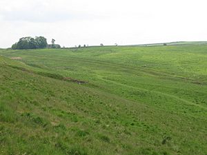
You can still see much of the Military Way today. It is even possible to walk along parts of it. A good section to explore is between Sewing Shields (near Milecastle 35) and Walltown Quarry (near Turret 45A).
There is a public right of way that follows the Military Way. This path runs from Milking Gap (near Milecastle 38) to Walltown Quarry. It's a great way to experience a piece of Roman history!
 | Selma Burke |
 | Pauline Powell Burns |
 | Frederick J. Brown |
 | Robert Blackburn |

