Milecastle 9 facts for kids
Quick facts for kids Milecastle 9 |
|
|---|---|
| Tyne and Wear, England, UK | |

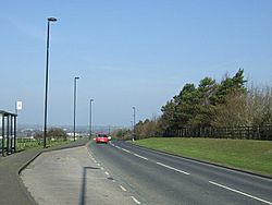
Milecastle 9 lies under the B6528 road in West Denton
|
|
|
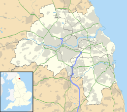
Location in Tyne and Wear
|
|
| Coordinates | 54°59′27″N 1°43′20″W / 54.990701°N 1.722327°W |
Milecastle 9 (Chapel House) was a small fort, called a milecastle, built by the Romans as part of Hadrian's Wall. You can still see some of its remains as a low, flat area in West Denton, which is west of Newcastle upon Tyne. It's about 300 meters (330 yards) from Chapel House Farm.
However, the northern part of this milecastle is now mostly covered by modern roads, like the A69 and B6528. Milecastle 9 is important because it marks a point where the milecastles to its west have clearer locations, while those to its east are harder to find.
Contents
Building Milecastle 9
Milecastle 9 was built with its longest side facing the Wall, which is called a "long-axis milecastle." It had special gates known as "Type IV gateways." These were a wider version of another gate style.
Historians believe that the Legio XX Valeria Victrix (the Twentieth Legion, a Roman army group) built milecastles with these types of gates. This legion was based in a Roman city called Deva Victrix, which is now Chester. Only a few other milecastles, like Milecastle 27 and possibly Milecastle 10, are known to have these same Type IV gateways.
The inside of Milecastle 9 was about 14.9 meters (48 feet 10 inches) wide and 18.3 meters (60 feet) long. Its gates were about 2.7 meters (9 feet) wide. The side walls were also about 2.7 meters (9 feet) thick. The south wall was a bit thinner and had rounded corners. The walls were made from a mix of clay and rubble, with stones on the outside held together by mortar.
Workers found seven stones from the bottom layer of the walls that had Roman numerals carved into them. Five stones had 'VIII', one had 'VIIII', and one had 'IX'. These numbers might have been carved at the quarry where the stones were cut.
Archaeologists also found a posthole in the western part of Milecastle 9. This suggests there might have been an older wooden building there before the stone one. The stone barracks, where the soldiers lived, were quite small, only 32 square meters (344 square feet). Because of this, some experts think only 8 soldiers lived here, which is fewer than in many other milecastles (some held up to 32). The stone barracks were made bigger in the 200s AD, and another building was put up nearby to the west.
Discoveries and Studies
Over the years, many people have studied and dug at Milecastle 9.
- 1840: A historian named Hodgson wrote that around 1790, strong stone foundations were dug up at Chapel Houses, in an area called "Chapel."
- 1858: Henry MacLauchlan noted that the remains at Chapel House were so damaged that it was hard to see their original shape.
- 1929: During excavations, only the very bottom layer of the milecastle's side walls remained. However, six layers of stones were still standing on the north and south walls. This dig helped figure out the milecastle's size. Many interesting items were found, including:
- A posthole in the western part, hinting at an earlier wooden structure.
- Part of a stone barrack block, which was small (32 square meters). This suggested a small group of 8 soldiers, called a Contubernium, lived there. The barracks were later expanded in the 200s AD, probably to hold 32 soldiers.
- Another building nearby, whose purpose is still unknown.
- Pieces of pottery from different periods when the Wall was in use.
- Coins from Roman emperors Tetricus I and Valentinian I. Finding Valentinian I's coin was important because it showed that Milecastle 9 was one of only 10 milecastles that had evidence of being used in the 300s AD.
- A board for playing games.
- Part of a sword scabbard chape (the metal tip of a sword sheath).
- Part of a stone carving (a relief) of a female figure.
- A very unusual discovery was a Roman or later cist burial (a stone box grave) found outside the south wall. It held a skeleton of a 17-year-old person, but without a head. Bones of an adult man and a woman around 20 years old were also found nearby.
- The Military Way, a Roman road that ran behind Hadrian's Wall, was found about 9.7 meters (32 feet) south of the milecastle. It was over 9.7 meters (32 feet) wide and had a branch road leading to the milecastle's gate.
- 1951: More digging confirmed the north gate and identified it as a Type IV gateway.
- 1966: English Heritage (a group that looks after historic places) noted that most of the milecastle was now covered by road widening. The southern part was still visible as a slight bump in a farm field.
- Late 1990s: An English Heritage study found that Milecastle 9 was one of only 14 milecastles on farmland. It was also one of only two (the other being Milecastle 19) that were being damaged by farming. Plows were scraping the tops of the remaining walls on the south side. Experts concluded that the only way to protect it was to stop farming on that land.
- 2000: Another partial dig found a paved area outside the southeast corner. Evidence suggested the milecastle might have been built on older archaeological layers. A layer of yellow clay was found below the milecastle, possibly put there as a flat base for building. A ditch was also found to the east, which might have been part of the milecastle's defenses. If so, Milecastle 9 would be one of only five milecastles known to have a perimeter ditch.
Nearby Watchtowers
Every milecastle along Hadrian's Wall had two smaller watchtowers, called turrets, linked to it. These turrets were placed about one-third and two-thirds of a Roman mile to the west of the milecastle. Soldiers from the milecastle's group would likely have staffed them. The turrets connected to Milecastle 9 are known as Turret 9A and Turret 9B.
Turret 9A
Turret 9A is believed to be under a modern road in Walbottle. We don't know its exact spot because there are no visible signs left. Digs in 1929 tried to find it but were not successful.
Presumed location: 54°59′32″N 1°43′46″W / 54.9922°N 1.729511°W
Turret 9B
Turret 9B (Walbottle) is also located under a modern road called Hawthorn Terrace, near St. Cuthbert's Primary School. Even though the road now covers its surface remains, about 5.8 meters (19 feet) of Turret 9B's south wall was found in 1928. It was under a hedge north of the road. There's some debate about its exact position, but it was noted that it was built with strong stone, similar to Turret 7B, and had its door in the same place.
Location on Ordnance Survey 1:25 000 map: 54°59′37″N 1°44′12″W / 54.993672°N 1.736733°W
Official Records
| Monument | Monument Number | English Heritage Archive Number |
| Milecastle 9 | 22662 | NZ 16 NE 5 |
| Turret 9A | 22667 | NZ 16 NE 6 |
| Turret 9B | 22670 | NZ 16 NE 7 |
 | William Lucy |
 | Charles Hayes |
 | Cleveland Robinson |


