Milecastle 10 facts for kids
Quick facts for kids Milecastle 10 |
|
|---|---|
| Tyne and Wear, England, UK | |

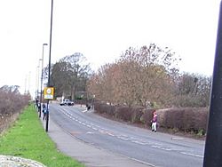
Milecastle 10 lies near the B6528 road near Throckley
|
|
|
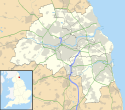
Location in Tyne and Wear
|
|
| Coordinates | 54°59′43″N 1°44′38″W / 54.995197°N 1.744027°W |
Milecastle 10, also known as Walbottle Dene, was a small fort built by the Romans. It was part of Hadrian's Wall, a famous ancient wall in northern England. This milecastle is found near the village of Throckley in Tyne and Wear.
Much of Milecastle 10 is now hidden under a road. However, parts of its northern wall can still be seen in a garden. Archaeologists have dug here many times to learn more about it. They found its walls, but farming over the years has damaged them. Only one of its two smaller watchtowers, called turrets, has been found so far.
Contents
Building Milecastle 10
Milecastle 10 was built as a "long-axis" milecastle. This means it was longer from north to south than from east to west. It also had a special type of gate called a Type IV gateway. Experts believe the legio XX Valeria Victrix, a Roman army group from Deva Victrix (modern-day Chester), built these kinds of milecastles.
Hadrian's Wall usually runs in a straight line. But near Milecastle 10, the wall makes a turn before crossing a small valley called a dene. The milecastle itself was about 78 feet (24 m) long and 67 feet (20 m) wide. Its walls were very thick, about 10 feet (3.0 m) across.
You can still see parts of the north gate in a garden. It has twelve large foundation stones. On top of these are three stone blocks. One block has a star mark, and two have holes for the gate's hinges. Another block has a special hole for lifting tools. The southern part of the milecastle is now just a small mound in a field. You can also see a bit of the old Roman ditch.
Digging Up the Past: Excavations
Archaeologists have explored Milecastle 10 many times to uncover its secrets.
Early Discoveries: 1864 to 1928
- 1864: The north and south gates were dug up. The middle of the milecastle was already under a road. The north gate was found to be two stone layers high. It had an entrance about 11 feet (3.4 m) wide. A special stone, called a centurial stone, was found. It had "c[entvria] Car..." carved on it. This stone is now in the Black Gate Museum.
- 1928: The North of England Excavation Committee dug here. They found part of the southwest gate in a field. They learned that not much was left of the east wall. They also didn't find any signs of buildings inside the milecastle.
Later Investigations: 1966 to 2000
- 1966: An English Heritage team checked the site. They noted that only the northern gate could still be seen on the surface.
- 1979: Another English Heritage team recorded the foundations of part of the north wall. These foundations were 6.4 metres (21 ft) long. Three stone blocks from the first layer were still on top of them.
- 1988: The Royal Commission on the Historical Monuments of England carefully measured the milecastle.
- 1999: P Duffy from Central Archaeological Services dug two trenches. They wanted to see how well the milecastle was preserved. They found the east and west walls. They also found some stone paving on the west side and an oven in the southeast corner. Sadly, they saw that farming had "considerably damaged" the remains.
- 2000: English Heritage did another archaeological check. This time, they looked at the vallum (a ditch and bank system) near Milecastle 10.
Watchtowers: Associated Turrets
Every milecastle along Hadrian's Wall had two smaller watchtowers, called turrets. These turrets were placed about one-third and two-thirds of a Roman mile west of the milecastle. Soldiers from the milecastle would have guarded these turrets. The turrets linked to Milecastle 10 are Turret 10A and Turret 10B.
Turret 10A (Throckley East)
Turret 10A is about 509 yards (465 m) west of Milecastle 10. It is now under the modern Hexham Road (B6528). You can't see any parts of it on the surface. However, archaeologists dug it up in 1930 and 1980.
The 1930 dig could only look at the southeast corner. They found the walls were about 3 feet (0.91 m) thick and five stone layers high. The entrance was in the south wall. The 1980 dig was bigger. It happened before some building work. This dig found two main layers of occupation, meaning two periods when people lived there.
Most of the pottery found was from before 140 AD. Only one small piece was from later. This suggests the turret was mainly used in the early days of Hadrian's Wall. There's no sign it was destroyed when it was no longer used. The walls were made of sandstone and clay, held together with mortar. The foundations were stone slabs on clay.
Archaeologists found a lot of burnt wood and charcoal inside the turret. This might be from many campfires near the door and along the north wall. Other finds included a spearhead and four worked flints. They also found what might have been a platform in the southwest corner.
The 1980 dig also removed the turret's floor to look at the clay underneath. Here, they found criss-crossed grooves in the clay. These were marks from an ard, an ancient type of plough. These plough marks are much older than the Roman wall. They likely date back to the late Neolithic (New Stone Age) or early Bronze Age. After the dig, the turret and the plough marks were covered up again under the modern road.
Location: 54°59′45″N 1°45′04″W / 54.995841°N 1.751213°W
Turret 10B (Throckley)
Turret 10B has not been found yet. There are no visible signs of it on the surface. It is probably under Hexham Road, like Turret 10A. Digs in 1928 and 1983 tried to find it but were not successful. The soil in this area has burnt wood remains. This might be from when the Romans cleared the land to build the wall.
Location: 54°59′46″N 1°45′32″W / 54.996036°N 1.758871°W
Roman Records
The Roman sites like Milecastle 10 and its turrets are important historical places. They are given special numbers to help keep track of them.
| Roman Site | Monument Number | English Heritage Archive Number |
| Milecastle 10 | 22673 | NZ 16 NE 8 |
| Turret 10A | 22678 | NZ 16 NE 9 |
| Turret 10B | 22681 | NZ 16 NE 10 |
 | Leon Lynch |
 | Milton P. Webster |
 | Ferdinand Smith |


