Milecastle 27 facts for kids
Quick facts for kids Milecastle 27 |
|
|---|---|
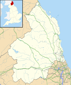
| Northumberland, England, UK | |

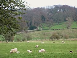
Site of Milecastle 27
|
|
|
Location in Northumberland
|
|
| Coordinates | 55°01′28″N 2°07′55″W / 55.024321°N 2.131845°W |
Milecastle 27 (Low Brunton) was a small fort or guard post built by the Romans. It was part of Hadrian's Wall, a famous ancient barrier in England. This milecastle was located about halfway between a modern road (the A6079) and the River North Tyne. Today, you can still see its remains as a low, square-shaped mound. It's about 0.4 metres (1.3 ft) high, but it's not very clear on its north and east sides.
Contents
Building the Milecastle
Milecastle 27 was built as a "long-axis milecastle." This means it was longer from north to south than from east to west. We don't know what type of gates it had. Experts believe that the Legio XX Valeria Victrix (the Twentieth Legion, also known as Valeria Victrix) built milecastles like this one. This Roman army group was based in a place called Deva Victrix, which is now the city of Chester.
The inside of Milecastle 27 measured about 60 feet (18 m) from north to south and 50 feet (15 m) from east to west. It is known as a Type IV milecastle, which means it had strong, wide side walls.
The milecastle was part of the "Broad Wall" section of Hadrian's Wall. At this spot, the wall had a core made of clay with stones set in mortar on the outside. The foundations of the wall here were unusually wide, between 3.35 metres (11.0 ft) and 3.5 metres (11 ft).
Discovering and Studying Milecastle 27
Over the years, people have investigated Milecastle 27 to learn more about it.
- 1930: A person named Miss T Hepple first found Milecastle 27 on April 5th.
- 1952: The size of the milecastle was measured. No ancient coins or writings were found here. Only one piece of pottery was discovered, but it was too old to tell exactly when it was made.
- 1966: English Heritage (a group that looks after historic places) did a field study. They saw the milecastle as a low but clear mound in a grassy field. However, no stone walls were left. They made a detailed map of the milecastle.
- 1989: English Heritage did another field study. They noted that the milecastle was still a slight square platform, about 0.4 metres (1.3 ft) high. They also noticed that nettle plants were growing inside the area.
Guard Towers (Turrets) Nearby
Every milecastle along Hadrian's Wall had two smaller guard towers, called turrets, connected to it. These turrets were placed about one-third and two-thirds of a Roman mile to the west of the milecastle. Soldiers from the milecastle would likely have guarded these towers. The turrets linked to Milecastle 27 are known as Turret 27A and Turret 27B.
Turret 27A
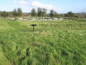
Turret 27A was actually taken down not long after it was built. This was done to make space for a larger Roman fort called Cilurnum (now known as Chesters Roman Fort). So, only its foundations remain, hidden beneath parts of the fort. You can find these foundations just east of the northwest corner of the fort's main headquarters building, called the principia. The foundations measured about 3.36 metres (11.0 ft) square and are made of a single layer of clay and large, rounded stones.
You can find Turret 27A on an Ordnance Survey map at these coordinates: 55°01′33″N 2°08′21″W / 55.025912°N 2.139139°W.
Turret 27B
There are no visible signs of Turret 27B left today. Its location has been figured out by calculations based on the spacing of other structures along the wall.
Its calculated location is: 55°01′40″N 2°08′44″W / 55.027639°N 2.145684°W.
Visiting These Roman Sites
You cannot visit Milecastle 27 or the calculated spot of Turret 27B, as they are not open to the public.
However, you can visit Turret 27A. It is located within Chesters Roman Fort, and you can see it when you pay for admission to the fort, which is managed by English Heritage.
 | Calvin Brent |
 | Walter T. Bailey |
 | Martha Cassell Thompson |
 | Alberta Jeannette Cassell |


