Banna (Birdoswald) facts for kids
Quick facts for kids Banna |
|
|---|---|
 |
|
| Known also as | Birdoswald Roman Fort |
| Founded | c. 112 AD |
| Abandoned | c. 500 AD |
| Place in the Roman world | |
| Province | Britannia |
| Location | |
| Coordinates | 54°59′22″N 2°36′08″W / 54.9894°N 2.6023°W |
| County | Cumbria |
| Country | England |
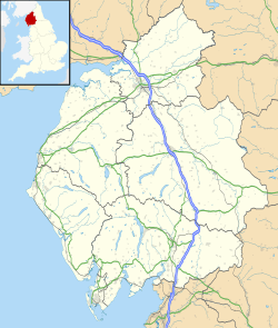
Birdoswald Roman Fort was called Banna by the Romans. This name meant "peak" or "horn" in the old Celtic language. It got this name because it sits on a high, triangular piece of land. Cliffs protect it on the south and east sides. From here, you can see a wide bend in the River Irthing in Cumbria.
The fort is near the western end of Hadrian's Wall. It's one of the best-preserved forts out of the 16 along the wall. It also has the longest surviving part of Hadrian's Wall attached to it.
Cumbria County Council managed Birdoswald fort from 1984 to 2004. Then, English Heritage took over its care.
Contents
Exploring Birdoswald Roman Fort
How the Fort Was Built
The western part of Hadrian's Wall was first built with turf starting around 122 AD. The stone fort was built later. It had the usual playing card shape, with gates on the east, west, and south. It was about 7.5 miles (12.1 km) east of Camboglanna (Castlesteads) fort. It was also 6.5 miles (10.5 km) from Aesica (Great Chesters).
Roman soldiers, called auxiliaries, lived here. The Cohors I Aelia Dacorum was one group stationed at Birdoswald. They occupied the fort from about 126 AD to 400 AD.
Hadrian's Wall: A Unique Section
The two-mile part of Hadrian's Wall around Birdoswald is very interesting. It's the only known section where the original turf wall was replaced. This new stone wall was built about 50 m (160 ft) further north. It lined up with the fort's north wall, not its east and west gates.
No one is completely sure why this change happened. Some think it was for better signaling. Others, like Stewart Ainsworth from Time Team, suggested a cliff collapse into the river caused it. This area is special because you can see both the turf and stone walls.
Life After the Romans
Birdoswald is the only place on Hadrian's Wall with clear signs of people living there after the Romans left. Digs from 1987 to 1992 showed continuous occupation. People lived in the fort's granaries from the late Roman period until possibly 500 AD.
The granaries were replaced by two large timber halls. These halls are similar to others found in Britain from the fifth and sixth centuries. Experts believe the fort became a base for a local group. They might have been descendants of the Roman soldiers.
What Was Inside the Fort?
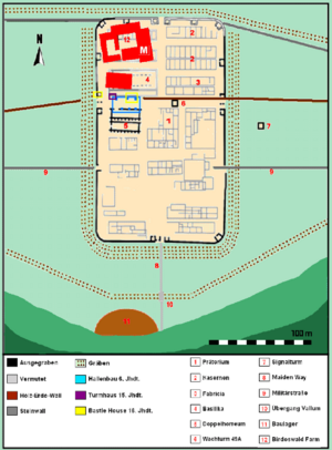
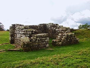
Inside the fort, there were stone buildings. These included a main headquarters building (principia) and granaries (horrea). There were also barracks for the soldiers.
Unusually, Birdoswald also had an exercise building (basilica exercitatoria). This might have been because training soldiers in the cold north of England was difficult.
Archaeologists have found signs of civilian settlements (vici) outside the fort. These were on the east, west, and north sides. A bathhouse was also found in the valley of the River Irthing.
Other Nearby Roman Sites
Willowford Bridge Remains
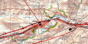
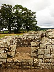
About 600 m (2,000 ft) east of Birdoswald, you can find the remains of Willowford bridge. This bridge carried Hadrian's Wall across the River Irthing. Over time, the river moved west. This left the east side of the bridge high and dry. The west side was likely destroyed by erosion.
Even so, the visible remains are very impressive. Until 1996, you couldn't easily reach these remains from the fort. Now, a metal footbridge over the Irthing makes it easy to visit.
Civilian Settlements and Outposts
The Vicus (civilian settlement) was just southwest of the fort. A cemetery was located southeast of the fort. It was near the edge of the Irthing cliffs.
Birdoswald fort was connected to Bewcastle, an outpost fort. Bewcastle is about 7 miles (11 km) to the north. Signals could be sent between the two forts using two signaling towers.
Digging Up the Past: Excavations
Birdoswald fort has been dug up and studied for over a hundred years. Excavations in the 20th century started in 1911. F.G. Simpson led these early digs. Ian Richmond continued the work from 1927 to 1933.
Later, Brenda Swinbank and J P Gillam re-excavated the gateways and walls. This happened from 1949 to 1950.
Between 1997 and 2001, TimeScape Surveys did extensive surveys. They used magnetometry and earth resistance to map what was underground. These surveys showed that the fort's buried remains were very well preserved.
In January 2000, the Channel 4 TV show Time Team excavated an area. This was between the fort and the cliffs. They found signs of a settlement outside the fort (vicus). However, this area is prone to erosion. Much of the settlement might have fallen over the cliffs.
In 2021, Newcastle University, Historic England, and English Heritage started a new major archaeological dig at the site.
Birdoswald Roman Fort Today
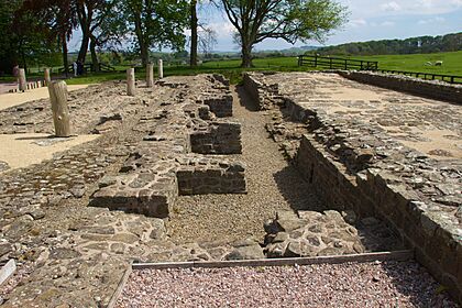
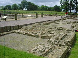
Today, English Heritage manages the fort's site. It is known as Birdoswald Roman Fort. The visitor centre has displays and models of the fort. You can learn about life in Roman Britain and the site's long history. It also shows discoveries from the 19th and 20th centuries. Visitors can walk around the excavated remains of the fort outside.
 | Lonnie Johnson |
 | Granville Woods |
 | Lewis Howard Latimer |
 | James West |


