Milecastle 5 facts for kids
Quick facts for kids Milecastle 5 |
|
|---|---|
| Tyne and Wear, England, UK | |

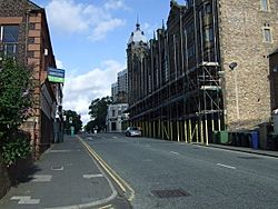
Milecastle 5 probably lies under the A186 road
|
|
|
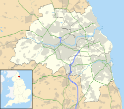
Location in Tyne and Wear
|
|
| Coordinates | 54°58′17″N 1°37′44″W / 54.971402°N 1.628967°W |
Milecastle 5 (Quarry House) was a small fort built by the Romans as part of Hadrian's Wall. Hadrian's Wall was a huge stone wall that stretched across northern England. It was built to protect the Roman Empire from tribes to the north. Milecastles were like mini-forts placed about one Roman mile apart along the wall. They helped control who passed through and provided shelter for soldiers.
Milecastle 5 was the first milecastle located to the west of a larger Roman fort called Pons Aelius. Pons Aelius is where the city of Newcastle upon Tyne is today. Sadly, you can't see any parts of Milecastle 5 anymore. It is believed to be located under the busy A186 Westgate road and the B1311 Corporation Street.
Contents
Building the Milecastle
We don't know much about how Milecastle 5 was built. For example, we don't know the exact shape of its walls or what its gates looked like. This is because no parts of it are left for archaeologists to study.
Discovering Milecastle 5
Even though we can't see Milecastle 5 today, historians and archaeologists have tried to find its location over the years.
Early Discoveries
- 1732 - A person named John Horsley explored the area. He thought he saw signs of a small fort right behind a building called the "quarry-house."
- 1858 - Later, Henry MacLauchlan agreed with Horsley's idea. He believed a milecastle was likely where Hadrian's Wall made a turn at the top of Westgate Road.
Modern Investigations
- 1968 - The organization English Heritage did an investigation. They found that all signs of the milecastle had been completely covered up by modern buildings and roads. This means it's very hard to find any remains today.
Turrets Near Milecastle 5
Each milecastle along Hadrian's Wall had two smaller lookout towers, called turrets, connected to it. These turrets were placed about one-third and two-thirds of a Roman mile to the west of the milecastle. Soldiers from the milecastle would have likely guarded these turrets.
The turrets linked to Milecastle 5 are known as Turret 5A and Turret 5B.
Turret 5A
The exact spot of Turret 5A is thought to be at these coordinates: 54°58′24″N 1°38′12″W / 54.973223°N 1.636761°W. However, finding Milecastle 4 in a different place than expected has made experts wonder about the exact locations of all the milecastles and turrets in this area. Even so, the site of Turret 5A is still recorded in the English Heritage Archive.
Turret 5B
Similar to Turret 5A, the discovery of Milecastle 4 in an unexpected spot has made people question the exact locations of other Roman structures nearby. The presumed location for Turret 5B is 54°58′27″N 1°38′40″W / 54.974144°N 1.644564°W. This site is also included in the English Heritage Archive.
Official Records
The locations of Milecastle 5 and its turrets are recorded in official historical documents.
| Monument | Monument Number | English Heritage Archive Number |
| Milecastle 5 | 25026 | NZ 26 SW 3 |
| Turret 5A | 22667 | NZ 26 SW 4 |
| Turret 5B | 25032 | NZ 26 SW 5 |
See also
 In Spanish: Castillo miliar 5 para niños
 | Janet Taylor Pickett |
 | Synthia Saint James |
 | Howardena Pindell |
 | Faith Ringgold |


