Milecastle 54 facts for kids
Quick facts for kids Milecastle 54 |
|
|---|---|

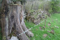
Small fragment of Hadrian's Wall visible to the west of the site of Milecastle 54
|
|
| Type | Milecastle |
| Location | |
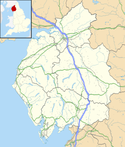
| Coordinates | 54°58′21″N 2°42′13″W / 54.972582°N 2.703493°W |
| County | Cumbria |
| Country | England |
Milecastle 54 (Randylands) was a small fort, called a milecastle, built along Hadrian's Wall in ancient Roman times. It was part of a huge wall that stretched across northern England.
Contents
What is Milecastle 54?
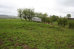
Milecastle 54 is located on a hillside that faces west, near the village of Lanercost. Today, you can't see much of the milecastle itself. There are only some unclear bumps and ditches in the ground, which archaeologists call earthworks.
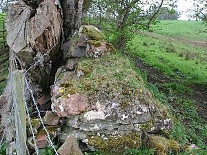
However, you can still see a small part of Hadrian's Wall about 250 meters (about 820 feet) west of where Milecastle 54 once stood. This piece of the wall is made of stone and mortar and is about 1.7 meters (about 5.5 feet) tall.
Digging Up the Past: Excavations at Milecastle 54
Archaeologists excavated (dug up) Milecastle 54 in 1934. They found that the inside of the fort measured about 19.3 meters (63 feet) from east to west and 23.3 meters (76 feet) from north to south.
Inside, there was a building that served as a barrack, a place where soldiers lived. This barrack had two rooms. One of these rooms had stone benches, a fireplace (called a hearth), and a large stone for grinding grain (a millstone).
The archaeologists also discovered that this stone milecastle was built on top of an older, earlier version. The first milecastle was part of the Turf Wall, which was made of earth and turf before the stone wall was built.
Meet the Turrets: 54A and 54B
Every milecastle along Hadrian's Wall had two smaller watchtowers, called turrets, connected to it. These turrets were placed about one-third and two-thirds of a Roman mile to the west of the milecastle.
Soldiers from the milecastle would likely have guarded these turrets. The turrets linked to Milecastle 54 are known as Turret 54A and Turret 54B.
Turret 54A: Garthside's Story
Turret 54A (Garthside) was excavated in 1933. During the dig, archaeologists found remains of two stone turrets. The first turret had been built on unstable ground, and its front wall had fallen down. Because of this, a second turret was built on a stronger, higher part of the hill.
The pottery found at both turrets helped experts figure out their age. The pottery showed that they were built in the early 100s AD. It also suggested that people probably stopped using them around 180 AD. Today, you can't see any remains of Turret 54A on the surface.
Near Turret 54A, Hadrian's Wall still exists as a large, turf-covered bank at the bottom of a hedge.
Turret 54B: Howgill's Secrets
Turret 54B (Howgill) was also excavated in 1933. The excavations uncovered four layers of red sandstone blocks. Like Turret 54A, there are no visible remains of Turret 54B on the surface today.
About 190 meters (623 feet) southwest of where Turret 54B once stood, you can see a small stone with writing on it. This stone is called a centurial stone. It was discovered around 1717 and is now built into the outside wall of a building at Howgill Farm. The stone tells us that the Catuvellauni people helped rebuild this part of Hadrian's Wall in 369 AD.
 | Selma Burke |
 | Pauline Powell Burns |
 | Frederick J. Brown |
 | Robert Blackburn |


