Milecastle 56 facts for kids
Quick facts for kids Milecastle 56 |
|
|---|---|

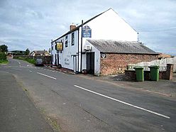
Milecastle 56 is thought to lie northeast of the former village inn at Walton
|
|
| Type | Milecastle |
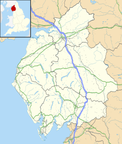
| Location | |
| Coordinates | 54°58′17″N 2°44′51″W / 54.971466°N 2.747448°W |
| County | Cumbria |
| Country | England |
Milecastle 56 (Walton) was a small fort, or "milecastle," built along Hadrian's Wall in ancient Roman times. These milecastles were like mini-forts placed about one Roman mile apart all along the wall. They helped the Roman soldiers guard the border and control who came in and out of Roman Britain.
Contents
Where Was Milecastle 56 Located?
Milecastle 56 was likely located just northeast of an old inn in a village called Walton, Cumbria. Today, the main path of Hadrian's Wall goes right under the village. This means Milecastle 56 has been completely covered up over time.
In 1858, people thought they could still see faint signs of the milecastle. However, by 1900, a new survey found no trace of it at all. It's now completely hidden from view.
What Were Associated Turrets?
Every milecastle on Hadrian's Wall had two smaller lookout towers, called turrets, connected to it. These turrets were placed about one-third and two-thirds of a Roman mile to the west of each milecastle. Soldiers from the milecastle would have likely staffed these turrets. The turrets linked to Milecastle 56 are known as Turret 56A and Turret 56B.
Turret 56A (Sandyside)
Turret 56A (Sandyside) is believed to be just east of a farm called Sandysike. This turret has never been found on the ground. Its likely position has been worked out by looking at other structures along Hadrian's Wall. There was an attempt to find it in 1933, but it was unsuccessful.
In the woods on both sides of Sandysike, you can still see Hadrian's Wall. It looks like an earth-covered bank, about 5.6 meters wide and up to 0.5 meters high. Close by, there's a Roman altar built into an old farm building at Sandysike, about 0.7 meters above the ground.
Turret 56B (Cambeck)
Turret 56B (Cambeck) is located about 140 meters east of a stream called Cam Beck. It sits on a raised area of land near the river. This turret was found in 1933. It measured 6.2 meters across. It stuck out about 0.8 meters in front of the main line of Hadrian's Wall. It's thought that this turret was originally part of the earlier Turf Wall, which was made of earth and turf before the stone wall was built. Today, you can't see any signs of this turret above ground.
The site of a larger Roman fort called Castlesteads (Camboglanna) is located about 440 meters south of Turret 56B.
 | Shirley Ann Jackson |
 | Garett Morgan |
 | J. Ernest Wilkins Jr. |
 | Elijah McCoy |


