Milecastle 77 facts for kids
Quick facts for kids Milecastle 77 |
|
|---|---|

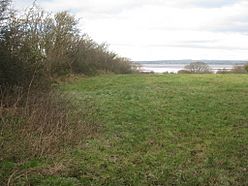
View towards the Solway Firth near the site of Milecastle 77
|
|
| Type | Milecastle |
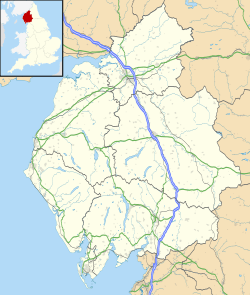
| Location | |
| Coordinates | 54°56′07″N 3°09′42″W / 54.935277°N 3.161712°W |
| County | Cumbria |
| Country | England |
Milecastle 77, also known as Raven Bank, was a small fort built by the Romans. It was part of a long line of similar forts called milecastles. These forts were placed about one Roman mile apart along Hadrian's Wall. Hadrian's Wall was a huge stone wall built by the Romans to protect their land.
Where is Milecastle 77?
Experts believe Milecastle 77 is located northeast of a village called Glasson. However, its exact spot has not been found yet. In 1973, archaeologists dug in the area to find it. But their search did not clearly show where the milecastle was. It is thought to be about 50 metres south of where the Glasson road meets the Bowness-Carlisle road.
Near the milecastle, you can still see parts of the vallum. The vallum was a large ditch and earthwork built by the Romans. It ran parallel to Hadrian's Wall. This part of the vallum is visible on the ground to the southwest of where the milecastle is thought to be.
What are Associated Turrets?
Every milecastle along Hadrian's Wall had two smaller watchtowers nearby. These towers are called turrets. They were usually placed about one-third and two-thirds of a Roman mile to the west of each milecastle. Soldiers from the milecastle would have guarded these turrets.
For Milecastle 77, these watchtowers are known as Turret 77A and Turret 77B. Just like the milecastle itself, the exact locations of these two turrets have not been found yet.
 | William L. Dawson |
 | W. E. B. Du Bois |
 | Harry Belafonte |


