Solway Firth facts for kids
Quick facts for kids Solway Firth |
|
|---|---|
| Location | Scotland, United Kingdom |
| Coordinates | 54°45′N 3°40′W / 54.750°N 3.667°W |
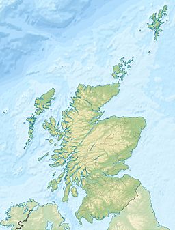
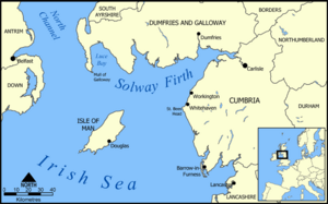
The Solway Firth (Scottish Gaelic: Tràchd Romhra) is a large firth (a type of sea inlet or bay) on the west coast of Great Britain. It is part of the Irish Sea, located near the Isle of Man.
This firth forms part of the border between England and Scotland. To the north, it touches Dumfries and Galloway in Scotland. To the south, it borders Cumbria in England, including the Solway Plain. From east to west, the Solway Firth stretches from St Bees Head in Cumbria to the Mull of Galloway in Scotland.
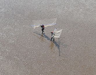
The coast around the firth has gentle hills and small mountains. It is mostly a countryside area. People here often work in fishing, hill farming, or growing crops. Tourism is also becoming more popular.
The coast of the Solway Firth is known as the Solway Coast. In 1964, it was named an “Area of Outstanding Natural Beauty” (AONB). This means it is a special place with beautiful landscapes. In 2007, work began on the Robin Rigg Wind Farm in the firth.
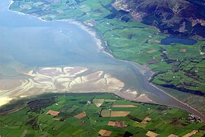
Inside the firth, there are areas of salt flats and mud flats. These can be dangerous because they sometimes have shifting patches of quicksand.
Contents
Wildlife and Nature
The Solway Firth area is home to many important natural sites. There are over 290 square kilometres (110 square miles) of Sites of Special Scientific Interest (SSSIs). One of these is Salta Moss. There are also national nature reserves at Caerlaverock and in Cumbria.
On the Cumbrian side, much of the coastline is an “Area of Outstanding Natural Beauty.” The Solway Coast’s AONB has two separate parts. The first part goes west from north of Carlisle to Skinburness. The second part goes south from the small village of Beckfoot, past Mawbray and Allonby, to Crosscanonby.
In 2013, efforts began to protect the honeycomb worm and blue mussel in the area. Allonby Bay, which is a small inlet of the Solway Firth, was suggested as a special Marine Conservation Zone.
Walking the Annandale Way
A long walking path, called the Annandale Way, is 53 miles (85 kilometres) long. It goes through Annandale, from where the River Annan starts in the Moffat Hills, all the way to the Solway Firth. This walking route opened in September 2009.
Islands of the Solway Firth
The Solway Firth does not have as many islands as other parts of Scotland's west coast. The few islands found here are:
- Hestan Island
- Rough Island
- Little Ross
- The place called Isle of Whithorn, which is actually a piece of land almost surrounded by water (a peninsula).
Rivers Flowing into the Firth
The Solway Firth is where the River Eden and the River Esk meet the sea. This meeting point is called an estuary.
Many other rivers also flow into the firth. You can find lists of these rivers here:
History of the Solway Firth
The name 'Solway' comes from an old Scandinavian language. It was first recorded as Sulewad in 1218. The name originally referred to a place where people could cross the mud flats at the mouth of the River Esk.
The first part of the name, 'Sol', might come from an Old Norse word meaning 'pillar'. This could refer to the Lochmaben Stone. Another idea is that it comes from a word meaning 'solan goose'. The second part of the name, 'way', comes from an Old Norse word meaning 'ford'. A ford is a shallow place in a river or sea where you can walk or drive across.
In the past, there were three main places to cross the firth: the Annan or Bowness Wath, the Dornock Wath, and the main one, the Solewath.
A wooden lighthouse was built at Barnkirk Point in 1841, but it was destroyed by fire in 1960.
In 1876, a French ship called the “St. Pierre” got stuck and was lost on Blackshaw Bank. This bank is a long, unclear area in the channel of the River Nith.
Between 1869 and 1921, a railway called the Solway Junction Railway crossed the firth on a long iron bridge. This bridge was about 1,780 metres (5,850 feet) long. The railway was built to carry iron ore from the Whitehaven area to Scotland. After the railway stopped running in 1921, the bridge became a popular path for people to walk across. It was taken down between 1931 and 1933.
Safety Information
The Ministry of Defence used a testing range at Dundrennan Range near the Solway Firth. By 1999, they had fired more than 6,350 practice rounds into the firth from this range.
See also
 In Spanish: Fiordo de Solway para niños
 | Dorothy Vaughan |
 | Charles Henry Turner |
 | Hildrus Poindexter |
 | Henry Cecil McBay |


