Mull of Galloway facts for kids
Quick facts for kids Mull of Galloway
|
|
|---|---|
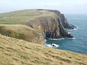
 Mull of Galloway headland |
|
| OS grid reference | NX158303 |
| • Edinburgh | 112 mi (180 km) |
| • London | 292 mi (470 km) |
| Council area | |
| Lieutenancy area | |
| Country | Scotland |
| Sovereign state | United Kingdom |
| Post town | STRANRAER |
| Postcode district | DG9 |
| Dialling code | 01776 |
| Police | Dumfries and Galloway |
| Fire | Dumfries and Galloway |
| Ambulance | Scottish |
| EU Parliament | Scotland |
| UK Parliament |
|
| Scottish Parliament |
|
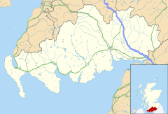
The Mull of Galloway (Scottish Gaelic: Maol nan Gall) is the most southerly point in Scotland. It is found in Wigtownshire, which is part of Dumfries and Galloway. This special place is at the very end of the Rhins of Galloway peninsula.
The Mull has one of the last natural coastal areas left on the Galloway coast. This means it supports a wide variety of plants and animals. It is now a nature reserve looked after by the RSPB. The word "Mull" means a rounded piece of land that sticks out into the sea.
The Mull of Galloway Trail is a long walking path. It is one of Scotland's Great Trails. The path is about 59 kilometres (37 miles) long. It runs from the Mull of Galloway through Stranraer. It ends near Glenapp, where it connects with the Ayrshire Coastal Path.
The Mull of Galloway Lighthouse
 |
|
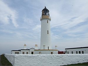
| Lighthouse on the Mull of Galloway | |
| Location | Mull of Galloway Wigtownshire Scotland United Kingdom |
|---|---|
| Coordinates | 54°38′06″N 4°51′27″W / 54.635005°N 4.857416°W |
| Year first constructed | 1830 |
| Automated | 1988 |
| Construction | masonry tower |
| Tower shape | cylindrical tower with balcony and lantern |
| Markings / pattern | white tower, black lantern, ochre trim |
| Height | 26 metres (85 ft) |
| Focal height | 99 metres (325 ft) |
| Range | 28 nautical miles (52 km; 32 mi) |
| Characteristic | Fl W 20s. |
| Admiralty number | A4610 |
| NGA number | 4816 |
| ARLHS number | SCO-144 |
A working lighthouse stands at the very tip of the Mull of Galloway. It was built in 1830 by a famous engineer named Robert Stevenson. The lighthouse is a white, round tower and stands 26 metres (85 feet) tall.
The light from the lighthouse is 99 metres (325 feet) above sea level. It can be seen from up to 28 nautical miles (52 kilometres) away. The lighthouse and the old houses where the lighthouse keepers lived are very important. They are protected as a Category A listed building. This means they are buildings of special historical interest.
Lighthouse History and Modern Use
During World War II, on June 8, 1944, a pilot sadly died in an accident near the lighthouse. He was flying a plane and hit the lighthouse while coming in low from the Irish Sea.
The lighthouse now works automatically. An old building nearby has been turned into a visitor centre. This centre is run by the South Rhins Community Development Trust. This is a group of local people and businesses. In 2013, the Mull of Galloway Trust bought the land and buildings. This was a "community buyout," meaning local people bought them. The lighthouse tower itself is still owned by the Northern Lighthouse Board.
In 2004, a new café called "Gallie Craig" was built at the Mull of Galloway. Its design helps it blend into the landscape. It has a turf roof covered in grass. From the café, you can see amazing views across to Northern Ireland and southwards to the Isle of Man.
 | Selma Burke |
 | Pauline Powell Burns |
 | Frederick J. Brown |
 | Robert Blackburn |


