Moffat Hills facts for kids
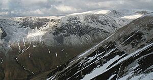
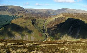
The Moffat Hills are a group of hills in the Southern Uplands of Scotland. They form a rough triangle shape. This area is about 17 kilometers wide from east to west and 16 kilometers long from north to south. The highest point is White Coomb, which stands at 821 meters (2,694 feet) tall. The town of Moffat is just south of these hills. Tweedsmuir is at the northern end. These are the only main towns nearby. Sometimes, the northern part of the Moffat Hills is called the Tweedsmuir Hills or even the Manor Hills.
Contents
Rivers and Roads to the West
The western side of the Moffat Hills is bordered by the River Annan and River Tweed. The sources of both rivers are very close, only about 1 kilometer apart. The Annan flows south into the Solway Firth. The Tweed goes north, then east, through the border country. It reaches the North Sea at Berwick-upon-Tweed.
West of the Annan valley (Annandale) is a major route to central Scotland. This route has the west coast railway line and the M74 motorway.
The Lowther Hills are the next group of hills to the west. The River Clyde starts there.
The A701 road from Moffat to Edinburgh quickly climbs high above Annandale. At Annanhead, where the River Annan begins, the A701 reaches 395 meters high. From here, you can look down into the Devil's Beef Tub. This spot is where the waters divide between the Annan and Tweed river systems. It is in the Dumfries and Galloway region. The Tweed starts in the Borders Region.
The border between these regions goes east from Annanhead. Then it turns north around Loch Skeen (or Skene). After that, it heads southeast to Birkhill Cottage in Moffatdale. A famous geologist named Charles Lapworth lived there from 1872 to 1877.
Rivers and Roads to the North
A small road marks the northern side of the Moffat Hills. It runs from Tweedsmuir village to St Mary's Loch. This road passes along the banks of the Talla Reservoir and the Megget Reservoir. It climbs to 450 meters near the Megget Stone. The hills north of here are called the Manor or Tweedsmuir hills. The Culters (pronounced Cooters) are to the northwest of the Moffat Hills.
There is another reservoir in the Moffat Hills area called Fruid. Two Bronze Age round houses were found there recently. There are also standing stones on the road from Tweedsmuir to Fruid. In 1885, a railway was built to help carry materials for the Talla dam.
Rivers and Roads to the South-East
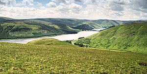
The southeast side of the Moffat Hills runs along the shores of St Mary's Loch and Loch of the Lowes. Be careful not to confuse this with another Loch of the Lowes in Perthshire. Where these two lochs almost meet, there is a monument to James Hogg, also known as the Ettrick Shepherd. You can visit Tibbie Shiels Inn there. Then, follow the Moffat Water down Moffatdale past the Grey Mare's Tail waterfall.
The A708 road from Moffat to Selkirk follows this route. It twists through amazing scenery. Sheep often wander freely on the unfenced road, so you need to drive carefully. There is a project to bring back a wild woodland environment to Carrifran Glen. This would make it look like it did six thousand years ago.
The Ettrick Hills are southeast of Moffatdale. The Ettrick Water starts in the middle of these hills. It flows northeast to join the Yarrow Water at Philiphaugh. The Yarrow Water then loses its name to the Ettrick. The Yarrow's headwaters are just east of Birkhill. This water flows through both Loch of the Lowes and St Mary's Loch. When the Yarrow and Ettrick Waters join, they also lose their names. They then meet the River Tweed between Selkirk and Galashiels.
Annandale Way Walking Trail
The Annandale Way is a new long-distance walking route. It is 55 miles (85 kilometers) long. The path follows the River Annan valley from its source to the sea. The route opened on September 12, 2009. You can walk it from north to south or south to north. It was created by Sulwath Connections and local communities. They wanted to make Annandale a new area for walking.
From the north, the trail starts high above the River Annan's source. It goes around the Devil's Beef Tub. Then it drops down its eastern side. It follows the River Annan along the valley bottom into the pretty town of Moffat. From Moffat, it follows the Annan valley through the historic town of Annan. The walk ends where the river flows into the Solway Firth. There are choices for different routes on two sections of the walk. The Annandale Way can be walked in 4 to 5 days. It also offers several great day walks.
Freedom to Explore
In Scotland, people have the right to roam freely. This means you can walk where you choose. This right was made into Scottish law by the new Scottish Parliament in 2002. Before that, it was a custom, not a written law. The Southern Uplands of Scotland have many wild places to explore. The Moffat Hills are one of the best places for this.
Where to Start Your Walk
Because of the freedom to explore, you can technically enter these hills anywhere. But in reality, you often need to park a car. The roads on all three sides are not good for random parking. Luckily, there are many useful places to start your walk. These spots depend on which part of the hills you want to visit. We will look at access points from Moffatdale in the southeast, Annandale in the west, and the Megget Stone in the north. These are the most scenic and challenging entry points. Most walkers choose these spots. Coming from the River Tweed area, the landscape is not as dramatic.
Exploring from Moffatdale
The routes from Moffatdale into the hills are often seen as the most amazing. They offer a variety of scenery and interesting walks. There are three main starting points from Moffatdale: Capplegill, Carrifran, and Grey Mare's Tail.
Legend says that Bodesbeck Farm, near Moffat Water, was once home to a brownie.
Starting from Capplegill
The Blackhope Burn joins Moffat Water near a farm called Capplegill. You can park one or two cars near Blackshope house, about 150 meters northeast of Capplegill. A popular walk from here is to head north. You will pass through a field where you might see Belted Galloway cows. Then you climb onto Saddle Yoke. This hill has two tops with a short saddle between them. These tops are Saddle Yoke (over 630 meters high) and Under Saddle Yoke (745 meters).
From there, you go down to the water in Whirly Gill. Then you climb to the top of Saddle Craigs. This is at the head of the Blackhope Glen. It is just below Hartfell Rig (739 meters). You could also go up onto the rig itself. But you would miss the views from the top of the crags at Saddle Craigs.
Next, climb to the top of Hart Fell. Then follow the ridge back to Capplegill, going over Swatte Fell on the way. This route goes up one side of the hills above Blackhope Glen and back down the other. The crags on this return path are amazing. You get views over the glen to Under Saddle Yoke, then Carrifran Gans and White Coomb. White Coomb is the highest hill in the Moffat Hills.
Capplegill is also a good place to start walks into the Ettrick Hills. These hills are south of Moffatdale.
Starting from Carrifran
There is parking for the Carrifran Wildwood project. From there, it is a steep climb to the top of Carrifran Gans. This is almost 670 meters high in 2 kilometers.
From the top, you can either go to White Coomb and Firthhope Rig. Or, you can go down to the interesting waterfalls around Firthhope Burn. You can save White Coomb for the Grey Mare's Tail routes. The area around the waterfalls has the best views. It also has fun terrain to climb over. This includes the waterfalls themselves and the steep lower slopes of Firthhope Rig. You will pass Games Castle, which looks like a castle, and Rotten Bottom.
Now, the route goes along the top of the crags of Raven Craig and Priest Craig. This is around the top of Carrifran Glen. It heads towards Saddle Yoke. From there, you go down to your parked car. Again, this route goes up one side of a glen (Carrifran Glen) and back down the other. You walk along the tops above the glen.
Starting from Grey Mare's Tail
You can park at the National Trust for Scotland car park at Grey Mare's Tail. There is a path built by them that goes up the hill towards Loch Skeen. There are many warnings about staying on the path. People have fallen when they left the path for a better view of the waterfall. Because of the amazing scenery, the walk to Loch Skeen is very popular. But you really need proper hiking shoes for this path. Many people go there without the right gear. There is a visitor center by the car park. You can watch wild birds nesting live from a remote camera on the hillside.
From Loch Skeen, walkers have many choices:
- You can walk around Loch Skeen over Lochcraig Head. This involves a 280-meter climb from the loch. Then continue along the tops to White Coomb. Finally, go back down to where the Tail Burn flows out of the loch and back to the car park.
- Between Lochcraig Head and White Coomb, there is a small ridge over Mid Craig. You can access it where the Tail Burn leaves the loch. From the top of this ridge, you can go left to White Coomb or right to Lochcraig Head. Mid Craig ridge is like the middle part of the letter "E". White Coomb and Lochcraig Head are the longer parts at each end. Firthybrig Head ridge is the back of the "E". This layout gives you many route choices.
- You can go directly from White Coomb back down to the car park. But the final descent into Moffatdale is steep. It is not advised when it is wet or icy. However, you can get great views of the Grey Mare's Tail at the top of that descent.
You can combine any of these routes.
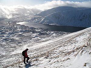
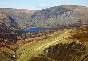
The hills around Loch Skeen show classic geological features. These are interesting to people all over the world. Loch Skeen has also been used to save an endangered fish called the vendace. This fish has been in Britain since the Ice Age. Vendace were in the Lochmaben Lochs until 1963. As these lochs filled with silt, the fish were in danger. An attempt was made to move some to Loch Trool in the Galloway hills to save them.
The beautiful, shaped landscape in these hills was formed by glaciers. This makes it very interesting to look at. The surface of Loch Skeen is 510 meters above sea level. It is probably the highest large loch in the South of Scotland.
Exploring from Annandale
Starting from Annanhead
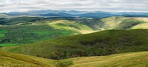
A popular route here is to park at Annanhead, above the Devil's Beef Tub. There is room for several cars there. Then walk up over Annanhead Hill, Great Hill, and Chalk Rig Edge to Whitehope Heights. This route goes around the top of the Beef Tub. From Whitehope Heights, most walkers would continue to the top of Hartfell.
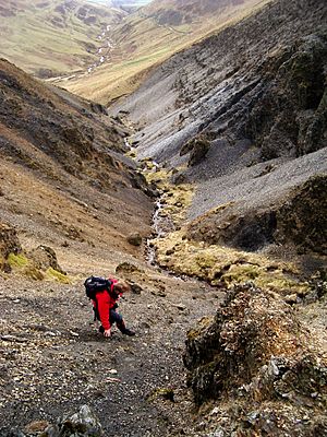
Most people return by the same route. But you can go down over Arthur's Seat to the River Annan at Ericstane. Then climb out of the other side of the valley onto the A701. From there, you can walk back to Annanhead. The valley around Ericstane has many old remains, like settlements and burnt mounds. Before you get back to your car, you will pass a monument above the Beef Tub. It honors John Hunter of Tweedsmuir, a covenanter. He was shot in 1685 while trying to escape from soldiers by climbing the side of the Beef Tub.
Starting from Moffat Well
Park at Moffat Well, about 2 kilometers north of Moffat town. You will need to find your way through the back streets of Moffat to get there. Then head up over Greygill Head and Blue Cairn to Swatte Fell. From there, most walkers would probably want to go to Hartfell. On the way back, return to Birnock Cloves, just south of Swatte Fell summit. From there, go down Birnock Water back to Moffat Well.
The water from Moffat Well had a sulfur smell. People believed it had healing powers. During the Victorian era, many people wanted this water. So, it was piped down from the well to a special bath house in the town center. This building is now the Town Hall.
Starting from the Community Hall
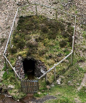
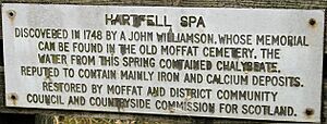
To reach the community hall, go north on the A701 from Moffat town center. You will come to a small roundabout by the school. This is just before the 30 miles per hour sign at the edge of town. Leave the A701 here, turning right onto a smaller road. This road goes through Corehead and leads to the Devil's Beef Tub. The community hall is on your right, about four and a half kilometers along this road. It is near a sign for "Hartfell Spa," where there is a Chalybeate spring. The Borders Forest Trust bought Corehead in July 2009. They want to bring back lost wildlife and habitats to Corehead. They also aim to protect the special character of the Devil’s Beef Tub. These hills and valleys were once covered with native woodlands, which made up the Ettrick Forest.
From the community hall, follow the track towards the spa. After about one and a half kilometers, the track enters the Auchencat Burn valley. You will see a metal gate. From there, go down from the path to the burn. Cross it using one of the rough planks. From the burn, climb to Swatte Fell. Go on to Hartfell. Then come down over Arthur's Seat, heading for the gully above the spa. The descent down this gully to the spa is on steep, slate-like scree. It is quite interesting, as is the spa itself. From there, just follow the spa path back to the community hall.
Exploring from the Megget Stone
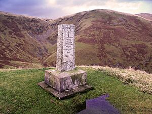
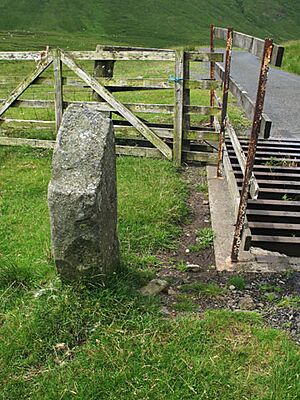
The Megget Stone is by a cattle grid. It is at the highest point between the Talla and Megget reservoirs. This is on the small road that runs from Tweedsmuir on the A701 to Cappercleuch by St Mary's Loch. It is easy to miss the stone when coming from Talla, as a gate hides it. At over 430 meters high, parking here gives you a high starting point. You can go into the Manor hills to the north or the Moffat hills to the south. No special stories or traditions have been found about this stone. But it is likely that this spot was used as a meeting place. This is common for similar places throughout the Scottish Borders.
There are two ridges that go south from here. You can take them into the Lochcraig Head area above Loch Skeen. It is easy to go out on one ridge and come back on the other. This makes for a relatively easy day's walk. You can make this walk a bit longer by visiting Dead For Cauld. This spot offers great views over the Megget reservoir. From there, go over Port Hill, Nickie's Knowe, and Talla East Side to Lochcraig Head. Then return by Firthybrig Head, Molls Cleuch Dod, and Carlavin Hill to the Megget Stone.
 | Sharif Bey |
 | Hale Woodruff |
 | Richmond Barthé |
 | Purvis Young |


