Manor Hills facts for kids
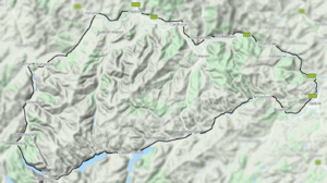
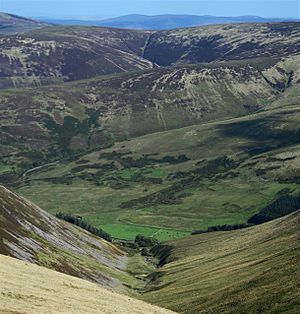
The Manor Hills, also called the Tweedsmuir Hills, are a group of hills in the Scottish Borders. They are found south of the town of Peebles. These hills are part of a larger group known as the Southern Uplands.
The Manor Hills are separated from other hill ranges by natural features. For example, the Moffat Hills are on the other side of Talla Reservoir, Megget Reservoir, and St Mary's Loch. The Moorfoot Hills are separated by the A72 road, and the Culter Hills by the A701 road.
A special part of the western Manor Hills is protected. It's called the 'Tweedsmuir Hills' Site of Special Scientific Interest. This means it's important for its plants, animals, or geology. Another protected area is the 'Upper Tweeddale' National Scenic Area. This area is recognized for its beautiful landscapes. The main rivers flowing through these hills are also protected as Special Areas of Conservation.
Exploring the Manor Hills
The Manor Hills cover a wide area. You can think of the higher hills as being in three main parts. Some are directly south of Peebles. Others are north of the Megget Reservoir. A third group is southeast of Drumelzier. There are also some lower hills to the east of the B709 road. You can find other hills scattered around too.
The tallest point in the Manor Hills is a mountain called Broad Law. It stands at 840 meters (about 2,756 feet) high. Broad Law is also the highest point in the old county of Peeblesshire.
Many hills in this range are classified in special ways. For example, there are five "Marilyns" and thirteen "Donalds." These are terms used to classify hills in Britain based on their height and how much they rise above the surrounding land. The Manor Hills also include one "Graham" and one "Corbett," which are other types of classified mountains.
Some of the highest hills in the range (over 2,000 feet or 610 meters) include:
- Broad Law (840 m) - The highest point in the range.
- Cramalt Craig (830 m)
- Dollar Law (817 m)
- Pykestone Hill (737 m)
- Glenrath Heights (732 m)
- Dun Rig (744 m)
- Middle Hill (717 m)
- Black Law (698 m)
- Talla Cleuch Head (691 m)
- Drumelzier Law (668 m)
- Birkscairn Hill (661 m)
- Stob Law (676 m)
- Greenside Law (643 m)
Walking the Southern Upland Way
The Southern Upland Way is a long-distance walking path. It goes through the eastern part of the Manor Hills. This path comes very close to the top of Minch Moor. Minch Moor is the second highest point along the entire Southern Upland Way route. Only the Lowther Hills section is higher.
 | Charles R. Drew |
 | Benjamin Banneker |
 | Jane C. Wright |
 | Roger Arliner Young |


