Lowther Hills facts for kids
The Lowther Hills are a large area of hills in the Southern Uplands of Scotland. People sometimes just call them the "Lowthers." These hills look a bit like a diamond shape on a map.
Rivers flow along the edges of the Lowther Hills. The Clydesdale valley is to the northeast, and Nithsdale is to the southwest. These valleys have important roads and routes that go north into the middle of Scotland. Small towns have grown up along these routes over time.
Most of the Lowther Hills are in Dumfries and Galloway. However, a small part, near the village of Leadhills and the Daer Reservoir, is in South Lanarkshire.
Contents
What's in a Name? The Lowther Hills
The name Lowther is a bit of a mystery. Some people think it comes from an old Irish word, lothur. This word meant "a canal" or "a trench," which could mean a "pass between hills."
Where are the Lowther Hills?
The Lowther Hills stretch about 30 kilometers (18 miles) from the town of Sanquhar in the west to Beattock and Moffat in the east. They are also about 28 kilometers (17 miles) from Thornhill in the south to Abington in the north.
Sanquhar and Thornhill are near the River Nith. Moffat is by the River Annan, and Abington is by the River Clyde. The Annandale and Clydesdale valleys create a path between the Lowther Hills and the Moffat Hills to the east.
This path is a major route north into Scotland. It holds the main railway line (the West Coast Main Line) and the M74 motorway. People have used this route for hundreds of years. To the west of the Lowthers, the Nithsdale valley has the A76 road and a railway line. The next group of hills to the west are the Carsphairn and Scaur Hills.
North and South Borders
The northwest edge of the hills follows the Crawick Water. This boundary goes along the B740 road through Crawfordjohn. North of this road, the hills become flatter and lead into the Central Lowlands of Scotland. Tinto is a single hill about 11 kilometers (7 miles) north of Abington.
The southeast edge of the hills is the Forest of Ae. This is one of Britain's largest forests, covering 10,000 hectares (about 25,000 acres). A long line of trees runs from Auldgirth on the River Nith for about 26 kilometers (16 miles). This forest ends near the M74 motorway. South of the Forest of Ae, the land flattens out around the town of Dumfries.
Exploring the Hill Passes
There are three main road passes that cut through the Lowther Hills. These passes connect the A76 road to the M74 motorway. There are also older "ancient passes" that are now walking paths.
Dalveen Pass: A Scenic Route
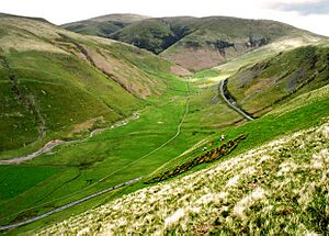
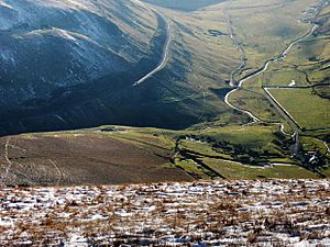
The Dalveen Pass is the most southerly and longest pass in the Lowther Hills. It runs from Carronbridge on the A76 road to Elvanfoot near the M74. The A702 road goes through this pass. It passes near the village of Durisdeer and reaches a height of 350 meters (1,150 feet). This pass was shaped by ice during the Ice Age, making it a U-shaped valley.
Mennock Pass: Scotland's Highest Village
The Mennock Pass carries the B797 road. It goes from the small village of Mennock on the A76 to Abington near the M74. This road passes through Wanlockhead and Leadhills. The B797 reaches 467 meters (1,532 feet) as it leaves Wanlockhead. Wanlockhead is the highest village in Scotland!
Crawick Pass: The Shortest Way
The Crawick Pass is the most northerly of the three passes. It carries the B740 road from Crawick to Crawfordjohn and then to the M74. This is the shortest pass and doesn't have the steep climbs of the other two. It reaches a maximum height of 288 meters (945 feet).
Ancient Paths and Roman Roads
The Enterkin Pass was an old path for pack horses, connecting Dumfries to Glasgow. It was mainly used to transport lead. Today, it's a track for walkers. In 1684, a group called the Covenanters ambushed soldiers here during a time known as the "Killing Time."
The Romans also built a road through the hills near Durisdeer. This route, called Well Path, was likely a main path for pilgrims traveling from Edinburgh to Whithorn. It was one of the important ancient routes through the Southern Uplands.
How the Passes Were Formed
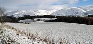
The Lowther Hills are made of strong rocks called Ordovician shales. These rocks were squeezed and twisted when mountains formed long ago. The Dalveen Pass and Enterkin Pass were deeply carved by glaciers. Melted ice from these glaciers likely created a deep channel connecting these passes. It's thought that the River Clyde might have originally started here before its waters were "captured" by the River Nith.
Durisdeer Village and Its History
The village of Durisdeer is tucked away from the main road, at the foot of Durisdeer Hill. It's near the old Roman pass. The Duke of Buccleuch, a very large landowner in Britain, owns much of the land around here. His castle, Drumlanrig Castle, is about 5 kilometers (3 miles) north of Thornhill.
Durisdeer Church has a special tomb for the first Duke of Buccleuch and his wife, Mary. It has beautiful marble statues from 1713. There has been a church on this spot since medieval times.
The Source of the River Clyde
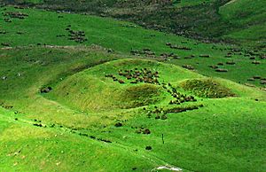
Near Elvanfoot, you can find Glenochar farmhouse. Just north of it are the remains of Glenochar Bastle and Fermtoun. This was a fortified settlement from the 1600s. An archaeological dig here won an award in 1997 for amateur archaeologists.
Just south of Glenochar is where the River Clyde begins! The Clyde flows north through Lanarkshire and past the city of Glasgow. It starts where the Daer Water and Potrail Water meet. The Daer Water begins near Queensberry and flows through the Daer Reservoir. The Potrail Water starts on the northeast side of Durisdeer Hill.
"God's Treasure House" in Scotland
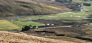
It might seem strange to find two villages, Wanlockhead and Leadhills, nearly 500 meters (1,640 feet) up in these hills. But this area was known as "God's Treasure House in Scotland" because of its many minerals.
This region produced some of the purest gold in the world (22.8 carats). This gold was used to make the Scottish Crown Jewels in the 1400s and 1500s. The name "Leadhills" shows that the area was famous for lead mining. There's even a lead mining museum in nearby Wanlockhead.
Leadhills also has the oldest library in the UK that people paid to join, started by miners in 1741. It was the birthplace of the poet Allan Ramsay in the 1700s. His son, also named Allan Ramsay, became a famous portrait painter. The Leadhills & Wanlockhead Railway is an old narrow-gauge railway line that has been preserved.
Hiking in the Lowther Hills
The Lowther Hills can be thought of in two parts: a northern section and a southern section.
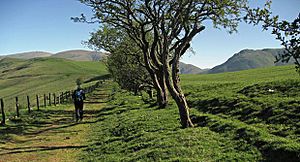
The northern part includes hills like Lousie Wood Law, White Law, Dun Law, Dungrain Law, Peden Head, Green Lowther, Lowther Hill, East Mount Lowther, Thirstane Hill, and Steygail. Green Lowther is the highest point in the Lowther Hills. Both Green Lowther and Lowther Hill have aircraft tracking stations on their tops. The huge white "golf ball" on Lowther Hill can be seen from far away! The Southern Upland Way, a long-distance walking path, goes over Lowther Hill, which is the highest point on the entire route.
The southern part of the hills is lower but covers a wider area. Its highest point is Queensberry. Places like Mitchellslacks and Locherben, on the edge of the Forest of Ae, offer great views of the northern Lowthers, Nithsdale, and Annandale.

Winter Sports in the Lowther Hills
The Lowther Hills are one of the places where Scottish winter sports began. Curling started here as early as 1777, with the Wanlockhead Curling Society being one of Scotland's first. The first boys' curling club in Scotland was also set up in Wanlockhead in 1883. Curling was popular in the area until the 1930s.
Since the 1920s, skiing has been organized in the Lowther Hills by local people and sports clubs. Lowther Hill has the only ski area in the south of Scotland, and it's Scotland's only community-owned ski center. The Lowther Hills Ski Club runs three ski lifts for beginners and intermediate skiers above the villages of Leadhills and Wanlockhead.
 | Calvin Brent |
 | Walter T. Bailey |
 | Martha Cassell Thompson |
 | Alberta Jeannette Cassell |


