Enterkinfoot facts for kids
Quick facts for kids Enterkinfoot and the Enterkin Pass |
|
|---|---|
 The Enterkin Pass, path and burn |
|
| OS grid reference | NS 8597 0404 |
| Council area | |
| Country | Scotland |
| Sovereign state | United Kingdom |
| Police | Dumfries and Galloway |
| Fire | Dumfries and Galloway |
| Ambulance | Scottish |
| EU Parliament | Scotland |
| UK Parliament |
|
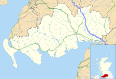
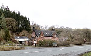
Enterkinfoot is a small village or hamlet in south-west Scotland. It's about 6 miles (10 km) north of Thornhill on the main road to Sanquhar. The village grew around an old mill and the famous Enterkin Pass. This pass was a path that followed the Enterkin Glen all the way to Wanlockhead and then on to Edinburgh. Enterkinfoot is located near the A76 road, the River Nith, and the Enterkin Burn. The Enterkin Burn once powered the mill before it joined the River Nith. This area is well-known for its connection to the Covenanters, a group of Scottish Presbyterians who faced tough times for their beliefs.
Contents
Discovering Enterkinfoot's Past
Enterkinfoot is the name used today for this village. The stream flowing through it is called the 'Enterkin Burn'. This burn starts about 5 miles (8 km) away on Lowther Hill and flows into the River Nith here. The area is famous for its links to the Covenanters. These were Scottish people who wanted to keep their own church rules. They faced difficult times during the reigns of King Charles II and King James VII and II. These events eventually led to the Presbyterian Church of Scotland being officially set up. Many small cottages, some still lived in, made up the original village. There was also a public house (a type of pub) by the Enterkin Burn.
Enterkinfoot School and its schoolhouse used to be near the cottages at Auchenbraith. There's also a 'Holywell Cleuch' above Hapland Farm, which means a small valley with a holy well. A part of the Enterkin Path went up the glen on the eastern side. A place where people could cross the Nith River by foot or horse, called a ford, was at Auchenbraith.
Enterkinfoot Mill: A Look at the Old Mill
Old maps from the late 1500s and mid-1600s show a mill in the same spot as the later Enterkinfoot Mill. The burn was called 'Interkyn' in 1745. By 1898, the newer two-storey mill was known as a meal mill, used for grinding grain. The mill building itself no longer stands today.
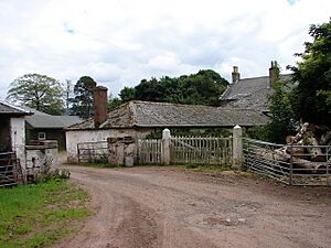
The miller's house, where the mill worker lived, is made of red sandstone. It had small extensions on each side. One side used to be a blacksmith's shop, and the other was a small store. Next to it was an older mill building with other small buildings, a cobbled yard, and a small garden. Water for the mill came from a wooden channel called a lade. This lade carried water from a sluice (a water gate) near the railway viaduct to the mill wheel.
Coshogle Castle: A Lost Fortress
Coshogle Castle once stood near Enterkinfoot, owned by the Douglas family. Sadly, nothing remains of the castle at the site today. However, some parts of it were used in nearby cottages. These include a special doorway with an arch and a 'marriage stone'. This stone has two family crests, the date 1576, and the initials RD and NJ. These initials stand for Robert Douglas and his wife Nicola Johnston. Parts of the castle walls were still standing 6 feet (1.8 meters) high and 6 feet (1.8 meters) thick until at least 1825.
Morton Castle: A Stronghold's Story
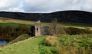
Morton Castle was first mentioned in the 1100s. It was owned by Dunegal, Lord of Strathnith, and later by Thomas Randolph, Earl of Moray. The castle ruins you can see today are on a high, easily defended spot. It's surrounded on three sides by a man-made loch, which was originally just marshland.
In 1357, a peace agreement called the Treaty of Berwick required the Scots to destroy Morton Castle and thirteen other castles in the area. The Earl of March likely built much of the castle we see today in the early 1400s. Later, James Douglas of Dalkeith, Earl of Morton, owned it. In 1608, the castle was sold, and then bought again ten years later by William Douglas of Drumlanrig. The castle might have been used as a hunting lodge until about 1714. Morton Castle is still owned by the Duke of Buccleuch and is looked after by Historic Environment Scotland.
Kirkbride Church: An Ancient Place of Worship
The ruins of Kirkbride Church and its cemetery are in a quiet, remote spot above Enterkinfoot. In the 1200s, Holyrood Abbey owned Kirkbride Church. In 1732, the church's area was divided and added to the parishes of Durisdeer and Sanquhar. The parts of the church that remain today are from the early 1500s. A small room for church items, called a sacristy, sticks out from the north wall. Kirkbride is thought to be only the second reformed church built in Scotland. After the church was left empty, its bell was stolen. It was found in Glasgow because people recognized its sound when it was rung. The bell was brought back and hung again in the small bell tower on the church's end wall.
Enoch Castle: A Vanished Stronghold
Enoch Castle was once the main building of a large estate. However, nothing is left of it today because its stones were taken and used for other buildings. Even so, the way the land lies shows it must have been a very strong and important place. It was taken over by the Douglas family from Morton Castle and added to their lands.
Getting Around: Transport in Enterkinfoot
Enterkinfoot is in Nithsdale, a natural path for travel. This is why the main A76 road goes through it. The railway also cuts through the area at a higher level, with the Drumlanrig Tunnel nearby. The road from Dumfries to Ayr passes through Enterkinfoot on its way to Sanquhar. The Duke of Queensberry built about 22 miles (35 km) of new roads here. He also built a road (the B797) through the Mennock Pass to the county border and on to Edinburgh. Enterkinfoot never had its own passenger train station. Today, the closest station is Sanquhar. There used to be a station at Carron Bridge.
The Enterkin Pass: A Historic Mountain Path
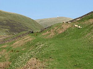
The Enterkin Pass was one of the old routes, a path for horses, that went north from Nithsdale into Clydesdale. Other nearby passes included Mennock, Well, and Dalveen. These paths crossed the Lowther Hills and continued to Edinburgh or Glasgow. The Enterkin Pass might have been a medieval travel route or built in the 1500s. It was used to transport lead from mines by pack horses with baskets to Dumfries.
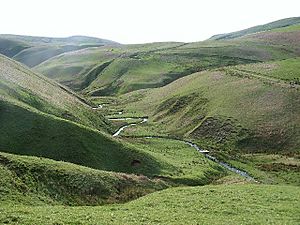
In 1726, a writer named Daniel Defoe described the pass in his book "A Tour Thro' the Whole Island of Great Britain". He called it "the frightfullest pass, and most dangerous that I met with, between that and Penmenmuir in North Wales." Another writer said, "A few steps and you are on its edge, looking down giddy and amazed into its sudden and immense depths. ... but we know nothing more noticeable, more unlike any other place, more impressive, than this short, deep, narrow, and sudden glen."
The original path near the school was cut off by the railway. But it used to go directly from Enterkinfoot. Another route from the south branched off from the Dalveen Pass road. Today's path goes east from Wanlockhead. It passes around the west side of Stake Hill and joins the road to the radar station. Then it leaves the road to go south to the Enterkin Pass, between Lowther Hill and East Mount Lowther. The path goes down on the west bank of the Enterkin Burn for about 3 km (1.9 miles). It then reaches Glenvalentine, where it climbs south away from the burn to the ridge above. As you walk south from the ridge, you get great views of Enterkin Glen. There's a paved road near Inglestone, and a public road runs through Muiryhill. This road turns west to the A76 Nithsdale road and then to Enterkinfoot.
The Enterkin Raid: A Daring Rescue
On July 29, 1684, the Enterkin Pass was the site of a dramatic rescue, known as the 'Enterkin Raid'. Twelve Covenanters rescued five of their friends and a minister. These prisoners were being escorted by soldiers from Dumfries to Edinburgh, passing through Thornhill.
The leaders of the rescue group were James and Thomas Harkness. They set up an ambush at a place called Glenvalentine. During the ambush, the officer leading the soldiers was shot. The troops fired once and then gave up their prisoners. Reports say there were injuries on both sides. Five of the Covenanters involved, including Thomas Harkness, were caught soon after. They were executed in Edinburgh's Grassmarket. However, James Harkness escaped to Ulster in Northern Ireland. His grave and story can still be seen at Dalgarnock near Thornhill. His memorial stone tells his story.
Railway Engineering: Tunnels and Viaducts
The Duke of Buccleuch wanted the railway to be hidden from his home at Drumlanrig Castle. This meant building a very long tunnel, 1,397 yards (1,277 meters) long. It took 600 workers and seven million bricks to build it! The first company hired to build it found the job too difficult. The tunnel opens at the south near the old Carronbridge railway station.
Enterkin Viaduct: A Bridge Over the Glen
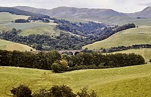
The Enterkin Viaduct is 111 feet (34 meters) high and has four arches. It runs above Enterkinfoot. A very strong retaining wall is just north of it. This viaduct is 219 feet (67 meters) long and was built by John Miller using red ashlar stone. It has been a listed building since 1986, meaning it's an important historic structure.
Enterkinfoot Retaining Wall: A Strong Structure
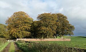
The impressive Enterkinfoot retaining wall is considered a top example of its kind. It was built by German engineers around 1848 for the Glasgow, Dumfries and Carlisle Railway. This railway opened in 1850 and later became the Glasgow and South Western Railway. The design of this huge wall makes sure the double-track railway above it stays stable. It also stops the hillside from wearing away.
Understanding the Names: Etymology
The name 'Enterkin Burn' might come from the Scots Gaelic language. 'Eanach t'uircein' could mean 'sow's marsh' or 't'arcoin' could mean 'mastiff's or bloodhound's marsh'. 'Coshochel' is thought to be from an older language, not Gaelic, and means 'red height'. Hapland Farm's name might come from the Scots word for the Curlew bird.
Quick Facts: What is Enterkinfoot?
In British English, Enterkinfoot is technically a hamlet, not a village. This is because it has never had its own official church.
 | Frances Mary Albrier |
 | Whitney Young |
 | Muhammad Ali |


