Carsphairn and Scaur Hills facts for kids
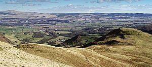
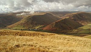
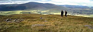
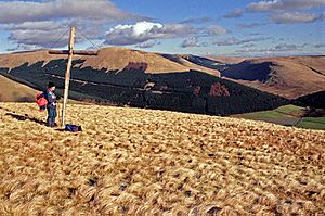
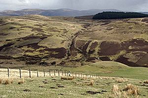
The Carsphairn and Scaur Hills are a group of hills in the Southern Uplands of Scotland. The Carsphairn Hills are in the west, and the Scaur Hills are in the east. Even though they are a single area, official maps don't have one name for them all. The name "Scaur" is pronounced like "Scar."
Contents
Where are the Carsphairn and Scaur Hills?
These hills are located between two other famous hill ranges. To the west are the Galloway Hills, and to the east are the Lowther Hills. The area is shaped like an oval. It stretches about 39 kilometers from Dalmellington in the northwest to Thornhill in the southeast.
A cross-section from New Cumnock in the north to Carsphairn in the south is over 19 kilometers wide. A similar cross-section from Sanquhar to Moniaive is also about 19 kilometers. The northwest part of these hills is in Ayrshire, while the rest is in Dumfries and Galloway.
These hills are not as well-known as the Galloway or Lowther Hills. However, local people love them and use them often. They are easier to access and less challenging for walks. Many small towns and villages surround these hills.
Northern Boundary of the Hills
The northern edge of the hills follows a route from Dalmellington. The B741 road goes northeast to New Cumnock, passing the start of the River Nith. In New Cumnock, this road joins the A76. The A76 follows the Nith Valley eastward through towns like Kirkconnel and Sanquhar. It then turns south towards Thornhill. So, the northern boundary mostly follows the River Nith.
Southern Boundary of the Hills
From Thornhill, the A702 road forms the southern boundary. It travels southwest through small villages like Penpont and Moniaive. From Moniaive, the B729 road goes westward towards Carsphairn. This is mostly a single-track road. At Carsphairn, the B729 meets the A713, which heads northwest back to Dalmellington.
Rivers Flowing from the Hills
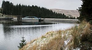
Blacklorg Hill is near the center of this hill area. The Afton Reservoir is just to its west. Many main rivers flow out from this central area in all directions. Here are some of the important ones:
Water of Ken
The Water of Ken starts near Polskeoch. It flows south and joins the Water of Deugh. This river is part of the Galloway hydro-electric power scheme. This scheme uses several power stations and reservoirs, including Loch Doon. The Water of Ken eventually flows into Loch Ken, then becomes part of the River Dee. The River Dee flows south past Threave Castle and into Kirkcudbright Bay.
Dalwhat Water
This river flows southeast to Moniaive. There, it joins other waters to become the River Cairn. The River Cairn then flows into the River Nith near Dumfries.
Shinnel Water
Shinnel Water flows southeast through the village of Tynron. It joins the Scaur Water just west of Penpont. The Scaur Water then flows into the River Nith south of Thornhill.
Scaur Water
This river also starts near Polskeoch, close to the Water of Ken. It flows southeast to Penpont. The roads along these two river valleys almost meet, with only a small gap between them.
Euchan Water and Kello Water
These two rivers start near Blacklorg Hill. They both flow northeast. The Euchan Water joins the River Nith south of Sanquhar, near Sanquhar Castle. The Kello Water joins the Nith at Kelloholm, near Kirkconnel.
Afton Water
Afton Water starts south of the Afton Reservoir. It flows north through the reservoir and then through New Cumnock. It joins the River Nith just north of New Cumnock, where Cumnock Castle once stood. This river is famous because of Robert Burns' song "Flow Gently Sweet Afton."
River Nith
The River Nith begins about a kilometer southwest of Enoch Hill. It flows north under the B741 road, then turns eastward. From New Cumnock, it forms the boundary between the Lowther Hills and the Carsphairn/Scaur Hills. The A76 road follows its valley, called Nithsdale. Drumlanrig Castle is located just north of Thornhill, along the river.
Water of Deugh
This river starts west of Afton Reservoir. It joins Carsphairn Lane near Carsphairn village and then flows into the Water of Ken. As part of the Galloway hydro-electric power scheme, water from the Water of Deugh can be sent through tunnels to Loch Doon when there's a lot of rain. This water is then used to generate power.
Exploring the Scaur Hills
Access from the North
From Sanquhar, the Southern Upland Way (a long-distance walking path) heads southwest. It goes over gentle moorland and then down to Scaur Water at Polgown. From there, it follows a small road along Scaur Water to Polskeoch. There's a basic shelter called a bothy at Polskeoch for walkers. The path then continues south to St John's Town of Dalry.
Another route from Mennock village goes over Fardingmulloch Moor. There's a good track that leads past the ruins of Fardingmulloch house. This old track continues over to Druidhill Burn and Scaur Water, leading to Penpont. This path might have been an ancient route, as it passes an old earthwork.
Access from the East
East of the old path from Mennock to Penpont, the hills drop into a small valley. A minor road runs north from Penpont to Burnmouth on the River Nith. Several spots along this valley offer ways to enter the Scaur Hills.
Drumlanrig Castle and its large grounds are located on a low, forested ridge between this valley and the River Nith. There are many walking and cycling trails in these woods and along the river. This area has good farmland, and many small roads wind through the low, green hills, serving the local farming community.
Access from the South and Southeast
In the south and southeast, roads go deep into the central hill area along the valleys of Water of Ken, Dalwhat, Shinnel, and Scaur Waters. Farming communities live far up these valleys. Between the valleys, there are ridges that gradually get higher towards the central hills around Blacklorg and Polskeoch. These ridges offer easy and pleasant walks.
Near the head of Scaur Water, you'll find interesting, shapely hills like Glenmanna, Glenwhargen Craig, and Cairnkinna Hill. Cairnkinna Hill is the highest in the eastern part of these hills, at 552 meters.
Just over a kilometer east of Tynron village is Tynron Doon (289 meters). This was the site of an Iron Age fort, used from ancient times until the 16th century.
Exploring the Carsphairn Hills
At the western end of these hills, near Dalmellington, there's a large forest called Carsphairn Forest. While it might not be the most exciting for walking, it has a 23-kilometer cycling route with some climbing.
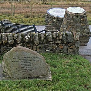
For music lovers, "Twin Music Festivals" are held twice a year at Knockengorroch. These are "World Ceilidh" and "Doonhame Hairth" festivals. Buses go directly to the festivals from Glasgow and Edinburgh. The festival site is about 4 kilometers into the hills from the remote A713 road.
The highest hills in this entire area are located east of Carsphairn Forest.
Cairnsmore of Carsphairn
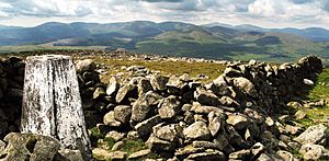
At 797 meters, Cairnsmore of Carsphairn is the highest of the Carsphairn hills. The most common way to climb this hill is to park near the Green Well of Scotland, where the Water of Deuch flows under the A713. From there, you follow a winding ridge over Willieana (over 420 meters), Dunool (541 meters), and Black Shoulder (688 meters). This leads to the saddle between Cairnsmore and Beninner (710 meters). Both peaks offer great views. Most walkers return the same way, but you can also come back via the Benlock Burn.
Water of Ken Routes
Where the B729 road crosses the Water of Ken, a small road heads north up the valley. There are three good places to park along this road to explore the Carsphairn hills: Moorbrock house, Nether Holm of Dalquhairn, and Lorg.
- To reach Moorbrock house, drive about 2 kilometers north from the Water of Ken minor road from Craigengillan. Park just south of Moorbrock house. From here, you can walk over Moorbrock Hill (650 meters) and then southwest to Cairnsmore of Carsphairn and Beninner. This is an interesting day's walk. You'll pass a memorial to the crew of a Spitfire plane that crashed in 1942 before climbing Cairnsmore. You can return to Moorbrock house from Beninner.
- From Moorbrock house, you can also go over Moorbrock Hill and head northeast to Windy Standard (698 meters). This hill has many windmills, built in 1996. You can return by Mid Hill of Glenhead (531 meters) and Dodd Hill (496 meters).
- If you park near Nether Holm of Dalquhairn on the Water of Ken road, you can climb Dodd Hill. You'll follow 14 Stations of the Cross marked by crosses up the hill, starting from the house. Head towards Windy Standard and return by Alhang (642 meters) and Mid Rig. The source of Afton Water is in the dip between Alhang and Alwhat (628 meters). From Alwhat, you can see Afton reservoir to the north, with Cannock Hill (594 meters) and Blackcraig Hill (700 meters) to its east.
- Parking just south of Lorg, you can walk over Lorg Hill, Meikledodd Hill, to Blacklorg Hill and Blackcraig Hill. Then descend over Craigbraneoch Rig (576 meters) to the north end of Afton Reservoir. Return by walking along the west shore of the reservoir, then Alwhat and the Lorg Burn.
Access from Afton Water
- New Cumnock is at the foot of Hare Hill, to its southeast. So, you can start walking directly into the hills from the town. Hare Hill has a wind farm on top that started working in 2000.
- You can also head southwest from New Cumnock up Connelburn Rig and Benty Cowan Hill (447 meters) to Enoch Hill (569 meters). The River Nith starts on the southwest side of Enoch Hill.
- To get into the heart of the hills faster, you can drive south up Glen Afton to the parking area just north of the reservoir. A good circular route from here is to head northwest onto Blackcraig Hill. Then follow the winding ridge south over Blacklorg Hill (681 meters) and Meikledodd Hill. Continue southwest to Alwhat and Alhang. You can then follow the River Afton down to the reservoir. Or, you can visit Windy Standard, which involves a descent and then a steep climb. Returning northeast from Windy Standard over Wedder Hill (597 meters) offers good views over the reservoir to Craigbraneoch Rig and Blackcraig Hill beyond it. The surface of Afton Reservoir is around 400 meters high.
Access from Kirkconnel and Sanquhar
Mining towns often have a strong sense of community and loyalty to their local area. For example, in 2010, Sanquhar celebrated 100 years of its "riding of the marches," a 10-day event in August. The Euchan Water, Kello Water, and Crawick all flow into the River Nith near Sanquhar and Kirkconnel. Local people use these waters for walking and swimming in the summer.
Communities Around the Hills
There are three different types of communities surrounding these hills:
- Farming Communities: From Carron Bridge through Thornhill and Penpont to Moniaive, these areas are mostly agricultural.
- Isolated Moorland Community: Carsphairn is a remote village surrounded by moorland.
- Coal Mining Towns: From Dalmellington through New Cumnock, Kirkconnel, and Kelloholm to Sanquhar, these towns historically relied on coal mining.
Carronbridge to Moniaive Area
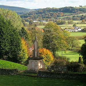
The economy here is largely influenced by the Duke of Buccleuch's Drumlanrig Estate, which owns much of the land and provides many jobs. A medieval pilgrimage route from Edinburgh to Whithorn in Galloway passed through this area. Parts of it are still preserved today.
- Carronbridge is a small village where the A76 and A702 roads meet. The estate built a sawmill here in the 1850s.
- Thornhill (population about 2,600) was established as a town in 1664. In the 18th century, it was developed as a planned village for Drumlanrig Castle, with wide, tree-lined streets.
- Penpont is a small rural village with about 400 people. It was the birthplace of Joseph Thomson, a geologist and explorer. Thomson's gazelle is named after him. The sculptor Andy Goldsworthy lives here, and many of his works can be found nearby. Kirkpatrick Macmillan, who invented the bicycle, was born just south of Penpont. Between Penpont and Moniaive, at Maxwelton House, was the birthplace of Annie Laurie, famous from the song.
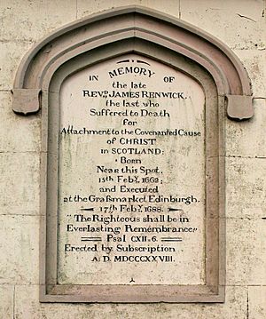
- Moniaive is the last community on the A702 before a long drive over moorland to St John's Town Dalry or Carsphairn. It's a very picturesque village and has become popular for people wanting to escape city life. It's a hub for artists, craftspeople, and musicians, continuing a tradition that goes back to James Paterson, a landscape artist from the Glasgow Boys, who moved here in 1884. In the 17th century, Moniaive was a refuge for the Covenanters. These were Presbyterians who disagreed with the Episcopalian religion being forced on them by the Stuart kings. There's a monument to James Renwick, a Covenanter leader born here who was executed in Edinburgh.
Carsphairn Village
Carsphairn is the only village between Moniaive and Dalmellington. It's about 15 miles from Moniaive and 10 miles from Dalmellington, over remote moorland roads. It's a large parish (about 80 square miles) but has fewer than 200 people. It sits in a valley between the Rhinns of Kells and Cairnsmore of Carsphairn. Farming used to be the main activity, but now much of the land is forested. Carsphairn village has about 38 houses, a school, a church, a pub, a shop, and a post office. It also has a Heritage Centre that's open seasonally. It's a remote and scattered community, very different from the busy towns along the River Nith.
Dalmellington to Sanquhar Area
- Dalmellington is the last town in Ayrshire before the A713 road climbs towards the Glenkens. In 2001, it had a population of 1,407. The River Doon flows from Loch Doon near the town. The River Doon also flows through Alloway, where Robert Burns' cottage is located, and the river appears in his songs. Dalmellington once produced yarn for carpets. By the 20th century, coal mining was the main industry, though miners often traveled to other areas. Today, the area relies on opencast mining, which is less labor-intensive than deep mining.
- New Cumnock is mentioned in historical records from 1296. Cumnock Castle played a role in the Scottish Wars of Independence, involving William Wallace and Robert the Bruce. Wallace might have been born nearby. In 1509, New Cumnock became a burgh. More recently, coal mining dominated its economy. In 1950, 13 miners died in the Knockshinnoch Disaster, but 116 men were rescued.
- Kirkconnel was mainly a farming community until a coal pit opened in the 1890s. Coal had been mined there before, but not in large amounts. After that, coal mining became central to the town's life. When the coal industry declined, many people moved away.
- Kelloholm was built in 1921 as a model village for miners and grew after World War II. Since the end of deep mining, its main industry is now meat processing.
- Sanquhar's economy was once linked to the wool trade and carpet making before coal mining took over. A special two-colored knitting pattern is still known as 'Sanquhar knitting'. It was also where the Covenanters signed the Sanquhar Declaration, declaring their independence from the King. A monument on the main street remembers this event. The church of St. Brides has a memorial to James Crichton, a brilliant scholar from the 16th century. Sanquhar is also famous for its tiny post office, established in 1712, which claims to be the oldest working post office in the world.
Cormilligan: A Special Place
The remote, deserted cottage of Cormilligan near Tynron shows how much hidden corners of these hills can mean to people. In 2009, during Scotland's Year of Homecoming, 38 descendants of the McCaw family gathered here. They came from places like New Zealand, the USA, Mexico, Greece, and England. They joined local people to celebrate their ancestors, William and Isabella McCaw, who moved to New Zealand with nine of their children in 1880.
Deil's Dyke: An Ancient Mystery
"Deil's Dyke" is a name given to several ancient earthworks in Scotland. "Deil" is a Scots word for "Devil." People once thought these earthworks marked a border, perhaps between the Strathclyde Britons and the Angles in Galloway. It was believed to run from Loch Ryan to near Annan on the Solway, possibly even across Scotland.
This idea came from an old story shared by Joseph Train (1779–1852), who heard about a "Deil's Dyke" in local folklore. Later, experts decided that these were separate earthworks, not one long continuous wall. However, a section of the dyke from New Cumnock to Burnmouth in Durisdeer Parish still interests historians and archaeologists.
|
 | William M. Jackson |
 | Juan E. Gilbert |
 | Neil deGrasse Tyson |


