Nithsdale facts for kids
Quick facts for kids Nithsdale |
|
| Image:Scot1975Nithsdale.png | |
| Geography | |
| HQ | Dumfries |
| History | |
| Created | 16 May 1975 |
| Abolished | 31 March 1996 |
| Succeeded by | Dumfries and Galloway |
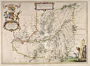
Nithsdale (which means Srath Nid in Scottish Gaelic) is also known as Strathnith, Stranith or Stranit. It is the valley or "dale" of the River Nith in southern Scotland. Nithsdale was once an important area in medieval Scotland.
Over time, these old areas lost their importance. New areas called "shires" took over from the 1100s. Nithsdale became part of Dumfriesshire. Later, in 1975, a new "district" called Nithsdale was created. It covered a similar area to the old province. Its main town was Dumfries. This district stopped existing in 1996. Since then, Dumfries and Galloway Council has managed the area directly.
Nithsdale's Story
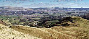
The name Strath Nid might come from the old Cumbric language, Ystrad Nidd. Cumbric was spoken here before Roman times, until about the 11th or 12th century. The River Nith flows from north to south through the Southern Uplands in south-west Scotland. It separates the Lowther Hills from the Scaur Hills.
Nithsdale was a very important place historically. It lay on major routes connecting England to the rest of Scotland. These routes were good for trade. They were also important for armies during the Wars of Scottish Independence and other wars between Scotland and England.
The old area of Nithsdale bordered Annandale to the east. To the north was Clydesdale. Kyle was to the north-west, and Galloway to the west. By 1305, Nithsdale was part of the shire of Dumfries.
The sheriff of Dumfries was in charge here. Even though he also had power over Annandale and Eskdale, Nithsdale was where his authority was strongest. The title Earl of Nithsdale was created in 1620. This title was taken away in 1716 because William Maxwell, 5th Earl of Nithsdale was involved in a rebellion.
Over time, the shires became more important for local government. In 1890, the Dumfriesshire County Council was set up.
Nithsdale as a District
A new local government area called Nithsdale District was created on May 16, 1975. This was part of a big change to local government in Scotland. Scotland was divided into "regions" and smaller "districts." Nithsdale was one of four districts within the Dumfries and Galloway region.
This new district covered the western part of Dumfriesshire. It also included some areas that used to be in Kirkcudbrightshire. These included the parishes of Kirkbean, Kirkpatrick Irongray, New Abbey, Terregles, and Troqueer.
Before 1975, Nithsdale District covered parts of seven older areas. These older areas were all removed at the same time.
- Dumfries Burgh (a type of town council)
- Dumfries District (most of it)
- Eastern District
- Sanquhar Burgh
- Thornhill
- Upper Nithsdale District
In 1996, there was another change to local government. The four districts of Dumfries and Galloway were removed. The Dumfries and Galloway Council took over all their jobs. The council still uses the old Nithsdale district area for one of its local committees.
Who Was in Charge?
The first election for the Nithsdale District Council was in 1974. The council officially started its work in May 1975. Here's how political control changed:
| Party in control | Years | |
|---|---|---|
| Independent | 1975–1984 | |
| No overall control | 1984–1996 | |
Council Buildings
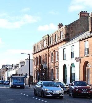
Nithsdale District Council was based at the Municipal Buildings in Dumfries. Dumfries was the biggest town in the district. This building was built in 1932 for the old Dumfries Burgh Council.
See also
 | DeHart Hubbard |
 | Wilma Rudolph |
 | Jesse Owens |
 | Jackie Joyner-Kersee |
 | Major Taylor |


