Loch Ryan facts for kids
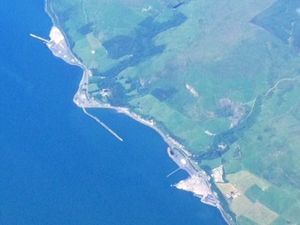
Loch Ryan (pronounced 'Loch Ree-an') is a sea loch in Scotland. It's like a long, narrow arm of the sea that reaches inland. This loch is a very important natural harbor, offering calm waters for ships, especially the ferries that travel between Scotland and Northern Ireland. The biggest town on its shores is Stranraer, but most ferries now leave from Cairnryan, which is a bit further north on the loch.
Quick facts for kids Loch RyanLoch Rìoghaine |
|||||||||||||||||||||
|---|---|---|---|---|---|---|---|---|---|---|---|---|---|---|---|---|---|---|---|---|---|
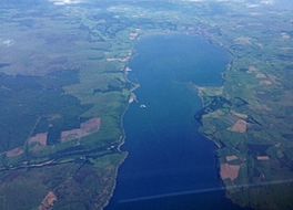
Aerial view of Loch Ryan.
|
|||||||||||||||||||||
| Location | Scottish Lowlands, Scotland | ||||||||||||||||||||
| Coordinates | 54°59′10″N 5°03′18″W / 54.986°N 5.055°W | ||||||||||||||||||||
| Type | Sea loch | ||||||||||||||||||||
| Primary inflows | Water of App, Glen Burn | ||||||||||||||||||||
| Primary outflows | North Channel | ||||||||||||||||||||
| Catchment area | 197 km2 (76 sq mi) | ||||||||||||||||||||
| Basin countries | Scotland | ||||||||||||||||||||
| Max. length | 13.4 kilometers (8.3 mi) | ||||||||||||||||||||
| Max. depth | 16 m (52 ft) | ||||||||||||||||||||
| Surface elevation | 0 m (0 ft) | ||||||||||||||||||||
| Settlements | Stranraer, Cairnryan, Kirkcolm | ||||||||||||||||||||
|
|||||||||||||||||||||
Contents
Where is Loch Ryan?
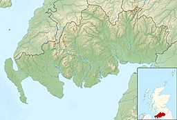
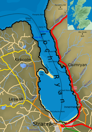
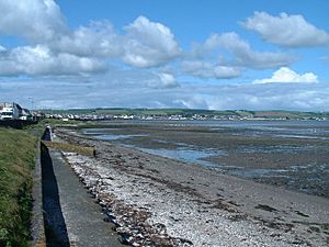
Loch Ryan stretches from north to south. Its northern end opens up to the North Atlantic Ocean and the Firth of Clyde. The town of Stranraer is located at its southern end.
The loch is bordered by the Rhins of Galloway peninsula on its western side. To the east, you'll find the Scottish mainland, including areas like Galloway and South Ayrshire. The northernmost points of the loch are Milleur Point and Finnarts Point.
The loch is about 8 miles (13 km) long from north to south. At its widest, it measures about 3 miles (4.8 km) across. Roads like the A77 (east) and the A718 (west) run nearby.
How Loch Ryan was Formed
Loch Ryan was shaped by two main natural processes: geology and glaciers.
First, millions of years ago, during the Paleozoic era, the land changed a lot. During the Devonian period (360 to 416 million years ago), the land was pushed and pulled, creating a basin shape. Later, in the Permian period (250 to 300 million years ago), this basin filled with soft sediments. These sediments eventually turned into soft sandstones. At this time, the area was near the equator and part of a huge continent called Pangaea.
The second big change happened during the Quaternary period, which started about 2 million years ago. This was a time of many Ice ages. Huge sheets of ice, called glaciers, moved across the land. As they moved, they wore away the soft sandstone, leaving behind harder rocks. When the last glaciers melted about 10,000 years ago, the basin was uncovered. The sea then flooded this basin, creating the loch we see today.
Since the last ice age, the sea has continued to shape the loch. It does this by eroding (wearing away) the land and depositing (dropping) sand and other materials. On the western side of the loch, there's a sandbank called 'the Scar'. This sandbank, located just south of Kirkcolm, is an important place where terns (a type of seabird) come to breed.
A Look at Loch Ryan's Past
People have lived and worked around Loch Ryan for a very long time. Because it's sheltered from the rough seas of the North Channel and the North Atlantic, it has always been a safe place for ships.
An ancient writer named Ptolemy described a river called Abrauannus. Some historians believe this was Loch Ryan, or the stream that flows into it.
In 1307, during the Scottish Wars of Independence, Robert the Bruce sent forces to take control of southwest Scotland. One group, led by his brothers, landed in Loch Ryan. However, they were quickly defeated by local forces in the Battle of Loch Ryan.
Historically, fishing was very important here. Old records from the late 1700s say the loch was full of delicious oysters and many other fish like skate, flounders, and cod. By the mid-1800s, however, the herring (a type of fish) had mostly left the loch.
A lighthouse was built at Cairn Point in 1847. In 1849, the main ferry route to Northern Ireland moved from Portpatrick to Stranraer in Loch Ryan. This was because the ships were getting bigger and needed the calmer, safer waters of the loch to avoid storms.
Loch Ryan in World War II
During World War II, Loch Ryan was a very busy place. Cairnryan became "No. 2 Military Port." This was a crucial backup port in case the main ports on the Mersey and Clyde were damaged by enemy bombs.
Work on the port began in 1941, and by 1943, two large piers, the North Deep and the South Deep, were finished. They even had their own railway line. Although the port was never used to its full capacity, it was ready if needed.
After 1942, the harbor was used to bring in troops from the United States. Today, only one of the piers remains, but it's not safe to use.
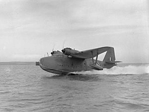
The area also became important for fighting against German U-boats (submarines) in the Atlantic. Flying boats (planes that could land on water) operated from the loch to protect Allied ships. There were two RAF (Royal Air Force) stations: RAF Wig Bay near Kirkcolm and RAF Stranraer in the town.
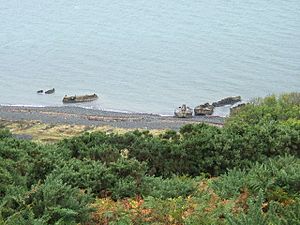
Just north of Cairnryan, you can still see some concrete structures on the shore. These are 'Beetles' from the Mulberry harbour project. These pontoons were used to support the floating roadways of the Mulberry harbors, which were temporary ports built for the D-Day landings in France. Four of these roadways were built at Cairnryan.
After the war ended in 1945, many German U-boats surrendered in the Atlantic. They were brought to Loch Ryan and held at Cairnryan. Later, these U-boats were towed out into the Atlantic and sunk as part of Operation Deadlight.
The loch was also used for other wartime activities. Target rafts, made of wood and cork, were built in Stranraer. They were then floated out of the loch to Luce Bay for bombing practice.
Even famous people had connections to Loch Ryan during the war. The comedian Tony Hancock was stationed at RAF Wig Bay. He was assigned to the Marine Craft Section, where he was responsible for things like coal and boiler houses. He used his time there to develop his comedy skills.
Ship Breaking Facility
After they were no longer needed, two large aircraft carriers, HMS Eagle and HMS Ark Royal, were brought to Cairnryan to be taken apart. HMS Eagle arrived in 1978, and HMS Ark Royal followed in 1980.
The facility in Loch Ryan was used to scrap many old naval vessels. These included frigates, submarines, and even aircraft carriers.
Loch Ryan Today
Today, Loch Ryan is still a vital link for ferries to Northern Ireland. It offers the shortest sea crossing between Britain and Ireland. Ferry activity has grown a lot since the route first started in 1849.
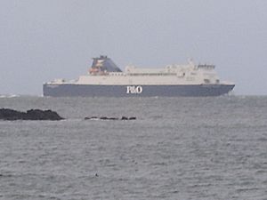
Currently, two ferry companies, Stena Line and P&O Ferries, operate from the loch.
On November 21, 2011, Stena Line moved its ferry service to Belfast to a new port north of Cairnryan Village. This new Loch Ryan Port is now served by two large ferries, Stena Superfast VII and Stena Superfast VIII. They complete the journey to Belfast in about 2 hours and 15 minutes.
P&O Ferries also operates from Cairnryan with two ferries, European Causeway and European Highlander. The new port facilities at Cairnryan help ensure the future of this important ferry route. This also means that the southern part of the loch will be free for smaller boats, as it won't have large ferry traffic.
Loch Ryan is already used by small boats. The Loch Ryan Sailing Club operates from Wig Bay, and there's also Stranraer Marina in Stranraer harbor.
Between 1992 and 1999, a company called Sea Containers ran a fast ferry service between Stranraer and Belfast. These fast ferries could travel much quicker (around 40 knots) than traditional ferries (about 15 knots). However, the large waves they created led to speed limits being put in place within most of the loch. Fast ferries could not go above 12 knots (22 km/h) until they were further north.
More speed limits were added during the tern breeding season. This was to protect the breeding birds on the Scar sandbank, as the waves from the ships could disturb them.
Rail Access to Loch Ryan
Stranraer station connects to the Glasgow South Western Line. You can take a train from Stranraer to places like Ayr, Paisley Gilmour Street, and Glasgow Central. There are also connections to Kilmarnock, Dumfries, and Carlisle. From Carlisle, you can connect to the West Coast Main Line for trains to Preston, Crewe, and London Euston.
 | William L. Dawson |
 | W. E. B. Du Bois |
 | Harry Belafonte |


