Whitehope Heights facts for kids
Quick facts for kids Whitehope Heights |
|
|---|---|
 |
|
| Highest point | |
| Elevation | 637 m (2,090 ft) |
| Prominence | 109 m (358 ft) |
| Listing | Hu,Tu,Sim, D,GT,DN,Y |
| Geography | |
| Location | Dumfries and Galloway, Scottish Borders, Scotland |
| Parent range | Moffat Hills, Southern Uplands |
| OS grid | NT 09575 13898 |
| Topo map | OS Landranger 78 |
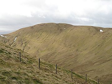
Whitehope Heights is a hill found in the Moffat Hills. These hills are part of the Southern Uplands in Scotland. It stands 637 meters (about 2,090 feet) tall. This makes it the lowest "Donald" hill in the Moffat Hills range. A "Donald" is a Scottish hill over 2,000 feet high.
About Whitehope Heights
Whitehope Heights is a special place in Scotland. It is known for its beautiful views. The hill is located where two areas meet. These are Dumfries and Galloway and the Scottish Borders. The border between them actually runs right along the top of the hill.
Location and Features
Whitehope Heights is separated from a nearby hill called Hart Fell. A steep, grassy valley known as The Gyle lies between them. The southern parts of Whitehope Heights are part of Corehead hill farm. This land is owned by the Borders Forest Trust. They are working to help nature grow back here. Because of this, you might see a large deer fence. It helps protect the young trees and plants.
Exploring the Area
Many people enjoy climbing Whitehope Heights. The most common way to reach the top is from the east. This path goes past the Devil's Beef Tub and the Annandale Way. You can also climb Whitehope Heights from Hart Fell. Both routes offer great outdoor adventures.
 | Emma Amos |
 | Edward Mitchell Bannister |
 | Larry D. Alexander |
 | Ernie Barnes |

