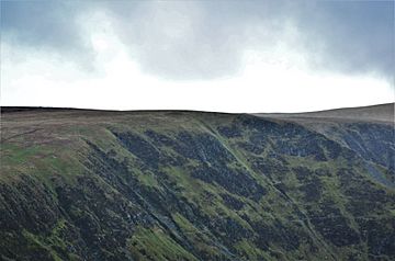
Swatte Fell facts for kids
Quick facts for kids Swatte Fell |
|
|---|---|
 |
|
| Highest point | |
| Elevation | 729.9 m (2,395 ft) |
| Prominence | 36.3 m (119 ft) |
| Listing | Tu,Sim, D,GT,DN |
| Geography | |
| Location | Dumfries and Galloway, Scotland |
| Parent range | Moffat Hills, Southern Uplands |
| OS grid | NT 11848 11385 |
| Topo map | OS Landranger 78 |
Swatte Fell is a beautiful hill in Scotland. It's part of the Moffat Hills. These hills are found in the Southern Uplands of Scotland. Swatte Fell is located in Dumfries and Galloway. This area is in the south of Scotland.
Discovering Swatte Fell
Swatte Fell stands at about 730 meters (2,395 feet) tall. It is located north of the town of Moffat. The hill is south of its taller neighbor, Hart Fell. Most of Swatte Fell has gentle slopes. This makes it easier to walk up.
The East Ridge and Blackhope
The eastern side of Swatte Fell is different. It has a steep and rocky ridge. This side also features a deep, bowl-shaped valley. This valley is called a corrie. Its name is Blackhope. Blackhope is a popular spot for climbers. A famous rock climb, the Coomb Craig ridge, starts here. It finishes near the top of Swatte Fell. This climb was even shown on the front cover of an OS map!
Popular Walking Routes
The usual way to climb Swatte Fell is from its southern ridge. This path is quite popular. You can also make your walk longer. Many people enjoy a full loop around Blackhope. This longer walk is known as the Hart Fell Horseshoe. It finishes on a nearby hill called Saddle Yoke. It's a great way to see more of the stunning scenery.
 | Kyle Baker |
 | Joseph Yoakum |
 | Laura Wheeler Waring |
 | Henry Ossawa Tanner |

