Milne Ice Shelf facts for kids
Quick facts for kids Milne Ice Shelf |
|
|---|---|
| Type | Ice shelf |
| Coordinates | 82°45′N 081°55′W / 82.750°N 81.917°W |
| Area | 290 km2 (110 sq mi) (1986) |
| Thickness | 100 metres (330 ft) (1986) |
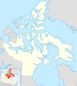
The Milne Ice Shelf was a very large floating sheet of ice. It was once part of the bigger Ellesmere Ice Shelf. This ice shelf was located in the Qikiqtaaluk Region of Nunavut, Canada. It was the second largest ice shelf in the Arctic Ocean.
The Milne Ice Shelf was found on the northwest coast of Ellesmere Island. It was about 270 km (170 mi) west of a place called Alert, Nunavut.
What was the Milne Ice Shelf like?
In 1986, the Milne Ice Shelf covered an area of about 290 km2 (110 sq mi). This is roughly the size of a medium-sized city. In its middle, the ice was about 100 m (330 ft) thick. That's as tall as a 30-story building!
What happened to the ice shelf?
The Milne Ice Shelf was the last fully whole ice shelf in the Canadian Arctic. But in July 2020, something big happened. Over 40 percent of the ice shelf broke off and collapsed into the ocean. This happened in just two days.
This collapse was a direct result of global warming. Global warming means our planet is getting hotter. This causes ice to melt and break apart. A research camp that was not being used at the time was lost when the ice shelf collapsed. This camp had tools to measure how water moved through the ice.
See also
 In Spanish: Plataforma de hielo Milne para niños
 | Janet Taylor Pickett |
 | Synthia Saint James |
 | Howardena Pindell |
 | Faith Ringgold |


