Mineola, Iowa facts for kids
Quick facts for kids
Mineola, Iowa
|
|
|---|---|
 |
|
| Country | United States |
| State | Iowa |
| County | Mills |
| Area | |
| • Total | 0.39 sq mi (1.01 km2) |
| • Land | 0.39 sq mi (1.01 km2) |
| • Water | 0.00 sq mi (0.00 km2) |
| Elevation | 1,030 ft (310 m) |
| Population
(2020)
|
|
| • Total | 154 |
| • Density | 395.89/sq mi (153.00/km2) |
| Time zone | UTC-6 (Central (CST)) |
| • Summer (DST) | UTC-5 (CDT) |
| ZIP code |
51554
|
| FIPS code | 19-52635 |
| GNIS feature ID | 459123 |
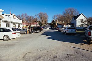
Mineola is a small community in Mills County, Iowa, United States. It's known as an unincorporated village. This means it's not officially a city or town with its own local government. It's also a census-designated place, which is a special area the government defines for counting people during a census.
In the 2020 census, 154 people lived in Mineola. Students from Mineola attend schools in the Glenwood Community School District.
Where is Mineola?
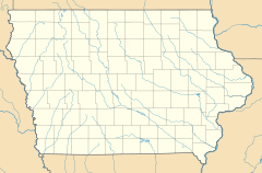
Mineola is located in the northern part of Mills County. It is about 8 miles (13 km) north of Glenwood. Glenwood is the main town and county seat of Mills County. Mineola is also about 13 miles (21 km) southeast of Council Bluffs.
The community sits on the east side of the valley of Keg Creek. This creek flows south and eventually joins the Missouri River. The total area of Mineola is about 0.39 square miles (1.01 square kilometers), and all of it is land.
How Many People Live Here?
The population of Mineola has changed a bit over the years. Here's a look at the numbers from recent censuses:
| Historical population | |||
|---|---|---|---|
| Census | Pop. | %± | |
| 2010 | 166 | — | |
| 2020 | 154 | −7.2% | |
| U.S. Decennial Census | |||
- In 2010, the population was 166 people.
- By 2020, the population had slightly decreased to 154 people.
See also

- In Spanish: Mineola (Iowa) para niños


