
Council Bluffs, Iowa facts for kids
Quick facts for kids
Council Bluffs, Pottawattamie County, Iowa
|
|
|---|---|

Haymarket Historic District (2015)
|
|
| Motto(s):
"Iowa's Spirit"
|
|

Location of Council Bluffs in Pottawattamie County, Iowa
|
|
| Country | United States |
| State | Iowa |
| County | Pottawattamie |
| Incorporated | January 19, 1853 |
| Area | |
| • City | 45.672 sq mi (118.290 km2) |
| • Land | 42.963 sq mi (111.275 km2) |
| • Water | 2.709 sq mi (7.016 km2) |
| Elevation | 978 ft (298 m) |
| Population
(2020)
|
|
| • City | 62,799 |
| • Estimate
(2023)
|
62,399 |
| • Rank | US: 619th IA: 10th |
| • Density | 1,452.46/sq mi (560.79/km2) |
| • Urban | 819,508 (US: 55th) |
| • Metro | 983,969 (US: 56th) |
| Time zone | UTC−6 (Central (CST)) |
| • Summer (DST) | UTC−5 (CDT) |
| ZIP Codes |
51501, 51502, 51503
|
| Area code(s) | 712 |
| FIPS code | 19-16860 |
| GNIS feature ID | 2393650 |
| Sales tax | 7.0% |


Council Bluffs is a city in Iowa, United States. It is the main city of Pottawattamie County. In 2020, about 62,799 people lived there. This makes it the tenth largest city in Iowa.
Council Bluffs is part of a bigger area called the Omaha metropolitan region. This area has nearly a million people. The city is on the east side of the Missouri River, right across from Omaha, Nebraska.
Before 1853, Council Bluffs was known as Kanesville. Kanesville was a very important starting point for pioneers heading west. It was the beginning of the Mormon Trail. It was also a key place for other trails because a steamboat helped settlers and their wagons cross the Missouri River. In 1869, the first transcontinental railroad connected here, linking the eastern and western parts of the U.S. by rail.
Contents
History of Council Bluffs
Early Days and Native American Lands (1804–1843)
The name "Council Bluff" first came from an area in Nebraska. Lewis and Clark named it after meeting with the Otoe tribe there in 1804. This spot was about 20 miles northwest of today's Council Bluffs.
The Iowa side of the river became a home for Native American tribes. These included the Chippewa, Ottawa, and Potawatomi people. They were asked to move from the Chicago area after a treaty in 1833/1835.
Many Potawatomi people moved to this area. They were led by a man named Sauganash, also known as Billy Caldwell. His village was called Caldwell's Camp. A missionary named Pierre-Jean De Smet also came here in 1838. He tried to help the Potawatomi people. He also made one of the first detailed maps of the Council Bluffs area.

More Native American tribes were moved to this area. This caused more problems and conflicts. The U.S. Army built a small fort in 1842 to help keep peace. But it was destroyed by a flood that same year. By 1846, the Potawatomi people had to move again to a new reservation in Kansas.
Kanesville: A Mormon Community (1844–1851)
In 1844, the Stephens-Townsend-Murphy Party crossed the Missouri River here. They were on their way to California. Starting in 1846, many Latter-day Saints (also known as Mormons) came to the area. At first, the place was called "Miller's Hollow."
By 1848, the town was known as Kanesville. It was named after Thomas L. Kane, who helped the Mormons. Kanesville became the main starting point for the Mormon Exodus to Utah. It is known as the official beginning of the Mormon Trail.
Many settlers heading west started their journeys from Kanesville. They traveled in wagon trains along famous routes like the Oregon Trail, Mormon Trail, and California Trail. These trails were very important for people moving to the western United States. The use of these trails slowed down after the first transcontinental railway was finished in 1869.
The Mormon Battalion also began their march to California from Kanesville during the Mexican–American War. Many Mormons left for Utah by 1852.
Council Bluffs and the Railroad Era (1852-1900)
In 1852, the town's name changed to Council Bluffs. It remained a major stop on the Emigrant Trail for people moving west. It was also a busy place for steamboats.

President Abraham Lincoln chose Council Bluffs as the official starting point for the Transcontinental Railroad. This railroad was finished in 1869. The official "Mile 0" spot is at 21st Street and 9th Avenue. It is marked by a gold spike. The railroad connection to Council Bluffs was fully ready in 1872 when the Union Pacific Missouri River Bridge opened. Before that, train cars had to be ferried across the Missouri River.
Many other railroads also came to Council Bluffs. This made the city a very important center for trains.
Council Bluffs in the 20th and 21st Centuries
In 1926, a part of Council Bluffs west of the Missouri River became its own town, Carter Lake, Iowa. This happened because the river changed its path.
By the 1930s, Council Bluffs was one of the biggest rail centers in the country. The railroads helped the city become a major place for storing grain. You can still see large grain elevators in the city's skyline. Other businesses included food companies and manufacturers.
Over time, changes in the railroad and other industries led to job losses. The city worked to create new jobs and improve its downtown area.
Today, Council Bluffs is home to large companies like Google. Google has built big server farms here, creating many jobs. This has been a huge investment for the state of Iowa.
Geography of Council Bluffs
Council Bluffs is located at 41°15′13″N 95°51′45″W / 41.25361°N 95.86250°W. The city covers about 43.62 square miles (113 square kilometers). Most of this is land, with some water.
The city is in a special area with prairie and savanna landscapes. It has unique Loess Hills and wetlands along the Missouri River. You can find great views from places like KOIL Point, the Lincoln Monument, and the Lewis and Clark Monument. Lake Manawa State Park is also at the southern edge of the city.
Population and People
| Historical population | |||
|---|---|---|---|
| Census | Pop. | %± | |
| 1860 | 2,011 | — | |
| 1870 | 10,020 | 398.3% | |
| 1880 | 18,063 | 80.3% | |
| 1890 | 21,474 | 18.9% | |
| 1900 | 25,802 | 20.2% | |
| 1910 | 29,292 | 13.5% | |
| 1920 | 36,162 | 23.5% | |
| 1930 | 42,048 | 16.3% | |
| 1940 | 41,439 | −1.4% | |
| 1950 | 45,429 | 9.6% | |
| 1960 | 55,641 | 22.5% | |
| 1970 | 60,348 | 8.5% | |
| 1980 | 56,449 | −6.5% | |
| 1990 | 54,315 | −3.8% | |
| 2000 | 58,268 | 7.3% | |
| 2010 | 62,230 | 6.8% | |
| 2020 | 62,799 | 0.9% | |
| 2023 (est.) | 62,399 | 0.3% | |
| U.S. Decennial Census Iowa State Data Center 2020 Census |
|||
Council Bluffs is the main city in the Omaha-Council Bluffs Metropolitan Area.
Population in 2020
| Race | Number | Percentage |
|---|---|---|
| White (NH) | 50,787 | 80.9% |
| Black or African American (NH) | 1,679 | 2.7% |
| Native American or Alaska Native (NH) | 310 | 0.5% |
| Asian (NH) | 640 | 1.0% |
| Pacific Islander (NH) | 67 | 0.1% |
| Some Other Race (NH) | 201 | 0.3% |
| Mixed/Multi-Racial (NH) | 2,607 | 4.2% |
| Hispanic or Latino | 6,508 | 10.4% |
| Total | 62,799 | 100.0% |
In 2020, there were 62,799 people living in Council Bluffs. There were 25,271 households. The city had about 1,462 people per square mile.
Most people in the city were White (83.7%). Other groups included African American (2.7%), Native American (0.9%), and Asian (1.0%). About 10.4% of the population was Hispanic or Latino.
Population in 2010
In 2010, the city had 62,230 people. There were 24,793 households. About 31.6% of households had children under 18. The average age in the city was 35.9 years.
Economy and Jobs
Council Bluffs has a strong economy with different types of businesses. The city is known for its casinos, which bring in a lot of money.
Industries in Council Bluffs include frozen foods, robotics, and making things like plastics and electrical products. Companies like Tyson Foods have plants here.
Google has also built large server farms in Council Bluffs. These facilities create many jobs and are a big investment for the city. These server farms help power Google's online services.
Arts and Culture
Council Bluffs has many interesting places to visit. One unique spot is the Pottawattamie County "Squirrel Cage" Jail. It was used from 1885 to 1969. It's one of only three rotary jails left in the world. Its cells were on a turntable that the jailer would spin to reach each cell.

The city has strong ties to the railroad. You can learn about this at three local museums. The Union Pacific Museum is in a former library building. The Grenville Dodge Home was built by a famous railroad builder. The RailsWest Railroad Museum is in an old train station. It has historic train cars on display.
Council Bluffs also has many public art displays. The Iowa West Foundation helps fund these art projects. You can see sculptures and art installations around the city, like the Molecule Man sculpture.
The black squirrel is the city's mascot. The famous artist John James Audubon wrote about these squirrels in 1843.
Every year in late July or early August, the Pottawattamie County Fair takes place. It has carnival rides, concerts, and other fun events.
Sports
Council Bluffs has hosted different sports teams. The Iowa Blackhawks (later Council Bluffs Express) played football here. The Omaha Lancers hockey team also played at the Mid-America Center.
The city has also had two minor league baseball teams: the Council Bluffs Rails and the Council Bluffs Bluffers.
Education
Students in Council Bluffs attend public schools run by two districts. Most of the city is in the Council Bluffs Community School District. This district has elementary schools, middle schools, and two high schools: Abraham Lincoln and Thomas Jefferson. The Lewis Central Community School District serves the southern part of the city.
There are also several private schools in Council Bluffs. The Iowa School for the Deaf is located here. It helps students with hearing loss.
For higher education, Iowa Western Community College is on the eastern edge of the city. Buena Vista University also has a location in Council Bluffs.
Transportation
Council Bluffs has good transportation links. Major highways like Interstate 80, Interstate 29, and U.S. Route 6 pass through the city. Many important railroads also connect here, carrying freight traffic.
The city has a system of paved trails for walking and biking. You can even walk or bike across the Missouri River into Omaha using the Bob Kerrey Pedestrian Bridge.

Buses help people get around Council Bluffs and to Omaha. There are also plans for a streetcar line in the future. For air travel, most people use Omaha's Eppley Airfield. The Council Bluffs Municipal Airport is available for smaller planes.
Notable People from Council Bluffs
Many interesting people have come from Council Bluffs, including:
Academics
- Nathan M. Pusey: A former president of Harvard University.
Arts
- Walter Cassel: An opera singer.
- Janet Dailey: A famous romance novelist.
- Harry Langdon: A star from silent movies.
- Ernest Schoedsack: A film director who made the original King Kong.
Business
- Jonathan Browning: A skilled gunsmith.
- Martin Burns: A championship wrestler who started a wrestling school.
Journalism
- William Pfaff: A well-known journalist.
Military
- John S. McCain Jr.: A Navy Admiral and father of Senator John McCain.
Religion
- Pierre-Jean De Smet: A Jesuit missionary.
Science and Engineering
- Lee De Forest: An inventor known as the "Grandfather of Television."
- Hans Schlegel: An astronaut.
Sports
- Stan Bahnsen: A pitcher for several Major League Baseball teams.
- Zoe Ann Olsen-Jensen: An Olympic medalist in diving.
- William Smith: An Olympic gold medalist in wrestling.
- Ron Stander: A boxer known as the "Bluffs Butcher."
- Max Duggan: A football player and Heisman Trophy Finalist.
Other Notable People
- Sauganash or Billy Caldwell: A leader and spokesman for the Potawatomi people.
- Farrah Abraham: A reality television star.
Sister Cities
Council Bluffs has special connections with cities around the world. These are its sister cities:
 El Hajeb, Morocco
 Herat, Afghanistan
- Kandahar, Afghanistan
 Karrada (Baghdad), Iraq
 Prizren, Kosovo
 Tobolsk, Russia
Images for kids
-
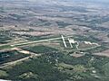
Airfield at Council Bluffs Iowa
See also
 In Spanish: Council Bluffs para niños
