Kandahar facts for kids
Quick facts for kids
Kandahar
|
||
|---|---|---|
|
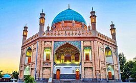
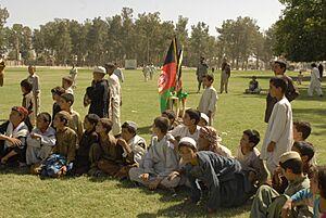
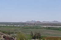
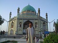
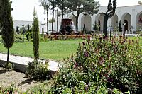
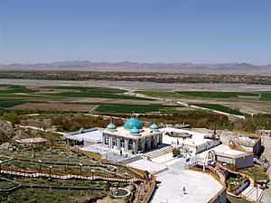
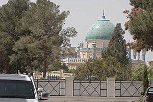
Top to bottom and left to right: The Eidgah Jaami Jumat at Kandahar University, Friday Mosque of Kandahar, Tomb of Ahmad Shah Durrani, aerial view over the Mausoleum of Baba Wali, a Mosque in Kandahar
|
||
|
||
| Country | ||
| Province | Kandahar | |
| District | Kandahar | |
| Government | ||
| • Type | Municipality | |
| Area | ||
| • Total | 273.37 km2 (105.55 sq mi) | |
| Elevation | 1,010 m (3,310 ft) | |
| Population
(2021)
|
||
| • Total | 651,484 | |
| • Density | 2,383.16/km2 (6,172.35/sq mi) | |
| Time zone | UTC+4:30 (Afghanistan Standard Time) | |
| Postal Code |
38XX
|
|
Kandahar is a major city in Afghanistan. It is located in the southern part of the country, near the Arghandab River. Kandahar is Afghanistan's second-largest city, after Kabul. About 614,118 people live there. It is the capital of Kandahar Province and a very important cultural area.
Kandahar is a special place for the Taliban group. Even though Kabul is the official capital, Kandahar is where the supreme leader and his advisors are based. This means Kandahar is often seen as the real center of power in Afghanistan.
In 1709, Mirwais Hotak made Kandahar the capital of an independent kingdom. Later, in 1747, Ahmad Shah Durrani made it the capital of the Afghan Empire. Many groups have fought over Kandahar because it is in a key spot. It sits on important trade routes that connect southern, central, and western Asia.
Kandahar is very important to the Pashtuns. It has been their main power center for over 300 years. The city is also a big trading hub. It deals with things like sheep, wool, cotton, silk, and food. The area is famous for its delicious fruits, especially pomegranates and grapes. The city even has factories that can, dry, and pack fruit.
The area around Kandahar has some of the oldest human settlements. A large city with strong walls existed here as early as 1000–750 BC. It became an important outpost for the Persian Empire in the 6th century BC. Alexander the Great founded what is now Old Kandahar in the 4th century BC. He named it Alexandria of Arachosia.
Contents
- Understanding the Name of Kandahar
- Kandahar's Long History
- Geography of Kandahar
- Transportation in Kandahar
- People and Population
- Education in Kandahar
- Communication Services
- Interesting Places to Visit
- City Growth and Modernization
- Sports in Kandahar
- Culture and People
- Famous People from Kandahar
- See also
Understanding the Name of Kandahar
There are a few ideas about where the name Kandahar comes from.
The old city of Kandahar was called Alexandria in Arachosia. This name was given by Alexander the Great after he arrived in 330 BC. Some people think "Kandahar" came from "Iskandar," which is how "Alexander" might have been said locally. A historian from the 1500s, João de Barros, wrote about the name changing from "Scandar" to "Candar."
Another idea is that the word "kand" or "qand" in Persian and Pashto means "candy." So, "Kandahar" might mean "candy area." This makes sense because the region is very fertile. It has always been known for growing sweet fruits like grapes, pomegranates, and apricots.
Some historians believe Kandahar got its name from an ancient king. Ernst Herzfeld thought it came from the Indo-Parthian king Gondophares. He might have rebuilt the city and named it Gundopharron.
Another idea links the name to Gandhara. This was an ancient Hindu-Buddhist kingdom. It was located between the Kunar River and Abaseen River. The name Kandahar is thought to be a changed form of "Gandhara." This name was used a very long time ago, between 2000-1700 BCE.
Kandahar's Long History
Historical affiliations
Macedonia 330 BC–312 BC
Seleucid Empire 312 BC–304 BC
Maurya Empire 304 BC–204 BC
Seleucid Empire 204 BC–c. 180 BC
Greco-Bactrian Kingdom 180 BC-c. 150 BC
Yavana Kingdom c. 150 BC–142 BC
Indo-Scythians 142 BC–32 BC
Parthian Empire 32 BC–19 CE
Indo-Parthian Kingdom 19–36
Kushan Empire 36–230
Sasanian Empire 230–645
Rashidun Caliphate 645–661
Umayyad Caliphate 661–750
![]() Abbasid Caliphate 750-861
Abbasid Caliphate 750-861
Saffarid dynasty 861–977
Ghaznavid Empire 977–1175
Ghurid dynasty 1175-1207
Khwarazmian Empire 1207–1222
Mongol Empire 1222-1256
![]() Ilkhanate 1256-1347
Ilkhanate 1256-1347
Kart dynasty 1347-1382
![]() Timurid Empire 1382-1507
Timurid Empire 1382-1507
![]() Mughal Empire 1507–1649
Mughal Empire 1507–1649
![]() Safavid Empire 1649-1711
Safavid Empire 1649-1711
![]() Hotak dynasty 1711–1738
Hotak dynasty 1711–1738
![]() Afsharid Empire 1738–1747
Afsharid Empire 1738–1747
Durrani Empire 1747–1818
![]() Principality of Kandahar 1818-1839
Principality of Kandahar 1818-1839
![]() United Kingdom (Company Raj) 1839-1842
United Kingdom (Company Raj) 1839-1842
![]() Principality of Kandahar 1842-1855
Principality of Kandahar 1842-1855
![]() Afghanistan 1855–present
Afghanistan 1855–present
Ancient Times
Archaeologists have found signs that people lived around Kandahar a very long time ago. Early farming villages existed here around 5000 BC. This makes it one of the oldest known human settlements.
British excavations in the 1970s showed that Kandahar was a large, walled city around 1000 to 750 BC. This city became an important part of the Achaemenid Empire (Persian Empire) from the 6th to 4th centuries BC.
City's Founding and Greek Influence
Old Kandahar was founded in 330 BC by Alexander the Great. It was built near an even older city called Mundigak. The main people living in this area were the Pakhtas, who might be ancestors of today's Pashtuns. Alexander named the city Alexandria in Arachosia.
Kandahar has always been a target for conquerors. This is because it sits on a key trade route connecting India, the Middle East, and Central Asia. After Alexander's death, the city became part of the Seleucid Empire. Later, it was part of the Maurya Empire and the Greco-Bactrian Kingdom.
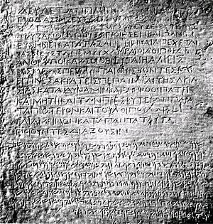
During the time of the Mauryas, Buddhism was brought to southern Afghanistan. It became a major religion there. Important inscriptions by Emperor Ashoka, a famous ruler, have been found in Kandahar. These writings are in both Greek and Aramaic. They show how important the city was.
Medieval Times
Islamic Influence
Until the 800s AD, Kandahar was seen as part of the Indian subcontinent. In the 600s AD, Arab armies arrived and brought Islam to the region. However, it took time for everyone to become Muslim. In 870 AD, a local ruler named Yaqub ibn Layth Saffari conquered Kandahar. He did this in the name of Islam.
Later Empires
The Zunbil dynasty ruled Kandahar from the 600s to the late 800s AD. In the 1000s, Sultan Mahmud of Ghazni took control, followed by the Ghurids. Kandahar was even renamed Teginābād for a while.
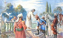
In 1221, a Mongol army attacked Kandahar. Later, Timur the Great, who founded the Timurid Empire, captured the city in 1383. He made his grandson the governor. The founder of Sikhism, Guru Nanak, is believed to have visited Kandahar around 1521 AD.
Mughal and Safavid Control
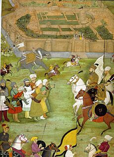
Babur, who started the Mughal Empire, took Kandahar in 1508. The city was often fought over by the Mughals and the Safavids (from Persia). Kandahar was important to the Mughal Empire. It was seen as a gateway to India. Controlling it helped stop foreign attacks.
Modern History (1709-Present)
In 1709, Mirwais Hotak, a leader of the Ghilji tribe, rebelled against the Persian rulers. He started the Hotak dynasty in Kandahar. Mirwais wanted to keep Afghans from being forced to change their religion. He died in 1715.
In 1738, Nader Shah, a new Persian ruler, invaded Afghanistan. He destroyed the old city of Kandahar. He also freed Ahmad Shah Durrani. Before leaving, Nader Shah started building a new town next to the destroyed city.
In 1747, Ahmad Shah Durrani took control of Kandahar. He made it the capital of his new Afghan Empire. He built a new city with strong walls and large gates. His empire was very big, including parts of present-day Afghanistan, Pakistan, and Iran. Ahmad Shah died in 1772. His tomb is in the center of Kandahar. Later, the capital was moved to Kabul.
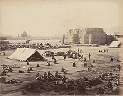
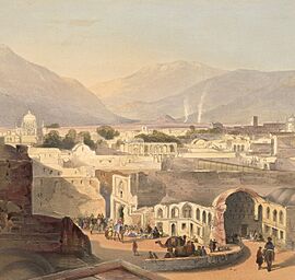
From 1818 to 1855, Kandahar was an independent area ruled by half-brothers of Dost Mohammad Khan. In 1839, British forces from India invaded the city. They left in 1842. The British returned in 1878 during another war. They left again a few years later.
Kandahar was mostly peaceful for the next 100 years. In the 1960s, the Kandahar International Airport was built by the United States. The U.S. also helped with other big projects in the area.
During the 1980s, Kandahar saw a lot of fighting. It became a center of resistance against the Soviet-backed government. Many civilians lost their lives during bombings. After the Soviet forces left, Kandahar faced more conflict. The city's population dropped a lot.
In 1994, the Taliban group took control of Kandahar. They made it their main headquarters. The Taliban brought in very strict rules. They banned things like formal education for girls and watching TV.
Kandahar in the 21st Century
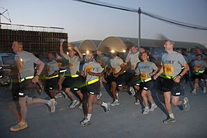
In 2001, the United States began hitting targets in Kandahar. This was part of a larger operation. About a month later, the Taliban began to surrender. Kandahar came under the control of local leaders again.
Since 2002, Kandahar International Airport has been used by U.S. and NATO forces. NATO helped train the new Afghan National Police. They also worked to make the city safer. The Afghan army also grew stronger with NATO's help.

NATO forces worked to expand the police force. They wanted to prevent the Taliban from returning. They also tried to provide services like electricity and clean water. This was to encourage people to support the government. In 2006, there was a big battle between NATO troops and the Taliban. The Taliban changed their fighting methods after this.
In 2010, Kandahar became a target for American operations. Afghan President Hamid Karzai held a meeting with local leaders. They discussed the need for NATO's help to make the province stable.
Geography of Kandahar
The Arghandab River flows along the west side of Kandahar. The city has 15 districts. Its total land area is about 273 square kilometers. There are over 61,902 homes in Kandahar.
About 64% of families in Kandahar have access to safe drinking water. Only 22% have safe toilets. About 27% of homes have electricity. The rest rely on public power. Kandahar has good roads. Most roads can be used by cars all year.
Land Use in Kandahar
Kandahar is a regional center in southern Afghanistan. It is close to the border with Pakistan. More than half of the land (59%) is not built up. In the built-up areas, empty plots of land take up more space (36%) than residential areas (34%). There are many shops and businesses along the road to Pakistan. India, Iran, and Pakistan have consulates here for trade and other connections.
Kandahar's Climate
Kandahar has a hot, dry climate. It gets very little rain. Temperatures change a lot between summer and winter. Summers start in mid-May and last until late September. They are extremely dry. July is the hottest month, with average temperatures around 31.9°C (89.4°F).
Autumn is dry, from early October to late November. Days are still warm, but nights get much cooler. Winter starts in December and brings most of the rain. January is the coldest month, with average temperatures around 5.1°C (41.2°F). Temperatures can drop below freezing. Spring is pleasant, from early March to late April. Sunny weather is common all year, especially in summer.
| Climate data for Kandahar (1964–1983) | |||||||||||||
|---|---|---|---|---|---|---|---|---|---|---|---|---|---|
| Month | Jan | Feb | Mar | Apr | May | Jun | Jul | Aug | Sep | Oct | Nov | Dec | Year |
| Record high °C (°F) | 25.0 (77.0) |
26.0 (78.8) |
36.5 (97.7) |
37.1 (98.8) |
43.0 (109.4) |
45.0 (113.0) |
46.5 (115.7) |
44.5 (112.1) |
41.0 (105.8) |
37.5 (99.5) |
31.5 (88.7) |
26.0 (78.8) |
46.5 (115.7) |
| Mean daily maximum °C (°F) | 12.2 (54.0) |
14.8 (58.6) |
21.6 (70.9) |
28.1 (82.6) |
34.1 (93.4) |
39.1 (102.4) |
40.2 (104.4) |
38.2 (100.8) |
34.0 (93.2) |
27.5 (81.5) |
21.0 (69.8) |
15.4 (59.7) |
27.2 (81.0) |
| Daily mean °C (°F) | 5.1 (41.2) |
7.8 (46.0) |
13.9 (57.0) |
20.2 (68.4) |
25.4 (77.7) |
30.0 (86.0) |
31.9 (89.4) |
29.4 (84.9) |
23.5 (74.3) |
17.5 (63.5) |
11.0 (51.8) |
7.3 (45.1) |
18.6 (65.4) |
| Mean daily minimum °C (°F) | 0.0 (32.0) |
2.4 (36.3) |
7.1 (44.8) |
12.3 (54.1) |
15.8 (60.4) |
19.5 (67.1) |
22.5 (72.5) |
20.0 (68.0) |
13.5 (56.3) |
8.5 (47.3) |
3.3 (37.9) |
1.0 (33.8) |
10.5 (50.9) |
| Record low °C (°F) | −12.1 (10.2) |
−10.0 (14.0) |
−4.8 (23.4) |
2.0 (35.6) |
2.4 (36.3) |
8.5 (47.3) |
13.5 (56.3) |
9.0 (48.2) |
5.2 (41.4) |
−2.2 (28.0) |
−9.3 (15.3) |
−11.4 (11.5) |
−12.1 (10.2) |
| Average precipitation mm (inches) | 54.0 (2.13) |
42.0 (1.65) |
41.1 (1.62) |
18.7 (0.74) |
2.2 (0.09) |
0 (0) |
2.3 (0.09) |
1.0 (0.04) |
0 (0) |
2.3 (0.09) |
7.0 (0.28) |
20.0 (0.79) |
190.6 (7.52) |
| Average precipitation days | 6 | 6 | 6 | 4 | 1 | 0 | 0 | 0 | 0 | 1 | 2 | 3 | 29 |
| Average relative humidity (%) | 58 | 59 | 50 | 41 | 30 | 23 | 25 | 25 | 24 | 29 | 40 | 52 | 38 |
| Mean monthly sunshine hours | 198.4 | 183.6 | 235.6 | 255.0 | 347.2 | 369.0 | 341.0 | 337.9 | 324.0 | 306.9 | 264.0 | 217.0 | 3,379.6 |
| Source: NOAA (1964–1983) | |||||||||||||
Transportation in Kandahar
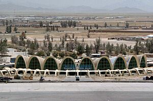
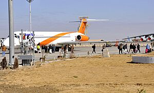
Kandahar International Airport is the main airport for southern Afghanistan. It handles both local and international flights. It is also a major military base. A part of the airport is for regular passengers. Most international flights go to the UAE, Iran, India, Saudi Arabia, and Pakistan.
Pakistan plans to build a railway track from Chaman to Kandahar. This would connect Afghan railways with Pakistan's. The study for this was done in 2006, but construction has not started yet.
Kandahar is connected to Quetta in Pakistan by road. It is also linked to Kabul by the Kabul-Kandahar Highway. Another highway connects it to Herat. There is a bus station where you can find buses to other major cities. People in Kandahar use public buses, taxis, and rickshaws to get around. More people are also using private cars.
People and Population
Kandahar had about 651,484 people in 2021. In the province, there are about 14,445 households. Each home has about seven people. Most of Kandahar's people (68%) live in rural areas. About 51% of the population are male.
The Pashtuns are the largest ethnic group in the province. Major Pashtun tribes include the Tareen, Durrani, Barakzai, Popalzai, and others. More than 98% of the people speak Pashto. A small number of people speak Balochi language and Dari. Kochi people (nomads) also live in Kandahar province. Their numbers change with the seasons.
Education in Kandahar
Before 1978, most children in Kandahar went to school. Many educated people left the city in the 1980s. They moved to other countries like North America, Europe, and Australia.
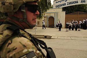
The two oldest schools are Ahmad Shah Baba High School and Zarghona Ana High School. Many new schools have opened in the last ten years. More are being built as the city grows. Afghan Turk High Schools is one of the best private schools.
The main university is Kandahar University. Several private colleges have also opened recently. These include Benawa Institute, Mirwais Neeka Institute, Malalay Institute, and Saba Institute. In 2012, about 16.8% of adults could read and write.
Communication Services
Phone and internet services in Kandahar are provided by several companies. These include Afghan Wireless, Roshan, Etisalat, MTN Group, and Afghan Telecom. In 2006, the Afghan government signed a deal to build a countrywide fiber optic cable network. This was to improve phone, internet, TV, and radio services across Afghanistan, including Kandahar.
Interesting Places to Visit
The tomb of Ahmad Shah Durrani is in the city center. It holds his brass helmet and other personal items. Next to his tomb is the Shrine of the Cloak. This shrine has a very important religious item. It is a sacred cloak that belonged to Prophet Muhammad. It is kept locked away and only brought out during big emergencies.
The village of Sher Surkh is southeast of the city. The Kandahar Museum is also in the city. It has many paintings by a famous artist named Ghiyassuddin.
North of the city, there is a shrine for a saint who lived over 300 years ago. His grave is very long, showing his importance. A monument to Islamic heroes stands in the main square, called Da Shahidanu Chawk. It was built in the 1940s.
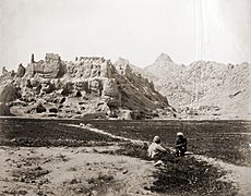
The Chilzina is a chamber carved into a rock. It is above the plain on the western side of Kandahar's Old City. This is where Ashoka's famous rock inscription was found. Forty steps lead up to the chamber. It is guarded by two lions.
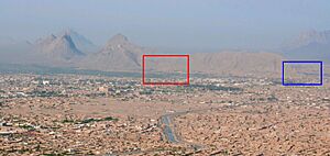
A short distance west of Chilzina is a bright blue dome. This is the tomb of Mirwais Hotak. He was the leader who made Kandahar independent in 1709. The shrine of Baba Wali Kandhari is also popular. It has terraces shaded by pomegranate trees next to the Arghandab River. It's a great place for picnics. Baba Wali was a Muslim holy man. His shrine is important to both Muslims and Sikhs. A military base is also near Baba Wali's shrine.
City Growth and Modernization
Decades of conflict damaged Kandahar. But in recent years, a lot of money has come in for rebuilding. Many Afghans who lived abroad have returned. New neighborhoods and modern buildings have been built around the city.
More homes now have clean drinking water and electricity. The government is working to provide these services to everyone. The city gets electricity from the Kajaki Dam in Helmand Province. This dam is being improved. The Dahla Dam, the second largest dam in Afghanistan, is also near the city.
The Aino Mina is a big new housing project. It is on the northern edge of the city. It plans to build up to 20,000 homes. It will also have roads, water systems, and community buildings like schools. This project has won awards for its design. Many government workers and wealthy business people live here.
Another new area, Hamidi Township, started construction in 2011. It is named after Ghulam Haider Hamidi, a former mayor of Kandahar. This new township will have 2,000 homes and businesses. It will also include new roads, schools, and clinics.
About 10 kilometers east of Kandahar, a large industrial park is being built. It will have modern facilities. It will also have professional management for roads, security, and other services.
Airports
- Kandahar International Airport
Neighborhoods
- Aino Meyna (new development)
- Hamidi Meyna (new development)
- Share Naw (meaning New City)
- Dand
- Karz
- Mirwais Meyna
- Daman
- Sarpuza
- Malajat
- Old Kandahar (Zorr Shar)
- Arghandab Valley
Cultural Sites and Parks
- Kandahar Park
- Baba Saab
- Kokaran Park
- Baghi Pul Park
- Chilzina View (a historical inscription site)
- Kandahar Museum
Mosques and Shrines
- Friday Mosque of Kandahar
- Mosque of the Hair of the Prophet
- Omar Al-Farooq Mosque
- Shrine of the Cloak
- Mosque at Kandahar University
Mausoleums
- Mausoleum of Ahmad Shah Durrani
- Mausoleum of Mirwais Hotak
- Mausoleum of Baba Wali
Shopping Areas
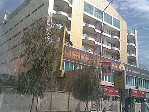
- Al-Jadeed indoor shopping center
- Herat Bazaar
- Kabul Bazaar
- Shah Bazaar
- Shkar Pur Bazaar
- Piaroz Super store
- Kandahr Super Store
- Samimi Super Store
Hospitals
- Afghan National Army Regional Hospital
- Mirwais Hospital
- Sial Curative Hospital
- Bilal Hospital
- Momand Hospital
- Sydal Hospital
Banks
- AIB Bank
- Kabul Bank
- Azizi Bank
Sports in Kandahar
Kandahar has several professional sports teams.
| Club | League | Sport | Venue | Established |
|---|---|---|---|---|
| Kandahar Knights | Afghanistan Premier League | Cricket | Sharjah Cricket Stadium | 2018 |
| Boost Defenders | Shpageeza Cricket League | Cricket | Kandahar International Cricket Stadium | 2013 |
| De Maiwand Atalan F.C. | Afghan Premier League | Football | Kandahar Stadium | 2012 |
Stadiums
- Kandahar International Cricket Stadium (being built)
- Kandahar Stadium (used for football)
- Ahmad Shahi Stadium (holds 20,000 people, used for football)
Culture and People
| Religions in Kandahar | ||||
|---|---|---|---|---|
| Religion | % | |||
| Muslims | 99.8% | |||
| Hindus | 0.15% | |||
| Others* | 0.05% | |||
| *includes Sikhs, Baháʼí and Atheists | ||||
The population of Kandahar is about 651,484 people as of 2021. The Pashtuns are the largest group in the city and province. Exact numbers are not fully known. In 2003, a study estimated that Pashtuns were about 70% of the population. Tajiks were 20%, Baloch 2%, and Uzbeks 2%.
Pashto is the main language spoken in Kandahar. A few people in the city also understand Persian. Both Pashto and Persian are official languages in Afghanistan. Most people in Kandahar province (over 98%) speak Pashto. A small number speak Dari or Balochi.
The Pashtun culture is very strong in this region. Their history, traditions, clothing, and way of life are very important here.
Famous People from Kandahar
- Kandahari Begum – wife of Mughal emperor Shah Jahan
- Nur Jahan – Empress of the Mughal Empire
- Mirwais Hotak – founder of the Hotak dynasty
- Mahmud Hotak – ruler of the Hotak dynasty and Shah of Persia
- Ahmad Shah Durrani – founding father of Afghanistan, buried in the city
- Dost Mohammad Khan – Emir of Afghanistan
- Abdur Rahman Khan – Emir of Afghanistan
- Abdul Hai Habibi – famous scholar and author
- The Karzais – family of Afghan President Hamid Karzai
- Gul Agha Sherzai – former governor of Kandahar Province
- Malalai of Maiwand – National folk hero of Afghanistan
- Hibatullah Akhundzada – Supreme leader of Afghanistan as of 2021
See also
 In Spanish: Kandahar para niños
 | Janet Taylor Pickett |
 | Synthia Saint James |
 | Howardena Pindell |
 | Faith Ringgold |


