Mochrum Loch facts for kids
Quick facts for kids Mochrum loch |
|
|---|---|
 |
|
| Location | Dumfries and Galloway, Scotland |
| Coordinates | 54°50′32″N 4°38′57″W / 54.842300°N 4.649300°W |
| Type | freshwater loch |
| Primary inflows | Castle Loch, Dumfries and Galloway burn |
| Primary outflows | Water of Malzie |
| Basin countries | Scotland |
| Max. length | 1.5 mi (2.4 km) |
| Max. width | 0.33 mi (0.53 km) |
| Surface area | 92 ha (230 acres) |
| Average depth | 7 ft (2.1 m) |
| Max. depth | 13 ft (4.0 m) |
| Water volume | 68,000,000 cu ft (1,900,000 m3) |
| Shore length1 | 10.2 km (6.3 mi) |
| Surface elevation | 75 m (246 ft) |
| Islands | 8 islets |
| 1 Shore length is not a well-defined measure. | |
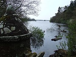
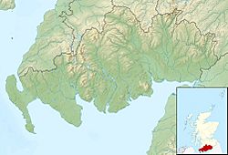
Mochrum Loch is a cool freshwater loch located in Dumfries and Galloway, in the south-west part of Scotland. It's a large loch with an interesting, irregular shape. You can find it about 8 mi (13 km) west of the town of Wigtown.
This loch is quite shallow, and it has several small, rocky islands. These islands add to its unique look.
Exploring Mochrum Loch
Have you ever wondered how we learn about lakes and lochs? Scientists often survey them to understand their size, depth, and other features.
Mapping the Loch
Mochrum Loch was carefully surveyed in 1903. A biologist named James Murray helped with this work. Later, the loch was mapped as part of a bigger project.
This project was called the Bathymetrical Survey of Fresh-Water Lochs of Scotland 1897-1909. It was led by Sir John Murray, a famous oceanographer. This survey helped create detailed maps of many Scottish lochs.
What is a Loch?
In Scotland, a "loch" is the word for a lake or a sea inlet. Mochrum Loch is a freshwater loch, meaning it's filled with fresh water, not salty ocean water. It's a natural basin that collects water from rain and streams.
Facts About Mochrum Loch
Mochrum Loch is a great example of Scotland's beautiful natural landscapes. Here are some quick facts about it:
- Size: The loch is about 1.5 mi (2.4 km) long and 0.33 mi (0.53 km) wide.
- Area: It covers an area of about 92 ha (230 acres). That's like 227 football fields!
- Depth: It's a shallow loch, with an average depth of 7 ft (2.1 m). The deepest part is about 13 ft (4.0 m).
- Islands: There are 8 small islands, or islets, in the loch.
- Water Flow: Water flows into Mochrum Loch from a burn connected to Castle Loch. The water then flows out into a stream called the Water of Malzie.
See also
 In Spanish: Mochrum Loch para niños
 | Bessie Coleman |
 | Spann Watson |
 | Jill E. Brown |
 | Sherman W. White |


