Moclips River facts for kids
Quick facts for kids Moclips River |
|
|---|---|
|
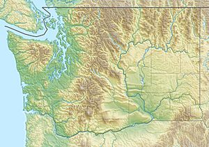
Location of the mouth of the Moclips River in Washington
|
|
| Country | United States |
| State | Washington |
| County | Grays Harbor |
| Physical characteristics | |
| Main source | Macafee Hill 47°16′27″N 124°2′33″W / 47.27417°N 124.04250°W |
| River mouth | Pacific Ocean 0 ft (0 m) 47°14′52″N 124°13′10″W / 47.24778°N 124.21944°W |
| Length | 12 mi (19 km) |
| Basin features | |
| Basin size | 22 sq mi (57 km2) |
The Moclips River is a river located in the state of Washington, United States. It flows for about 12 miles (19 km). The river has a main branch called the North Fork Moclips River. This branch is actually longer than the main river itself! If you measure the North Fork and the lower part of the main river together, they stretch about 17 miles (27 km). The area of land that drains into the Moclips River is about 22.4 square miles (58 km²).
Where the Moclips River Flows
Both the Moclips River and its important branch, the North Fork Moclips River, start high up on a place called Macafee Hill. From there, they both flow mostly towards the west. The North Fork joins the main river about 2 miles (3.2 km) before it reaches the Pacific Ocean. Finally, the Moclips River empties into the Pacific Ocean near the town of Moclips.
The Story Behind the Name
The name Moclips has an interesting history. According to a historian named Edmond S. Meany, the word comes from the Quinault language. He believed it meant a special place where young girls went as they were growing up. However, another expert, William Bright, had a different idea. He thought the Quinault word simply meant "large stream."
 | John T. Biggers |
 | Thomas Blackshear |
 | Mark Bradford |
 | Beverly Buchanan |


