Modena, Utah facts for kids
Quick facts for kids
Modena, Utah
|
|
|---|---|

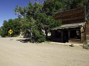
Abandoned buildings in Modena
|
|
| Country | United States |
| State | Utah |
| County | Iron |
| Named for | Modena, Italy |
| Elevation | 5,476 ft (1,669 m) |
| Time zone | UTC-7 (Mountain (MST)) |
| • Summer (DST) | UTC-6 (MDT) |
| ZIP codes |
84753
|
| GNIS feature ID | 1430394 |
Modena is a small, quiet place in the far western part of Iron County, Utah, United States. It's very close to the border with Nevada. Modena is known as an unincorporated community, which means it doesn't have its own local government like a city or town.
Where is Modena, Utah?
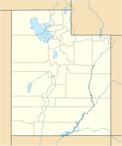
Modena is located along State Route 56. It sits west of Parowan, which is the main city and county seat of Iron County. Modena is quite high up, at an elevation of 5,476 feet (1,669 meters) above sea level. It even has its own post office with the ZIP code 84753.
How Modena Started
Modena began as a railroad town in 1899. It was first built by the Utah and Nevada Railway. By 1905, it became an important stop on the Los Angeles and Salt Lake Railroad route. This railway connected Salt Lake City in Utah to places in Southern California.
Modena's Climate
Modena has a cold semi-arid climate. This means it's usually dry, but not a desert. It can get quite cold in winter and warm in summer.
Population Changes Over Time
The number of people living in Modena has changed quite a bit over the years. Here's a look at its population from 1910 to 1950:
| Historical population | |||
|---|---|---|---|
| Census | Pop. | %± | |
| 1910 | 49 | — | |
| 1920 | 129 | 163.3% | |
| 1930 | 131 | 1.6% | |
| 1940 | 175 | 33.6% | |
| 1950 | 130 | −25.7% | |
| Source: U.S. Census Bureau | |||
 | Roy Wilkins |
 | John Lewis |
 | Linda Carol Brown |


