Molson Lake (Manitoba) facts for kids
Quick facts for kids Molson Lake |
|
|---|---|
| Location | Division No. 22, Northern Region, Manitoba |
| Coordinates | 54°13′N 96°45′W / 54.217°N 96.750°W |
| Primary inflows | Molson River, Keepeewiskawakun River |
| Primary outflows | Hayes River |
| Basin countries | Canada |
| Max. length | 45 km (28 mi) |
| Max. width | 22 km (14 mi) |
| Surface area | 400 km2 (150 sq mi) |
| Surface elevation | 221 m (725 ft) |
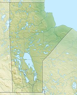
Molson Lake is a large lake located in the northern part of Manitoba, Canada. It is an important natural feature in the area. This lake is special because it is the starting point, or source, of the Hayes River.
The lake is found about 60 kilometers (37 miles) northeast of a community called Norway House. Molson Lake is quite big, stretching about 45 kilometers (28 miles) long and 22 kilometers (14 miles) wide. Its total surface area covers around 400 square kilometers (154 square miles). The lake sits 221 meters (725 feet) above sea level.
Contents
Water Flow in Molson Lake
Molson Lake gets its water from several rivers and streams. The main rivers that flow into the lake are the Molson River and the Keepeewiskawakun River. Both of these rivers enter the lake from its southern side.
The main river that flows out of Molson Lake is the Hayes River. This river starts at the northern end of Molson Lake and then flows towards another body of water called Robinson Lake.
Rivers and Creeks Feeding Molson Lake
Several waterways contribute to Molson Lake. Here are some of the important ones:
- Molson River
- Keepeewiskawakun River
- Panepuyew Creek
- Paimusk Creek
Molson Lake Airport
On the north shore of Molson Lake, near its western end, there is a small airport called Molson Lake Airport. This airport helps people travel to and from the remote areas around the lake. It is often used for transporting supplies or for people visiting the region for activities like fishing or exploring nature.
See also
 In Spanish: Lago Molson (Manitoba) para niños
 | William M. Jackson |
 | Juan E. Gilbert |
 | Neil deGrasse Tyson |


