Monroe, Oklahoma facts for kids
Quick facts for kids
Monroe, Oklahoma
|
|
|---|---|
| Country | United States |
| State | Oklahoma |
| County | Le Flore |
| Area | |
| • Total | 1.40 sq mi (3.62 km2) |
| • Land | 1.40 sq mi (3.62 km2) |
| • Water | 0.00 sq mi (0.00 km2) |
| Elevation | 532 ft (162 m) |
| Population
(2020)
|
|
| • Total | 164 |
| • Density | 117.23/sq mi (45.26/km2) |
| Time zone | UTC-6 (Central (CST)) |
| • Summer (DST) | UTC-5 (CDT) |
| FIPS code | 40-49050 |
| GNIS feature ID | 2629931 |
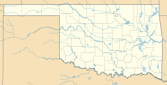
Monroe is a small community in eastern Le Flore County, Oklahoma, United States. It's known as an "unincorporated community" because it doesn't have its own local government like a city or town. However, it is also a "census-designated place," which means the government counts its population for official records.
Monroe's Beginnings
Monroe got its start when a post office opened there on February 25, 1881. The community was named after its very first postmaster, a person named Simon Monroe Griffith.
Monroe in Indian Territory
When Monroe was first established, it was located in what was known as Indian Territory. This was a large area set aside by the United States government for Native American tribes. Monroe was specifically part of Skullyville County, which was a section of the Choctaw Nation. The Choctaw Nation was a self-governing area for the Choctaw people.
Who Lives in Monroe?
The word "demographics" helps us understand the people who live in a certain place. It includes information like population numbers.
Monroe's Population
According to the 2020 United States Census, the population of Monroe was 164 people. This number helps us see how many residents call Monroe home.
| Historical population | |||
|---|---|---|---|
| Census | Pop. | %± | |
| 2020 | 164 | — | |
| U.S. Decennial Census | |||
 | Roy Wilkins |
 | John Lewis |
 | Linda Carol Brown |


