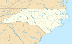
Montezuma, North Carolina facts for kids
Quick facts for kids
Montezuma
|
|
|---|---|
| Country | United States |
| State | North Carolina |
| County | Avery County |
| Founded | 1883 |
| Named for | Moctezuma II |
| Elevation | 3,766 ft (1,148 m) |
| Time zone | UTC-5 (Eastern (EST)) |
| • Summer (DST) | UTC-4 (EDT) |
| ZIP code |
28653
|
| Area code(s) | 828 |
| GNIS feature ID | 1013656 |
Montezuma is a small, unincorporated community located in Avery County, North Carolina, in the United States. This means it's a group of homes and businesses that isn't officially a city or town with its own local government. It's known for being situated on Old State Highway 181 and the Eastern Continental Divide. The Eastern Continental Divide is like an invisible line on the mountains. Rainwater that falls on one side flows towards the Atlantic Ocean, and water that falls on the other side flows towards the Gulf of Mexico.
History
Before it was officially named Montezuma in 1883, this area had a couple of other interesting names: Aaron and Bull Scrape.
From 1904 to 1940, Montezuma was an important stop along the East Tennessee and Western North Carolina Railroad. This railway line connected towns like Newland and Linville. There was even a special side track, called a spur, that went to Pineola. The railroad was very important for transporting goods and people in the mountains during that time.
 | Bayard Rustin |
 | Jeannette Carter |
 | Jeremiah A. Brown |


