Montfoort facts for kids
Quick facts for kids
Montfoort
|
|||
|---|---|---|---|

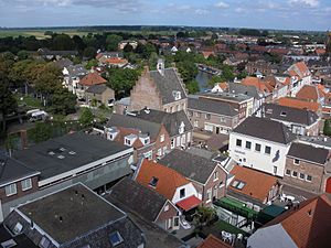
Montfoort city centre
|
|||
|
|||

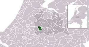
Location in Utrecht
|
|||
| Country | Netherlands | ||
| Province | Utrecht | ||
| Government | |||
| • Body | Municipal council | ||
| Area | |||
| • Total | 38.20 km2 (14.75 sq mi) | ||
| • Land | 37.69 km2 (14.55 sq mi) | ||
| • Water | 0.51 km2 (0.20 sq mi) | ||
| Elevation | 2 m (7 ft) | ||
| Population
(May 2014)
|
|||
| • Total | 13,653 | ||
| • Density | 362/km2 (940/sq mi) | ||
| Time zone | UTC+1 (CET) | ||
| • Summer (DST) | UTC+2 (CEST) | ||
| Postcode |
3417, 3460–3461
|
||
| Area code | 0348 | ||
Montfoort is a charming municipality and city located in the Netherlands. It is part of the Utrecht province. Montfoort has a long history, as it received special "city rights" in 1329. This meant it gained certain freedoms and the ability to govern itself.
Contents
Exploring Montfoort
Montfoort is more than just one city; it's a municipality made up of several smaller towns, villages, and districts. These areas work together under the Montfoort local government.
Towns and Villages in Montfoort
The municipality of Montfoort includes these places:
- Achthoven
- Achthoven-Oost
- Blokland
- Cattenbroek
- Heeswijk
- Knollemanshoek
- Linschoten
- Mastwijk
- Montfoort
- Willeskop
Montfoort's Landscape
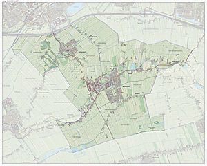
Montfoort is known for its beautiful Dutch landscape. You can see how the different parts of the municipality fit together on a map.
Famous People from Montfoort
Many interesting people have come from Montfoort over the centuries. Here are a few notable individuals:
- Jan III van Montfoort (around 1448 – 1522): He was an important leader during a time of conflict in the region. He led a group called the Hook Party in the area known as the Bishopric of Utrecht.
- Anthonie Blocklandt van Montfoort (1533 or 1534 - 1583): This talented person was a Dutch painter. He created many artworks during his lifetime.
- Isbrand van Diemerbroeck (1609–1674): He was a Dutch physician and anatomist. He also worked as a professor, teaching others about medicine.
- Matthew Maty (1718–1776): A physician and writer, he held important positions. He was the secretary of the Royal Society and a librarian at the British Museum.
- Mark van Eldik (born 1967): He is a Dutch rally driver. He is known for his skills in car racing.
Images for kids
See also
 In Spanish: Montfoort para niños
 | Percy Lavon Julian |
 | Katherine Johnson |
 | George Washington Carver |
 | Annie Easley |


