Montier, Missouri facts for kids
Quick facts for kids
Montier, Missouri
|
|
|---|---|
| Country | United States |
| State | Missouri |
| County | Shannon |
| Township | Montier |
| Area | |
| • Total | 0.99 sq mi (2.56 km2) |
| • Land | 0.99 sq mi (2.56 km2) |
| • Water | 0.00 sq mi (0.00 km2) |
| Elevation | 1,047 ft (319 m) |
| Population
(2020)
|
|
| • Total | 49 |
| • Density | 49.49/sq mi (19.12/km2) |
| Time zone | UTC-6 (Central (CST)) |
| • Summer (DST) | UTC-5 (CDT) |
| ZIP code |
65546
|
| Area code(s) | 573 |
| FIPS code | 29-49610 |
| GNIS feature ID | 2587092 |
Montier is a small community in Shannon County, Missouri, United States. It is known as a census-designated place. This means it's an area defined by the government for counting people. It does not have its own local government like a city or town. In 2020, the population of Montier was 49 people.
Contents
History of Montier
Montier has an interesting history. It was first known by a slightly different name, "Monteer." A post office was set up there in 1889 under this name.
Name Change and Origin
The spelling of the community's name changed in 1924. It became "Montier" instead of "Monteer." The area was named after A. N. Montier. He was an important official who worked for the railroad.
Geography and Location
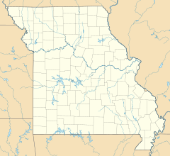
Montier is located in the southwestern part of Shannon County, Missouri. It is found along U.S. Route 60.
Nearby Towns and Transportation
The community is about seven miles east of Mountain View. It is also four miles west of Birch Tree. Montier was once an important stop on the old St. Louis–San Francisco Railway line.
Population Information
The number of people living in Montier is counted regularly. This helps us understand how the community is growing or changing.
Population Count
According to the 2020 census, 49 people lived in Montier.
| Historical population | |||
|---|---|---|---|
| Census | Pop. | %± | |
| 2020 | 49 | — | |
| U.S. Decennial Census | |||
See also
In Spanish: Montier (Misuri) para niños


