Mount Bethel, Pennsylvania facts for kids
Quick facts for kids
Mount Bethel, Pennsylvania
|
|
|---|---|
|
Unincorporated community
|
|

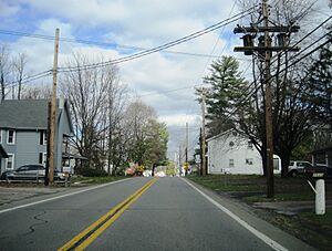
Northbound on PA Route 611 in Mouth Bethel
|
|
| Country | |
| State | |
| County | Northampton |
| Township | Upper Mount Bethel |
| Elevation | 160 m (525 ft) |
| Population | |
| • Metro | 865,310 (US: 68th) |
| Time zone | UTC−5 (Eastern (EST)) |
| • Summer (DST) | UTC−4 (EDT) |
| ZIP Code |
18343
|
| Area code(s) | 570 and 272 |
| GNIS feature ID | 1213141 |
Mount Bethel is a small place in Pennsylvania, United States. It's not an official town or city with its own local government. Instead, it's called an unincorporated community. This means it's part of a larger area called Upper Mount Bethel Township.
Mount Bethel is located in Northampton County. It is also part of a bigger region known as the Lehigh Valley metropolitan area. A metropolitan area is a large city and all the smaller towns and communities around it. In 2020, the Lehigh Valley area had over 861,000 people living there. It was the 68th largest metropolitan area in the U.S.
Where is Mount Bethel Located?
Mount Bethel is easy to find on a map. It sits along Pennsylvania Route 611, which is a main road in the area. You can find it just north of where Route 611 crosses another road, Pennsylvania Route 512. This makes it simple to travel to and from Mount Bethel.
 | Misty Copeland |
 | Raven Wilkinson |
 | Debra Austin |
 | Aesha Ash |


