Mount Crawford, Virginia facts for kids
Quick facts for kids
Mount Crawford, Virginia
|
|
|---|---|

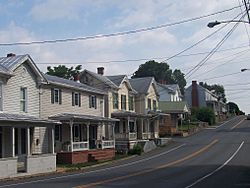
Mount Crawford on Route 11
|
|

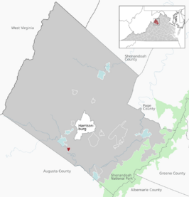
Location of Mount Crawford within the Rockingham County
|
|
| Country | United States |
| State | Virginia |
| County | Rockingham |
| Area | |
| • Total | 0.50 sq mi (1.30 km2) |
| • Land | 0.48 sq mi (1.25 km2) |
| • Water | 0.02 sq mi (0.05 km2) |
| Elevation | 1,204 ft (367 m) |
| Population
(2010)
|
|
| • Total | 433 |
| • Estimate
(2019)
|
458 |
| • Density | 948.24/sq mi (366.46/km2) |
| Time zone | UTC−5 (Eastern (EST)) |
| • Summer (DST) | UTC−4 (EDT) |
| ZIP code |
22841
|
| Area code(s) | 540 |
| FIPS code | 51-53864 |
| GNIS feature ID | 1495970 |
Mount Crawford is a small town in Rockingham County, Virginia, United States. It is part of the larger Harrisonburg area. In 2010, about 433 people lived there.
Contents
Mount Crawford's Story
Mount Crawford became a town in 1825. It was officially recognized and given its own rules in 1895.
Historic Homes and Buildings
The main street, which is part of US Route 11, has many old houses. There are 42 single-family homes and five apartments. Many of these houses are over 100 years old. The average year they were built is 1908. The oldest house was built way back in 1747! Twelve houses were built before the American Civil War. Four of these were built in the 1700s.
A special property called Contentment was added to the National Register of Historic Places in 2006. This means it's an important place in history.
Where is Mount Crawford?
Mount Crawford is located in Virginia. You can find it at these coordinates: 38 degrees, 21 minutes, 25 seconds North and 78 degrees, 56 minutes, 31 seconds West.
Land and Water
The town covers a total area of about 0.3 square miles (0.9 square kilometers). Most of this area is land. A small part, about 0.04 square miles (0.1 square kilometers), is water.
Getting Around Town
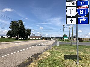
The main road that goes through Mount Crawford is U.S. Route 11. Just north of town, US 11 connects with Virginia State Route 257. This route then leads to Interstate 81. Interstate 81 is a major highway for traveling long distances in the region.
People of Mount Crawford
The town's population has changed over the years. In 2000, there were 254 people living in Mount Crawford. By 2010, the population had grown to 433 people. In 2019, it was estimated to be around 458 people.
Who Lives Here?
In 2000, most people in Mount Crawford were White (about 96.85%). There were also small numbers of African American and Native American residents. About 0.39% of the population was Hispanic or Latino.
The average age of people in Mount Crawford in 2000 was 40 years old. About 22.8% of the people were under 18 years old.
Local Businesses
Mount Crawford has several small businesses. You can find antique shops and furniture stores along Route 11. This is the main road that runs through the town.
Just outside the town, but still in the same ZIP code (22841), are two larger shipping places. One is a regional warehouse for Walmart. The other is a smaller facility for Rosetta Stone. Rosetta Stone is a company that helps people learn new languages. Their main office is in nearby Harrisonburg, Virginia.
See also
 In Spanish: Mount Crawford (Virginia) para niños
 | John T. Biggers |
 | Thomas Blackshear |
 | Mark Bradford |
 | Beverly Buchanan |


