Mount Duff (Yakutat) facts for kids
Quick facts for kids Mount Duff |
|
|---|---|
| Boundary Peak 174 | |
| Highest point | |
| Elevation | 7,211 ft (2,198 m) |
| Prominence | 945 ft (288 m) |
| Geography | |
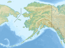
| Location | Stikine Region, British Columbia Glacier Bay National Park and Preserve, Alaska |
Mount Duff, also known as Boundary Peak 174, is a tall mountain that sits right on the border between Alaska in the United States and British Columbia in Canada. It is part of the Southern Icefield Ranges, which are a section of the much larger Saint Elias Mountains. This mountain range is known for its huge glaciers and snowy peaks.
Mount Duff got its name in 1923. It was named after Sir Lyman Poore Duff, who was an important person in Canadian history.
Contents
About Mount Duff
Mount Duff is a significant landmark because it helps mark the exact boundary line between two countries: Canada and the United States. Mountains like this are often used as natural borders.
Where is Mount Duff Located?
This mountain is found in a very wild and beautiful part of North America. On the Canadian side, it's in the Stikine Region of British Columbia. On the U.S. side, it's within the Glacier Bay National Park and Preserve in Alaska. This park is famous for its amazing glaciers, fjords, and wildlife.
How Tall is Mount Duff?
Mount Duff stands at an elevation of 7,211 feet (about 2,198 meters) above sea level. This makes it a prominent peak in its area. Its height means it often has snow and ice, even in the warmer months.
Why is it Called Mount Duff?
The mountain was named in honor of Sir Lyman Poore Duff (1865-1948). He was a very important Canadian judge. In 1903, he worked as a junior counsel for the International Boundary Commission. This group was responsible for figuring out and marking the exact border between Canada and the United States. Later, he became a Judge of the Supreme Court of Canada, which is the highest court in Canada. Naming the mountain after him was a way to recognize his contributions to defining the border.
 | Precious Adams |
 | Lauren Anderson |
 | Janet Collins |


