Mount Haast (Westland District) facts for kids
Quick facts for kids Mount Haast |
|
|---|---|

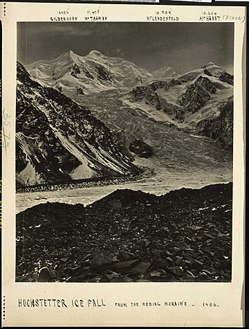
Mount Haast (right), with the Hochstetter Glacier in the foreground
|
|
| Highest point | |
| Elevation | 3,114 m (10,217 ft) |
| Prominence | 127 m (417 ft) |
| Isolation | 0.5 km (0.31 mi) |
| Naming | |
| Etymology | Julius von Haast |
| Geography | |
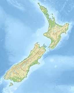
| Location | West Coast, New Zealand |
| Parent range | Southern Alps |
Mount Haast is a tall mountain peak in New Zealand. It stands at 3,114 meters (about 10,217 feet) high. You can find it in the Southern Alps / Kā Tiritiri o te Moana, which is a big mountain range. This mountain is located in the Westland District of New Zealand. It was named after a famous German geologist, Julius von Haast. The person who named it was James Mackay.
Exploring Mount Haast's Features
Mount Haast is just north of the main mountain range, called the Main Divide. This means it is located in the Westland District. The mountain actually has three peaks. The highest peak is 3,114 meters tall. The other two peaks are a bit shorter. They are 3,099 meters and 3,065 meters high. These peaks are found at the very top of the Albert Glacier. This glacier was originally called Albert Glacier. However, the lower part of it is now known as the Fox Glacier.
First Climbers on Mount Haast
The first people to successfully climb Mount Haast were Alex Graham and Henry Newton. They made their climb in February 1907. They reached the top by going through a place called the Marcel Col. This was a challenging and exciting adventure!
How Mount Haast Got Its Name
The mountain was named by James Mackay. He was an important person in New Zealand's history. Mackay named two different peaks after Julius von Haast. The other peak also called Mount Haast is a smaller hill. It is about 1,587 meters (5,207 feet) high. This smaller Mount Haast is located near a place called Springs Junction in the Buller District.
 | Dorothy Vaughan |
 | Charles Henry Turner |
 | Hildrus Poindexter |
 | Henry Cecil McBay |


