Mount Jetté facts for kids
Quick facts for kids Mount Jetté |
|
|---|---|
| Boundary Peak 177 | |
| Highest point | |
| Elevation | 8,425 ft (2,568 m) |
| Prominence | 1,693 ft (516 m) |
| Geography | |
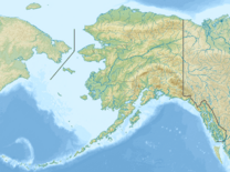
| Location | Stikine Region, British Columbia Glacier Bay National Park and Preserve, Alaska |
Mount Jetté, also known as Boundary Peak 177, is a tall mountain. It sits right on the border between Alaska in the United States and British Columbia in Canada. This mountain is part of the Southern Icefield Ranges, which are a section of the larger Saint Elias Mountains.
Contents
About Mount Jetté
Mount Jetté reaches an elevation of 8,425 feet (2,568 meters). It is a notable peak within the vast Saint Elias Mountains range. Its location makes it a natural landmark along the international boundary.
Why is it called Mount Jetté?
The mountain received its name in 1908. It was named after a very important person named Sir Louis-Amable Jetté (1836-1920). He played a significant role in Canadian history.
Sir Louis-Amable Jetté's Role
Sir Louis-Amable Jetté was a member of the 1903 Canadian Boundary Tribunal. This group helped to resolve a big disagreement called the Alaska boundary dispute. He also served as the Lieutenant Governor of the Province of Quebec from 1898 to 1908. A Lieutenant Governor is like a representative of the King or Queen in a Canadian province.
What was the Alaska Boundary Dispute?
The Alaska boundary dispute was a disagreement between the United States and Canada (which was then part of the British Empire). They argued about where the exact border was between Alaska and British Columbia. This was important because it affected who owned certain lands and resources.
How the Dispute Was Solved
The dispute was finally settled in 1903. A special group, or tribunal, was formed to decide the boundary. Sir Louis-Amable Jetté was a key member of this group. Their decision helped to officially mark the border, including where Mount Jetté stands today.
 | Janet Taylor Pickett |
 | Synthia Saint James |
 | Howardena Pindell |
 | Faith Ringgold |


