
Mount Pisgah (Massachusetts) facts for kids
Quick facts for kids Mount Pisgah |
|
|---|---|

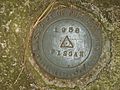
Triangulation station at summit
|
|
| Highest point | |
| Elevation | 715 ft (218 m) |
| Geography | |
| Location | Northborough, MA, U.S. |
| Parent range | n/a |
| Topo map | USGS Marlborough |
| Climbing | |
| Easiest route | Summit Trail via Mentzer Trail |
Mount Pisgah is the tallest spot in Northborough, Massachusetts. It's a fun place to explore nature and enjoy amazing views! This mountain is 715 feet (about 218 meters) high.
Contents
Exploring Mount Pisgah
Mount Pisgah offers a wonderful outdoor experience. It has a beautiful forest that used to be farmland long ago. You can find many interesting plants and animals here.
Amazing Views
When you visit Mount Pisgah, you'll discover two special spots where you can see far into the distance. On a clear day, you might even spot the tall buildings of Boston, Massachusetts! It's a great place to take photos or just enjoy the scenery.
Fun Trails to Explore
Mount Pisgah has many trails that connect to other paths in Berlin, MA. This means you can go on long hikes and discover new areas. About 92 acres (or 372,000 square meters) of land here are protected by MassWildlife.
The very top of Mount Pisgah is easy to find. It's where the Summit Trail and the Tyler Trail meet. Look for a pile of stones called a cairn; the marker is right next to it.
In June 2005, a group called the Northborough Trails Committee started taking care of about three miles (5 kilometers) of trails. These trails are on the land owned by MassWildlife. Some parts of the Fisher Trail and Vernal Pool Trail are on private land. The owners kindly let people use these trails.
It's important to remember that you cannot use any motorized vehicles, like ATVs, on the MassWildlife property. This helps keep the trails safe and peaceful for everyone.
In June 2006, a new map of the Mount Pisgah Conservation Area was made. This map shows all the trails that are open to the public. It covers the area from the MassWildlife land on the south side of Mount Pisgah all the way to Linden Street in Berlin on the north side. You can often find this map online or at the trailheads.
How to Get There
Getting to Mount Pisgah is quite easy. From Northborough, start on Church Street near the Mobil Station. Then, turn right onto Howard Street after you pass the church on the hill. Next, bear left onto Green Street and keep going until you reach the top of Ball Hill. Finally, turn right onto Smith Road. You'll see a sign for the conservation area on your right, which marks the parking spot for the trails. The mountain is about four miles (6 kilometers) from the center of town.
Images for kids
-
Triangulation station at summit
