Mount Selma facts for kids
Quick facts for kids Mount Selma |
|
|---|---|
| Highest point | |
| Elevation | 1,463 metres (4,800 ft) AHD |
| Geography | |
| Location | Victoria, Australia |
| Parent range | Great Dividing Range |
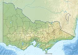
Mount Selma is a mountain located in Victoria, Australia. It is found to the northeast of a small town called Aberfeldy. The very top of Mount Selma is 1,463 metres (about 4,800 feet) above the ocean. The Aberfeldy River actually begins on the southern slopes of this mountain.
Getting to Mount Selma
A road called Mount Selma Road runs north of the mountain's peak. This road is "unsealed," meaning it is made of gravel or dirt, not pavement. It also acts as a border between two large forest areas: the Toombon State Forest to the south and the Licola State Forest to the north.
The very top of Mount Selma has a special marker called a trigonometrical station. This marker helps people make accurate maps. You can reach the summit using a four-wheel drive vehicle on a path called Mount Selma Track. A long walking path, the Australian Alps Walking Track, also follows Mount Selma Road.
Bushfires and Protection
In the summer of 2006-2007, a large series of fires, known as the Eastern Victoria Great Divide bushfires, affected the area around Mount Selma. Before the fire reached the mountain, the army was called in to help. They used big machines to clear a "firebreak" along Mount Selma Track. A firebreak is a gap in trees or other plants that helps stop a fire from spreading.
This firebreak was created to protect the Thomson Reservoir catchment. A catchment area collects water that flows into a reservoir, which is like a big lake that stores drinking water. Sadly, a small mountain cabin called Christians Hut, located near Mount Selma, was destroyed by these bushfires.
Unique Plants on Mount Selma
Mount Selma is home to a special plant called the Selma Saddle Grevillea (Grevillea miqueliana subsp. cincta). This plant is "endemic" to the area, which means it grows naturally only in a small part near Mount Selma and nowhere else in the world.
The Selma Saddle Grevillea is currently listed as "endangered." This means it is at risk of disappearing forever. Things like road construction, cutting down trees (logging), and planned fires (controlled burning) can threaten this unique plant.
 | Kyle Baker |
 | Joseph Yoakum |
 | Laura Wheeler Waring |
 | Henry Ossawa Tanner |


